Category:Maps by Herman Moll
Jump to navigation
Jump to search
Subcategories
This category has the following 19 subcategories, out of 19 total.
Media in category "Maps by Herman Moll"
The following 161 files are in this category, out of 161 total.
-

-
 "A Plan of Fort St. George and the City of Madras," by Herman Moll.jpg 2,400 × 2,516; 1.05 MB
-
 Cowley's Circumnavigation 1699.jpg 6,387 × 3,699; 5.24 MB
-
 Galapagos 1699.gif 600 × 700; 51 KB
-
 Galapagos 1699ef.gif 600 × 700; 60 KB
-
 Moll Africa 1701 UTA (cropped).jpg 2,267 × 1,817; 2.12 MB
-
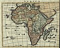
 Moll Africa 1701 UTA.jpg 2,349 × 3,551; 2.98 MB
-
 Moll Barbary and Bildulgerid 1701 UTA.jpg 2,299 × 1,159; 1.29 MB
-
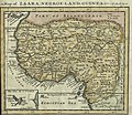 Moll Map of Zaara, Negro-Land, Guinea &c. 1701 UTA.jpg 2,299 × 2,002; 2.34 MB
-
 1710 moll.jpg 3,845 × 2,359; 11.03 MB
-
 Moll Map of the West-Indies or the Islands of America in the North Sea c. 1715 UTA.jpg 2,712 × 1,569; 3.76 MB
-
 1715 Caraccos detail Map of the West-Indies by Herman Moll BPL 14251 2.png 1,063 × 750; 1.31 MB
-

-

-
 Moll Africa 1729 UTA.jpg 3,341 × 2,663; 3.63 MB
-
-
 1729 West Africa map (Cameroon & Nigeria).jpg 466 × 355; 266 KB
-

-

-
 1730 map of Asia by Herman Moll.jpg 23,521 × 14,382; 72.95 MB
-
-

-
 1736 Cadiz detail West Part of Barbary map by Herman Moll BPL 14639.png 1,245 × 473; 1.21 MB
-
 1736 Cartagena detail West Part of Barbary map by Herman Moll BPL 14639.png 1,251 × 474; 1.22 MB
-
 1736 Jaffa detail East Part of Barbary map by Herman Moll BPL 14639.png 1,260 × 464; 1.11 MB
-
 1736 Lagos detail West Part of Barbary map by Herman Moll BPL 14639.png 1,251 × 474; 1.22 MB
-
 1736 Malaga detail West Part of Barbary map by Herman Moll BPL 14639.png 1,251 × 474; 1.22 MB
-
 1736 Oran detail West Part of Barbary map by Herman Moll BPL 14639.png 1,245 × 473; 1.21 MB
-
 1736 Palermo detail West Part of Barbary map by Herman Moll BPL 14639.png 1,245 × 473; 1.21 MB
-
 1736 Tripoli detail East Part of Barbary map by Herman Moll BPL 14639.png 1,260 × 464; 1.11 MB
-
 1740 map of Persia.jpg 6,602 × 4,885; 6 MB
-
 1746 Herman Moll Map of Carolina - Geographicus - CarolinabyMoll-moll-1746.jpg 3,400 × 2,494; 2.96 MB
-
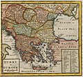
 A general map of Turkey in Europe, Hungary, 1736.jpg 915 × 734; 295 KB
-

-

-
 A map of the straits of Magellan etc - (H. Moll) - btv1b8596641n.jpg 2,112 × 1,538; 576 KB
-

-

-
-

-
-

-
 A New & Exact Plan of the Town of Gibraltar - By Herman Moll - btv1b530568968.jpg 8,256 × 6,560; 6.51 MB
-
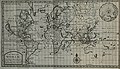
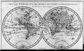
 A New and correct map of the world, laid down according to the latest discoveries.jpg 5,000 × 3,098; 18.31 MB
-

-

-
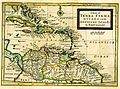
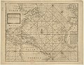 A new generall chart for the West Indies (sic) - H. Moll f. - btv1b5963475b.jpg 7,608 × 5,872; 5.4 MB
-
 A new groundplot of the citty of Hamburg - Herman Moll sculpsit - btv1b53040213z.jpg 7,833 × 5,877; 8.64 MB
-

-
 A Plan of ye Late Breach of Dagenheim.jpg 335 × 785; 60 KB
-
 Abissina and Nubia &c - DPLA - d9bc29c1c28876bf57bc07a640e39452.jpg 1,000 × 902; 285 KB
-
 Afm0002151.jpg 4,000 × 3,023; 2.88 MB
-

-
 Alderney - (Herman Moll) - btv1b85919110.jpg 2,165 × 1,166; 405 KB
-
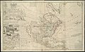
 America - by H. Moll, geographer. NYPL464991.tiff 4,248 × 4,819; 58.57 MB
-
 Arabia Agreable to Modern History.jpg 700 × 533; 150 KB
-
 Basic cartouche on a Persia map by Moll.jpg 1,640 × 972; 339 KB
-
 Britain. NYPL1505122.tiff 4,640 × 6,299; 83.64 MB
-
 Ca. 1715 map of Asia.tif 11,529 × 7,065; 233.09 MB
-
 CharlestonSC1733.jpg 889 × 698; 382 KB
-
-
 Hereford Shire - By H. Moll Geographer - btv1b53056737v.jpg 4,072 × 3,144; 1.9 MB
-
 Herman Moll Map of France.jpg 760 × 485; 118 KB
-
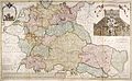 Herman Moll New Map of Germany.jpg 760 × 469; 118 KB
-
 Herman Moll's map of Turkey in Europe, Romanian areas (1726).png 1,023 × 710; 859 KB
-
 Herman Moll. A New Map of the Island of Jamaica. 1717.jpg 3,223 × 2,328; 342 KB
-
 Herman Moll. Persia, Caspian Sea, part of Independent Tartary. 1736. Caucasua.jpg 1,680 × 1,467; 604 KB
-
 Herman Moll. Persia, Caspian Sea, part of Independent Tartary. 1736.A.jpg 3,139 × 2,885; 1.96 MB
-
 Herman Moll. Persia, Caspian Sea, part of Independent Tartary. 1736.jpg 5,254 × 3,815; 3.43 MB
-
 Herman Moll.North Persia, Caspian Sea, part of Independent Tartary.jpg 787 × 967; 187 KB
-
 Iranian Armenia (Safavid Empire).png 703 × 513; 684 KB
-
 Iranian Armenia (Safavid Empire; version 2).png 793 × 513; 758 KB
-
 John Lord Sommers This map of North America Herman Moll Geogr. RMG F0005.tiff 7,278 × 4,418; 91.99 MB
-
 John Lord Sommers This map of North America Herman Moll Geogr. RMG F7412.tiff 4,800 × 2,951; 40.53 MB
-
 Kurfürstenturm Braunschweig Lüneburg Kupferstich.jpg 4,110 × 2,488; 10.11 MB
-
 Map of Asia by Herman Moll.jpg 23,367 × 14,299; 68.82 MB
-
 Map of Moscovy, Poland, Little Tartary, and ye Black Sea etc NYPL1630438.tiff 7,070 × 5,084; 102.84 MB
-
 Map of Russia and Poland 1730.jpg 12,048 × 7,509; 32.78 MB
-
 Map of Safavid Arabestan or Khuzestan, dated 1736.jpg 305 × 236; 25 KB
-
 Map of the Carolinas by Herman Moll 1736.jpeg 1,614 × 1,122; 425 KB
-

-

-
 MapaPerú.HermannMoll.JPG 1,737 × 2,309; 1.08 MB
-
 MapaPerú.HermannMoll2.JPG 1,740 × 2,346; 3.58 MB
-

-

-
 Midlesex - By H. Moll Geographer - btv1b530568320.jpg 4,248 × 3,120; 2.1 MB
-
 Moll - A Map of the West-Indies.png 1,200 × 907; 2.32 MB
-
-

-

-
 Moll - A new map of the whole world (Detail).png 699 × 480; 643 KB
-

-
 Moll - A Plan of Port Royal-Harbour in Carolina.png 1,059 × 800; 1.47 MB
-
 Moll - A view of ye general and coasting trade winds.png 1,800 × 678; 790 KB
-
 Moll - Brasil, Divided into its Captainships.jpg 655 × 561; 227 KB
-
 Moll - Chersonesi quae hodie Natolia descriptio.jpg 1,280 × 1,036; 435 KB
-
 Moll - John Lord Sommers This map of North America (Title cartouche).png 599 × 1,180; 1.22 MB
-
 Moll - John Lord Sommers This map of North America.png 2,911 × 1,767; 8.04 MB
-
 Moll - New England, New York, New Jersey and Pensilvania.jpg 2,000 × 1,486; 502 KB
-
 Moll - The Island of Barbados.png 5,065 × 3,881; 43.44 MB
-
 Moll - The Island of St Christophers alias St Kitts.png 1,247 × 900; 1.82 MB
-
 Moll - The South Part of the Shire of Air.jpg 2,098 × 1,609; 1,016 KB
-
 Moll, Herman. Caspian Sea, Terky, Derbent, Astracan. 1736.jpg 3,080 × 5,260; 2.92 MB
-
 Moll, Herman. Turkey in Asia; or Asia Minor &c. 1736 (K).jpg 846 × 837; 173 KB
-
 Negroland and Guinea with the European Settlements, 1736.jpg 1,200 × 894; 1.55 MB
-

-
-
 New Engelland, New York, New Yersey und Pensilvania (4071872903).jpg 2,000 × 1,701; 3.7 MB
-
 New England, New York, New Jersey and Pensilvania - by H. Moll, geographer. NYPL434019.tiff 4,632 × 3,904; 51.77 MB
-
 New Guinea, New Britain, and New Holland &c.png 2,106 × 1,517; 4.97 MB
-
 North Turkey in Euopre 1726.jpg 1,718 × 1,362; 1.01 MB
-
 Northwestern domains of the Safavid Empire (cropped).png 461 × 502; 468 KB
-
 Northwestern part of the Safavid Empire (cropped, more zoomed).png 477 × 659; 631 KB
-
 Northwestern part of the Safavid Empire (cropped, v2).png 550 × 665; 722 KB
-
 Northwestern provinces and domains of the Safavid Empire (cropped).png 479 × 700; 675 KB
-
-

-
 Map of Asia .. (NYPL b15369994-1630432).jpg 6,347 × 3,963; 7.86 MB
-
 Cartouche in an Eastern Europe map by Moll.jpg 1,236 × 2,687; 4.58 MB
-
 Map of Moscovy, Poland, Little Tartary, and ye Black Sea &c (NYPL b15369994-1630438).jpg 6,609 × 4,356; 36.14 MB
-
 Orkney Shire - By H. Moll - btv1b53056939h.jpg 2,688 × 3,480; 1.21 MB
-
 PCSIT (cropped).png 408 × 649; 543 KB
-
 Persia, Caspian Sea, part of Independent Tartary (cropped).png 539 × 699; 744 KB
-
 Persia, Caspian Sea, part of Independent Tartary (Makeran).png 780 × 513; 659 KB
-
 Persia, Caspian Sea, part of Independent Tartary.png 2,163 × 1,991; 6.98 MB
-
 Persian Empire by Herman Moll.jpg 1,028 × 720; 174 KB
-
 Russland BV014261263.jpg 7,992 × 5,485; 5 MB
-

-

-
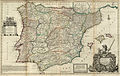 Spain and Portugal - Herman Moll, 1711.jpg 1,600 × 1,017; 1.4 MB
-
 St. Helena; Bay of Agoa de Saldanha by Herman Moll 1736.jpg 3,112 × 5,268; 2.78 MB
-
 Sussex - By Herman Moll Geographer - btv1b53056358m.jpg 4,080 × 2,896; 1.93 MB
-

-

-
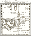
 The Gallapagos Islands - (Hermann Moll) - btv1b8596522z.jpg 1,560 × 844; 248 KB
-
 The island of Antego (4587174056).jpg 2,000 × 1,597; 3.44 MB
-

-
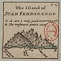 The Island of Juan Ferdinando - (Hermann Moll) - btv1b8596521j.jpg 775 × 784; 120 KB
-
 The island of St. Christophers, alias St. Kitts (4579411112).jpg 5,164 × 3,709; 9.19 MB
-
 The Isle Garnsey - (Herman Moll) - btv1b85919073.jpg 2,948 × 2,059; 969 KB
-
 The Isle Jersey - (Herman Moll) - btv1b8591903f.jpg 2,916 × 1,861; 897 KB
-
 The North Riding of York Shire - By H. Moll Geographer - btv1b53056860b.jpg 4,080 × 2,936; 1.94 MB
-
 The Philippine islands and others of the East Indies according to newest descriptions.png 3,357 × 2,340; 11.73 MB
-

-

-

-

-

-

-

-

-

-
-
 TierraFirme.jpg 800 × 596; 344 KB
-

-

-
 Turky in Europe, 1701 (Moll).jpg 2,251 × 2,081; 1.03 MB
-
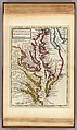 Virginia and Maryland by Augustine Herman, 1736.jpg 3,112 × 5,228; 2.82 MB
-
 Warwick Shire - By H. Moll Geographer - btv1b530566183.jpg 3,016 × 4,168; 1.93 MB
-
 Westmorland - By H. Moll Geographer - btv1b530566450.jpg 4,152 × 3,104; 2 MB


.jpg)


_-_Geographicus_-_NewEnglandNewYork-moll-1729.jpg)
.jpg)


_-_btv1b8596641n.jpg)

_what_belongs_to_Spain,_England,_France,_Holland_etc._also_ye_trade_winds,_and_ye_LOC_gm71004474.jpg)
_what_belongs_to_Spain,_England,_France,_Holland,_etc._also_ye_trade_winds,_and_ye_LOC_gm71005442.jpg)

.jpg)


_-_H._Moll_f._-_btv1b5963475b.jpg)


_-_btv1b85919110.jpg)


.jpg)


.png)


.png)
.png)


_-_New_Holland_-_Dimens_Land.png)


.png)
_-_region_Indian_Ocean-New_Holland-Dimens_Land.png)


.png)


.jpg)

.jpg)

.jpg)


.png)
.png)
.png)
.png)
.jpg)

.jpg)

.jpg)

.png)
.png)
.png)


_-_btv1b8596522z.jpg)
.jpg)
.jpg)
_-_btv1b8596521j.jpg)
.jpg)
_-_btv1b85919073.jpg)
_-_btv1b8591903f.jpg)


.jpg)


.jpg)

.jpg)

.jpg)


