Category:A map of the East-Indies and the adjacent countries (18th century)
Jump to navigation
Jump to search
Media in category "A map of the East-Indies and the adjacent countries (18th century)"
The following 11 files are in this category, out of 11 total.
-
 B26055943A - A map of the East-Indies and the adjacent countries.jpg 7,509 × 4,779; 12.73 MB
-
 1717 map of Bantam by Herman Moll.jpg 960 × 1,038; 484 KB
-
 1717 map of Batavia by Herman Moll.jpg 1,214 × 751; 480 KB
-
 1717 map of Madras by Hermann Moll.jpg 1,325 × 1,455; 966 KB
-
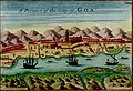 1717 map-view of Goa by Herman Moll.jpg 1,084 × 742; 391 KB
-
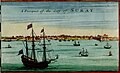 1717 map-View of Surat by Herman Moll.jpg 1,226 × 749; 364 KB
-
-
 1720 Map of the East Indies by Moll BPL 17058 detail.png 825 × 745; 1.06 MB
-

-
 Cartouche in an East-Indies map by Moll.jpg 842 × 1,429; 518 KB
-


.jpg)


.jpg)