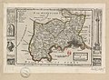
Category:A Set of Fifty New and Correct Maps of England and Wales
Jump to navigation
Jump to search
OF
ENGLAND and WALES, &c.
WITH
The GREAT ROADS and Principal CROSS-ROADS, &c.
Shewing the Computed Miles from Town to Town.
A Work long wanted, and very useful for all Gentlemen that Travel to any Part of ENGLAND.
All, except two, composed and done by HERMAN MOLL, Geographer.
VIZ.
| 1. The Map entituled, In gratiam Itineran- tium curiosum AN- TONINI AUG. Iti- nerarium per Britan- niam tentavit WIL. STUKELEY, 1723. |
4. Devonshire. | 14. Glocestershire. | 24. Huntingdonshire. | 34. Shropshire. | 43. — East Riding. |
| 5. Dorsetshire. | 15. Oxfordshire. | 25. Northamptonshire. | 35. Cheshire. | 44. — North Riding. | |
| 6. Somerset. | 16. Buckinghamshire. | 26. Leicestershire. | 36. Herefordshire. | 45. Durham. | |
| 7. Wiltshire. | 17. Bedfordshire. | 27. Rutlandshire. | 37. South-Wales. | 46. Lancashire. | |
| 8. Hantshire. | 18. Hartfordshire. | 28. Lincolnshire. | 38. Monmouthshire. | 47. Westmorland. | |
| 9. Isle of Wight. | 19. Middlesex. | 29. Nottinghamshire. | 39. North-Wales. | 48. Cumberland. | |
| 10. Berkshire. | 20. Essex. | 30. Derbyshire. | 40. Denbigh and Flint- shires. |
49. Northumberland. | |
| 2. A general Map of England. |
11. Surrey. | 21. Suffolk. | 31. Warwickshire. | 50. The Isle of Man, Guernsey, and Jersey. | |
| 12. Sussex. | 22. Norfolk. | 32. Worcestershire. | 41. Yorkshire. | ||
| 3. Cornwal. | 13. Kent. | 23. Cambridgeshire. | 33. Staffordshire. | 42. — West Riding. |
And, to render this Work more acceptable to the Curious, the Margins of each Map are adorn'd with great Variety of very remarkable Antiquities.
LONDON: Sold by H. MOLL over-against Devereux-Court in the Strand; THO. BOWLES, Print and Map-Seller near the Chapter-House in St. Paul's
Church-Yard, and J. BOWLES Print and Map-Seller over-against Stocks-Market. 1724.
Media in category "A Set of Fifty New and Correct Maps of England and Wales"
The following 200 files are in this category, out of 347 total.
(previous page) (next page)-

-
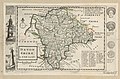
 England and Wales with the Islands of Garnsey, Iersey and c. - By H. M. - btv1b53056514x.jpg 3,272 × 3,544; 1.75 MB
-
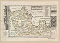
 Cornwal - By H. Moll Geographer - btv1b53056815h.jpg 4,080 × 2,936; 1.96 MB
-
 Cross at St. Blaise.jpg 331 × 437; 41 KB
-
 Half Stone at Pennant.jpg 335 × 430; 32 KB
-
 Half Stone.jpg 324 × 345; 25 KB
-
 Maugan Cross.jpg 328 × 140; 15 KB
-
 The Hurlers Stones near Killington.jpg 328 × 363; 31 KB
-
 The Wring Cheese Stones near Killington.jpg 307 × 501; 38 KB
-
 Tomb at St Buriens.jpg 339 × 759; 54 KB
-
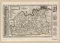
 Devon Shire - By H. Moll Geographer - btv1b53056863p.jpg 4,056 × 2,656; 1.58 MB
-
 Andromache Found at the Bath (back).jpg 308 × 366; 26 KB
-
 Andromache Found at the Bath (front).jpg 308 × 399; 24 KB
-
 Andromache Found at the Bath.jpg 308 × 850; 52 KB
-
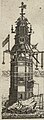 Edystone Light House.jpg 336 × 917; 63 KB
-
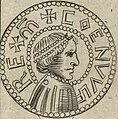
 Saxon Coin Struck at Exeter (bottom).jpg 275 × 262; 15 KB
-
 Saxon Coin Struck at Exeter (top).jpg 275 × 273; 16 KB
-
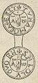 Saxon Coin Struck at Exeter.jpg 280 × 611; 32 KB
-
 The New Edystone Light.jpg 329 × 780; 49 KB
-
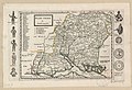
 Dorset Shire - By H. Moll Geographer - btv1b53056183v.jpg 4,000 × 2,600; 1.77 MB
-
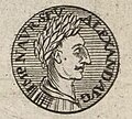
 Bacchus (Moll).jpg 237 × 409; 23 KB
-
 Hercules (Moll).jpg 320 × 503; 30 KB
-
 Iupiter Ammon.jpg 296 × 506; 30 KB
-
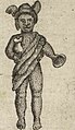
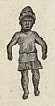
 Nameless Figure.jpg 209 × 468; 23 KB
-
 Neptunus (Moll).jpg 282 × 503; 31 KB
-
 The Roman Amphitheater at Dorchester.jpg 320 × 388; 27 KB
-
 Venus of Southbroom.jpg 338 × 659; 44 KB
-
 Vulcanus.jpg 199 × 475; 24 KB
-
 Somerset Shire - By H. Moll Geographer - btv1b530568661.jpg 4,192 × 3,160; 2.17 MB
-
 A Roman Pavement Found at Wellow.jpg 330 × 457; 46 KB
-
 Alfred Jewel (Moll).jpg 326 × 541; 52 KB
-
 Ground Platt of ye Cross Bath.jpg 311 × 280; 21 KB
-
 Ground Platts of the Baths.jpg 341 × 2,073; 143 KB
-
 Ground Platts of ye Hott Bath and ye Lazars Bath.jpg 309 × 221; 17 KB
-
 Ground Platts of ye King and Queens Baths.jpg 293 × 308; 24 KB
-
 Leaden Cross from King Arthurs Coffin.jpg 337 × 727; 51 KB
-
 Wilt Shire - By Her. Moll Geographer - btv1b530570005.jpg 3,016 × 4,304; 2.22 MB
-
 A Prospect of Stone Henge from the South.jpg 1,125 × 336; 111 KB
-
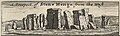 A Prospect of Stone Henge from the West.jpg 1,125 × 336; 111 KB
-
 Anubis (Moll).jpg 595 × 274; 47 KB
-
 Apis (Moll).jpg 418 × 329; 40 KB
-
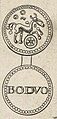
 Bucephalus.jpg 440 × 298; 35 KB
-
 Houshold Gods Found at the Devizes.jpg 2,236 × 338; 196 KB
-
 Lupa cum Romulo et Remo.jpg 351 × 304; 31 KB
-
 Unidentified Houshold God Found at the Devizes.jpg 244 × 303; 24 KB
-
 Hamp Shire - By H. Moll Geographer - btv1b530564887.jpg 4,296 × 2,920; 2.04 MB
-
 Bacchus 2 (Moll).jpg 159 × 416; 18 KB
-
 Denarius from the Southbroom Hoard.jpg 266 × 240; 17 KB
-
 Mercuris.jpg 333 × 520; 31 KB
-
 Nameless Figure 2.jpg 221 × 423; 19 KB
-
 Nameless Figure 3.jpg 232 × 423; 20 KB
-
 Nameless Figure 4.jpg 277 × 371; 22 KB
-
 Pallas (Moll).jpg 284 × 352; 23 KB
-
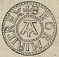
 Saxon Coin Struck at Winchester (Obverse).jpg 328 × 330; 32 KB
-
 Saxon Coin Struck at Winchester (reverse).jpg 328 × 333; 29 KB
-
 Saxon Coin Struck at Winchester.jpg 329 × 780; 65 KB
-
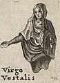 Virgo Vestalis.jpg 314 × 434; 32 KB
-
 The Isle of Wight - By H. Moll Geographer - btv1b53056365p.jpg 2,840 × 2,528; 1.11 MB
-
 A new description of England and Wales, with the adjacent islands Fleuron T145692-26.png 2,394 × 2,220; 165 KB
-
 Berk Shire - By H. Moll Geographer - btv1b53056293n.jpg 4,000 × 2,912; 1.88 MB
-
 The South Side of Windsor Castle.jpg 1,632 × 349; 165 KB
-
 Windsor Castle (Moll).jpg 353 × 318; 31 KB
-

-
 Surrey - By H. Moll Geographer - btv1b53056455n.jpg 4,080 × 2,952; 2.07 MB
-
 West side of London Bridg.jpg 2,032 × 356; 200 KB
-
 Janus Head Found near Peckham.jpg 314 × 460; 40 KB
-
 Saxon Coins.jpg 324 × 1,406; 103 KB
-
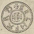
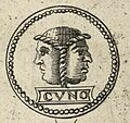
 Saxon Coin of Coenuulf.jpg 320 × 720; 58 KB
-
 Saxon Coin of Coenuulf (obverse).jpg 315 × 319; 29 KB
-
 Saxon Coin of Coenuulf (reverse).jpg 317 × 320; 27 KB
-
 Saxon Coin of Beormiric.jpg 299 × 555; 39 KB
-
 Saxon Coin of Beormiric (obverse).jpg 261 × 255; 19 KB
-
 Saxon Coin of Beormiric (reverse).jpg 262 × 262; 19 KB
-
 Kent - By Herman Moll Geographer - btv1b53056577r.jpg 3,968 × 2,928; 2.18 MB
-
 Kitts Coty House.jpg 524 × 318; 43 KB
-
 Roman Antiquities Found at Reculver.jpg 2,309 × 321; 133 KB
-
 The Royal Observatory at Greenwich.jpg 758 × 318; 69 KB
-
 Dover Castle (Moll).jpg 606 × 570; 96 KB
-
 Roman Pottery Found at Reculver.jpg 236 × 321; 15 KB
-
 Roman Strigil Found at Reculver.jpg 939 × 321; 58 KB
-
 Legulae Mensalis.jpg 372 × 121; 11 KB
-
 Cochleare Sacrium.jpg 375 × 154; 13 KB
-
 Roman Pottery Found at Reculver 2.jpg 238 × 203; 11 KB
-
 Roman Antiquities Found at Reculver 3.jpg 222 × 176; 9 KB
-
 Roman Pottery Found at Reculver 4.jpg 328 × 289; 18 KB
-
 Unnamed Figure.jpg 176 × 289; 12 KB
-
 Glocester Shire - By H. Moll Geographer - btv1b53056595p.jpg 4,128 × 2,784; 1.91 MB
-
 British Coin.jpg 298 × 638; 43 KB
-
 British Coin 1b.jpg 271 × 264; 19 KB
-
 British Coin 1a.jpg 279 × 263; 20 KB
-
 British Coin 2.jpg 286 × 636; 43 KB
-
 British Coin 2 (cropped).jpg 275 × 268; 21 KB
-
 British Coin 2b.jpg 274 × 266; 19 KB
-
 British Coin 3.jpg 286 × 658; 47 KB
-
 British Coin 3a.jpg 275 × 265; 21 KB
-
 British Coin 3b.jpg 275 × 268; 22 KB
-
 British Coin 4.jpg 308 × 622; 40 KB
-
 British Coin 4a.jpg 291 × 266; 18 KB
-
 British Coin 4b.jpg 281 × 264; 18 KB
-
 British Coin 5.jpg 301 × 733; 42 KB
-
 British Coin 5b.jpg 289 × 274; 19 KB
-
 British Coin 5a.jpg 289 × 274; 17 KB
-
 British Coins.jpg 347 × 436; 33 KB
-
 British Coin 6.jpg 172 × 413; 18 KB
-
 British Coin 6b.jpg 172 × 175; 9 KB
-
 British Coin 6a.jpg 172 × 178; 8 KB
-
 British Coin 7.jpg 162 × 413; 15 KB
-
 British Coin 7a.jpg 162 × 163; 7 KB
-
 British Coin 7b.jpg 162 × 151; 7 KB
-
 Oxford Shire - By H. Moll Geographer - btv1b53056541t.jpg 2,936 × 4,096; 1.83 MB
-
 Blenheim House.jpg 1,164 × 317; 83 KB
-
 The Bridge of Blenheim.jpg 1,060 × 314; 59 KB
-
 Roman Pavement.jpg 948 × 293; 90 KB
-
 Rolle-rich Stones.jpg 646 × 309; 56 KB
-
 Bodleian Libraries, Buckinghamshire by Herman Moll.jpg 672 × 1,000; 142 KB
-
 Buckingham Shire - By H. Moll Geographer - btv1b530563681.jpg 3,048 × 4,296; 1.83 MB
-
 British Coin 8.jpg 476 × 232; 22 KB
-
 British Coin 8b.jpg 174 × 191; 9 KB
-
 British Coin 8a.jpg 194 × 212; 11 KB
-
 British Coin 9.jpg 439 × 207; 21 KB
-
 British Coin 9a.jpg 189 × 187; 10 KB
-
 British Coin 9b.jpg 174 × 179; 9 KB
-
 British Coins 2.jpg 447 × 341; 33 KB
-
 British Coin 10.jpg 345 × 166; 15 KB
-
 British Coin 10a.jpg 169 × 148; 8 KB
-
 British Coin 10b.jpg 152 × 163; 8 KB
-
 British Coin 11.jpg 358 × 159; 15 KB
-
 British Coin 11a.jpg 146 × 159; 7 KB
-
 British Coin 11b.jpg 155 × 137; 7 KB
-
 British Coin 12.jpg 632 × 308; 40 KB
-
 British Coin 12a.jpg 233 × 255; 16 KB
-
 British Coin 12b.jpg 240 × 262; 17 KB
-
 British Coin 13.jpg 612 × 308; 37 KB
-
 British Coin 13a.jpg 240 × 265; 17 KB
-
 British Coin 13b.jpg 237 × 261; 16 KB
-
 British Coin 14.jpg 601 × 280; 32 KB
-
 British Coin 14a.jpg 235 × 258; 14 KB
-
 British Coin 14b.jpg 243 × 269; 15 KB
-
 British Coin 15.jpg 618 × 288; 33 KB
-
 British Coin 15a.jpg 243 × 267; 15 KB
-
 British Coin 15b.jpg 233 × 259; 15 KB
-
 Bedford Shire - By H. Moll Geographer - btv1b53056944p.jpg 4,024 × 2,952; 1.75 MB
-
 Roman Coin 1.jpg 330 × 699; 49 KB
-
 Roman Coin 1b.jpg 327 × 306; 24 KB
-
 Roman Coin 1a.jpg 330 × 298; 24 KB
-
 Roman Coin 2.jpg 341 × 710; 51 KB
-
 Roman Coin 2a.jpg 340 × 311; 25 KB
-
 Roman Coin 2b.jpg 324 × 320; 24 KB
-
 Roman Coin 3.jpg 335 × 702; 50 KB
-
 Roman Coin 3a.jpg 333 × 312; 25 KB
-
 Roman Coin 3b.jpg 325 × 314; 24 KB
-
 Roman Coin 4.jpg 335 × 709; 56 KB
-
 Roman Coin 4a.jpg 335 × 328; 28 KB
-
 Roman Coin 4b.jpg 328 × 320; 27 KB
-
 Roman Coin 5.jpg 339 × 723; 60 KB
-
 Roman Coin 5a.jpg 330 × 320; 30 KB
-
 Roman Coin 5b.jpg 335 × 334; 28 KB
-
 Roman Coin 6.jpg 339 × 709; 62 KB
-
 Roman Coin 6a.jpg 337 × 324; 30 KB
-
 Roman Coin 6b.jpg 337 × 328; 31 KB
-
 Hertford Shire - By H. Moll Geographer - btv1b530569867.jpg 4,112 × 3,032; 2.03 MB
-
 British Coin 16.jpg 303 × 669; 37 KB
-
 British Coin 16a.jpg 303 × 309; 17 KB
-
 British Coin 16b.jpg 294 × 298; 19 KB
-
 British Coin 17.jpg 286 × 654; 38 KB
-
 British Coin 17a.jpg 286 × 298; 19 KB
-
 British Coin 17b.jpg 286 × 288; 19 KB
-
 British Coin 18.jpg 300 × 614; 38 KB
-
 British Coin 18a.jpg 300 × 305; 20 KB
-
 British Coin 18b.jpg 289 × 280; 18 KB
-
 British Coin 19.jpg 296 × 625; 46 KB
-
 British Coin 19a.jpg 296 × 293; 24 KB
-
 British Coin 19b.jpg 287 × 286; 22 KB
-
 British Coin 21.jpg 296 × 618; 42 KB
-
 British Coin 21a.jpg 289 × 283; 18 KB
-
 British Coin 21b.jpg 296 × 282; 23 KB
-
 British Coin 22.jpg 300 × 625; 45 KB
-
 British Coin 22a.jpg 293 × 286; 21 KB
-
 British Coin 22b.jpg 287 × 285; 22 KB
-
 Midlesex - By H. Moll Geographer - btv1b530568320.jpg 4,248 × 3,120; 2.1 MB
-
 London 1724.jpg 874 × 608; 150 KB
-
 Stone Found in Digging the Foundation of Ludgate.jpg 323 × 880; 57 KB
-
 Roman Pavement Found near London Stone.jpg 343 × 454; 36 KB
-
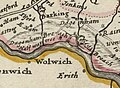
 Kinsington.jpg 328 × 350; 31 KB
-
 The Monument 1724.jpg 322 × 1,783; 133 KB
-
 Hamptoncourt.jpg 340 × 369; 41 KB
-
 Essex (5384794493).jpg 2,000 × 1,378; 2.9 MB
-
 Essex - By H. Moll Geographer - btv1b53056597k.jpg 4,080 × 2,976; 2.16 MB
-
 Dagenham Breach 1724.jpg 471 × 347; 38 KB
-
 Several Spacious Caverns near Tilbury.jpg 360 × 2,288; 188 KB
-
 Several Spacious Caverns near Tilbury (top).jpg 351 × 1,014; 84 KB
-
 Several Spacious Caverns near Tilbury (bottom).jpg 359 × 972; 85 KB
-
 Coins Supposed to Be British.jpg 335 × 1,666; 109 KB
-
 British Coin 20.jpg 302 × 609; 44 KB
-
 British Coin 20a.jpg 302 × 285; 22 KB
-
 British Coin 20b.jpg 302 × 286; 22 KB
-
 British Coin 23.jpg 301 × 611; 42 KB
-
 British Coin 23a.jpg 301 × 284; 20 KB
-
 British Coin 23b.jpg 301 × 284; 21 KB
-
 A Plan of ye Late Breach of Dagenheim.jpg 335 × 785; 60 KB


.jpg)
.jpg)
.jpg)
.jpg)


.jpg)
.jpg)


.jpg)


.jpg)


.jpg)
.jpg)


.jpg)
.jpg)
.jpg)


.jpg)


.jpg)
.jpg)

.jpg)
.jpg)


.jpg)


.jpg)


.jpg)


.jpg)
.jpg)
.jpg)