Category:Locator maps of municipalities in Landkreis Schwäbisch Hall
Jump to navigation
Jump to search
Urban districts (cities):
- English: This category contains maps of municipalities and collective municipalities in the Landkreis Schwäbisch Hall, Baden-Württemberg.
- Deutsch: Diese Kategorie enthält Karten von Gemeinden und Gemeindeverbänden im Landkreis Schwäbisch Hall in Baden-Württemberg.
Media in category "Locator maps of municipalities in Landkreis Schwäbisch Hall"
The following 84 files are in this category, out of 84 total.
-
 Map Landkreis Schwabisch Hall.png 818 × 784; 22 KB
-
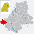
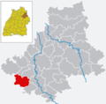
 SHA in BW.png 750 × 740; 37 KB
-
 SHA in BW.svg 921 × 921; 169 KB
-
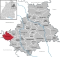
 Blaufelden in SHA.png 750 × 740; 24 KB
-
 Blaufelden in SHA.svg 692 × 652; 846 KB
-
 Braunsbach in SHA.png 750 × 740; 24 KB
-
 Braunsbach in SHA.svg 692 × 652; 847 KB
-
 Buehlertann in SHA.png 750 × 740; 24 KB
-
 Buehlerzell in SHA.png 750 × 740; 24 KB
-
 Bühlertann in SHA.svg 692 × 652; 847 KB
-
 Bühlerzell in SHA.svg 692 × 652; 847 KB
-
 Crailsheim in SHA.png 750 × 740; 24 KB
-
 Crailsheim in SHA.svg 692 × 652; 847 KB
-
 Fichtenau in SHA.png 750 × 740; 24 KB
-
 Fichtenau in SHA.svg 692 × 652; 847 KB
-
 Fichtenberg in SHA.png 750 × 740; 24 KB
-
 Fichtenberg in SHA.svg 692 × 652; 847 KB
-
 Frankenhardt in SHA.png 750 × 740; 24 KB
-
 Frankenhardt in SHA.svg 692 × 652; 847 KB
-
 Gaildorf in SHA.png 750 × 740; 24 KB
-
 Gaildorf in SHA.svg 692 × 652; 847 KB
-
 Gemeindeverwaltungsverband Braunsbach-Untermünkheim in SHA.svg 692 × 652; 846 KB
-
 Gemeindeverwaltungsverband Brettach-Jagst in SHA.svg 692 × 652; 847 KB
-
 Gemeindeverwaltungsverband Fichtenau in SHA.svg 692 × 652; 847 KB
-
 Gemeindeverwaltungsverband Ilshofen-Vellberg in SHA.svg 692 × 652; 846 KB
-
 Gemeindeverwaltungsverband Limpurger Land in SHA.svg 692 × 652; 847 KB
-
 Gemeindeverwaltungsverband Oberes Bühlertal in SHA.svg 692 × 652; 847 KB
-
 Gerabronn in SHA.png 750 × 740; 24 KB
-
 Gerabronn in SHA.svg 692 × 652; 847 KB
-
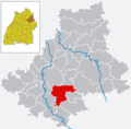
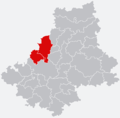 GVV Braunsbach-Untermünkheim.png 892 × 878; 126 KB
-
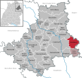
 GVV Brettach Jagst.png 892 × 878; 127 KB
-
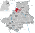
 GVV Fichtenau.png 892 × 878; 126 KB
-
 GVV Ilshofen-Vellberg.png 892 × 878; 126 KB
-
 GVV Limpurger Land.png 892 × 878; 126 KB
-
 GVV Oberes Bühlertal.png 892 × 878; 126 KB
-
 Ilshofen in SHA.png 750 × 740; 24 KB
-
 Ilshofen in SHA.svg 692 × 652; 847 KB
-
 Kirchberg an der Jagst in SHA.png 750 × 740; 24 KB
-
 Kirchberg an der Jagst in SHA.svg 692 × 652; 847 KB
-
 Kressberg in SHA.png 750 × 740; 24 KB
-
 Kreßberg in SHA.svg 692 × 652; 846 KB
-
 Langenburg in SHA.png 750 × 740; 24 KB
-
 Langenburg in SHA.svg 692 × 652; 846 KB
-
 Mainhardt in SHA.png 750 × 740; 24 KB
-
 Mainhardt in SHA.svg 692 × 652; 846 KB
-
 Map of Landkreis Schwäbisch Hall.png 628 × 603; 31 KB
-
 Michelbach an der Bilz in SHA.png 750 × 740; 24 KB
-
 Michelbach an der Bilz in SHA.svg 692 × 652; 847 KB
-
 Michelfeld in SHA.png 750 × 740; 24 KB
-
 Michelfeld in SHA.svg 692 × 652; 846 KB
-
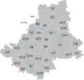
 Municipalities in SHA.svg 692 × 652; 847 KB
-
 Oberrot in SHA.png 750 × 740; 24 KB
-
 Oberrot in SHA.svg 692 × 652; 847 KB
-
 Obersontheim in SHA.png 750 × 740; 24 KB
-
 Obersontheim in SHA.svg 692 × 652; 846 KB
-
 Rosengarten in SHA.png 750 × 740; 24 KB
-
 Rosengarten in SHA.svg 692 × 652; 846 KB
-
 Rot am See in SHA.png 750 × 740; 24 KB
-
 Rot am See in SHA.svg 692 × 652; 847 KB
-
 Ruppertshofen in Ilshofen in SHA.png 750 × 740; 24 KB
-
 Satteldorf in SHA.png 750 × 740; 24 KB
-
 Satteldorf in SHA.svg 692 × 652; 847 KB
-
 Schrozberg in SHA.png 750 × 740; 24 KB
-
 Schrozberg in SHA.svg 692 × 652; 846 KB
-
 Map Schwabisch Hall.png 750 × 740; 52 KB
-
 Schwäbisch Hall in SHA.svg 692 × 652; 846 KB
-
 Stimpfach in SHA.png 750 × 740; 24 KB
-
 Stimpfach in SHA.svg 692 × 652; 847 KB
-
 Sulzbach-Laufen in SHA.png 750 × 740; 24 KB
-
 Sulzbach-Laufen in SHA.svg 692 × 652; 847 KB
-
 Untermuenkheim in SHA.png 750 × 740; 24 KB
-
 Untermünkheim in SHA.svg 692 × 652; 846 KB
-
 Vellberg in SHA.png 750 × 740; 24 KB
-
 Vellberg in SHA.svg 692 × 652; 847 KB
-
 Vereinbarte Verwaltungsgemeinschaft Crailsheim in SHA.svg 692 × 652; 847 KB
-
 Vereinbarte Verwaltungsgemeinschaft Gerabronn in SHA.svg 692 × 652; 846 KB
-
 Vereinbarte Verwaltungsgemeinschaft Schwäbisch Hall in SHA.svg 692 × 652; 846 KB
-
 VVG Crailsheim.png 892 × 878; 128 KB
-
 VVG Gerabronn.png 892 × 878; 125 KB
-
 VVG Schwäbisch Hall.png 892 × 878; 128 KB
-
 Wallhausen in SHA.png 750 × 740; 24 KB
-
 Wallhausen in SHA.svg 692 × 652; 847 KB
-
 Wolpertshausen in SHA.png 750 × 740; 24 KB
-
 Wolpertshausen in SHA.svg 692 × 652; 847 KB


