Category:Locator maps of municipalities in Landkreis Freudenstadt
Jump to navigation
Jump to search
Urban districts (cities):
Media in category "Locator maps of municipalities in Landkreis Freudenstadt"
The following 18 files are in this category, out of 18 total.
-
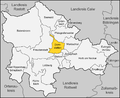
 Karte Alpirsbach.png 1,000 × 820; 136 KB
-
 Karte Bad Rippoldsau-Schapbach.png 1,000 × 820; 136 KB
-
 Karte Baiersbronn.png 1,000 × 820; 137 KB
-
 Karte Dornstetten.png 1,000 × 820; 208 KB
-
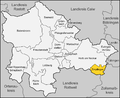 Karte Empfingen.png 1,000 × 820; 134 KB
-
 Karte Eutingen im Gäu.png 1,000 × 820; 208 KB
-
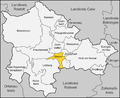
 Karte Freudenstadt.png 1,000 × 820; 136 KB
-
 Karte Glatten.png 1,000 × 820; 208 KB
-
 Karte Grömbach.png 1,000 × 820; 208 KB
-
 Karte Horb am Neckar.png 1,000 × 820; 209 KB
-
 Karte Landkreis Freudenstadt.png 1,000 × 820; 207 KB
-
 Karte Landkreis Freudenstadt.svg 678 × 556; 74 KB
-
 Karte Loßburg.png 1,000 × 820; 208 KB
-
 Karte Pfalzgrafenweiler.png 1,000 × 820; 135 KB
-
 Karte Schopfloch.png 1,000 × 820; 208 KB
-
 Karte Seewald.png 1,000 × 820; 208 KB
-
 Karte Waldachtal.png 1,000 × 820; 208 KB
-
 Karte Wörnersberg.png 1,000 × 820; 207 KB


