Category:Locator maps of municipalities in Hohenlohekreis
Jump to navigation
Jump to search
Urban districts (cities):
- English: This category contains maps of municipalities and collective municipalities in the Hohenlohekreis, Baden-Württemberg.
- Deutsch: Diese Kategorie enthält Karten von Gemeinden und Gemeindeverbänden im Hohenlohekreis in Baden-Württemberg.
Media in category "Locator maps of municipalities in Hohenlohekreis"
The following 40 files are in this category, out of 40 total.
-
 Bretzfeld in Hohenlohekreis.png 505 × 502; 19 KB
-
 Bretzfeld in KÜN.svg 451 × 442; 599 KB
-
 Doerzbach in Hohenlohekreis.png 505 × 502; 19 KB
-
 Dörzbach in KÜN.svg 451 × 442; 599 KB
-
 Forchtenberg in Hohenlohekr.png 505 × 502; 19 KB
-
 Forchtenberg in KÜN.svg 451 × 442; 599 KB
-
 Gemeindeverwaltungsverband Hohenloher Ebene in KÜN.svg 451 × 442; 599 KB
-
 Gemeindeverwaltungsverband Krautheim in KÜN.svg 451 × 442; 599 KB
-
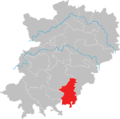
 Gemeindeverwaltungsverband Mittleres Kochertal in KÜN.svg 451 × 442; 599 KB
-
 Ingelfingen in Hohenlohekre.png 505 × 502; 19 KB
-
 Ingelfingen in KÜN.svg 451 × 442; 599 KB
-
 Krautheim in Hohenlohekreis.png 505 × 502; 19 KB
-
 Krautheim in KÜN.svg 451 × 442; 599 KB
-
 Kuenzelsau in Hohenlohekrei.png 505 × 502; 19 KB
-
 Kupferzell in Hohenlohekreis.png 505 × 502; 13 KB
-
 Kupferzell in KÜN.svg 451 × 442; 599 KB
-
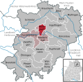
 Künzelsau in KÜN.svg 451 × 442; 599 KB
-
 Locator map KÜN in Baden-Württemberg.svg 1,058 × 1,161; 278 KB
-
 Map of Hohenlohekreis.png 505 × 502; 22 KB
-
 Mulfingen in Hohenlohekreis.png 505 × 502; 19 KB
-
 Mulfingen in KÜN.svg 451 × 442; 599 KB
-
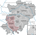
 Municipalities in KÜN.svg 451 × 442; 599 KB
-
 Neuenstein in Hohenlohekrei.png 505 × 502; 19 KB
-
 Neuenstein in KÜN.svg 451 × 442; 599 KB
-
 Niedernhall in Hohenlohekre.png 505 × 502; 19 KB
-
 Niedernhall in KÜN.svg 451 × 442; 599 KB
-
 Oehringen in Hohenlohekreis.png 505 × 502; 14 KB
-
 Pfedelbach in Hohenlohekrei.png 505 × 502; 19 KB
-
 Pfedelbach in KÜN.svg 451 × 442; 599 KB
-
 Schoental in Hohenlohekreis.png 505 × 502; 28 KB
-
 Schöntal in KÜN.svg 451 × 442; 599 KB
-
 Vereinbarte Verwaltungsgemeinschaft Künzelsau in KÜN.svg 451 × 442; 599 KB
-
 Vereinbarte Verwaltungsgemeinschaft Öhringen in KÜN.svg 451 × 442; 599 KB
-
 Waldenburg in Hohenlohekrei.png 505 × 502; 19 KB
-
 Waldenburg in KÜN.svg 451 × 442; 599 KB
-
 Weissbach in Hohenlohekreis.png 505 × 502; 19 KB
-
 Weißbach in KÜN.svg 451 × 442; 599 KB
-
 Zweiflingen in Hohenlohekre.png 505 × 502; 19 KB
-
 Zweiflingen in KÜN.svg 451 × 442; 599 KB
-
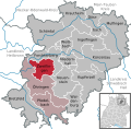
 Öhringen in KÜN.svg 451 × 442; 599 KB


