Category:Locator maps of municipalities in Landkreis Ravensburg
Jump to navigation
Jump to search
Urban districts (cities):
Media in category "Locator maps of municipalities in Landkreis Ravensburg"
The following 54 files are in this category, out of 54 total.
-
 Achberg in RV.svg 718 × 550; 923 KB
-
 Aichstetten in RV.svg 718 × 550; 923 KB
-
 Aitrach in RV.svg 718 × 550; 923 KB
-
 Altshausen in RV.svg 718 × 550; 923 KB
-
 Amtzell in RV.svg 718 × 550; 923 KB
-
 Argenbühl in RV.svg 718 × 550; 923 KB
-
 Aulendorf in RV.svg 718 × 550; 923 KB
-
 Bad Waldsee in RV.svg 718 × 550; 923 KB
-
 Bad Wurzach in RV.svg 718 × 550; 923 KB
-
 Baienfurt in RV.svg 718 × 550; 923 KB
-
 Baindt in RV.svg 718 × 550; 923 KB
-
 Berg in RV.svg 718 × 550; 923 KB
-
 Bergatreute in RV.svg 718 × 550; 923 KB
-
 Bodnegg in RV.svg 718 × 550; 923 KB
-
 Boms in RV.svg 718 × 550; 923 KB
-
 Ebenweiler in RV.svg 718 × 550; 923 KB
-
 Ebersbach-Musbach in RV.svg 718 × 550; 923 KB
-
 Eichstegen in RV.svg 718 × 550; 923 KB
-
 Fleischwangen in RV.svg 718 × 550; 923 KB
-
 Fronreute in RV.svg 718 × 550; 923 KB
-
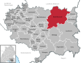
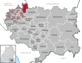
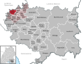
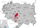
 Gemeindeverwaltungsverband Altshausen in RV.svg 718 × 550; 923 KB
-
 Gemeindeverwaltungsverband Altshausen.png 949 × 744; 172 KB
-
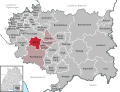
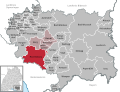
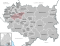 Gemeindeverwaltungsverband Fronreute-Wolpertswende in RV.svg 718 × 550; 923 KB
-
 Gemeindeverwaltungsverband Fronreute-Wolpertswende.png 949 × 744; 168 KB
-
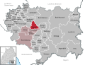
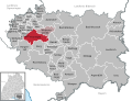
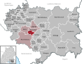
 Gemeindeverwaltungsverband Gullen in RV.svg 718 × 550; 923 KB
-
 Gemeindeverwaltungsverband Gullen.png 949 × 744; 160 KB
-
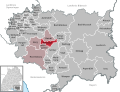
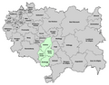
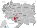
 Gemeindeverwaltungsverband Mittleres Schussental in RV.svg 718 × 550; 923 KB
-
 Gemeindeverwaltungsverband Mittleres Schussental.png 949 × 744; 177 KB
-
 Grünkraut in RV.svg 718 × 550; 923 KB
-
 Guggenhausen in RV.svg 718 × 550; 923 KB
-
 Horgenzell in RV.svg 718 × 550; 924 KB
-
 Hoßkirch in RV.svg 718 × 550; 923 KB
-
 Isny im Allgäu in RV.svg 718 × 550; 923 KB
-
 Kißlegg in RV.svg 718 × 550; 923 KB
-
 Königseggwald in RV.svg 718 × 550; 923 KB
-
 Landkreis Ravensburg Karte mit Ortsnamen.png 949 × 744; 165 KB
-
 Leutkirch im Allgäu in RV.svg 718 × 550; 923 KB
-
 Municipalities in RV.svg 718 × 550; 923 KB
-
 Ravensburg in RV.svg 718 × 550; 923 KB
-
 Riedhausen in RV.svg 718 × 550; 923 KB
-
 Schlier in RV.svg 718 × 550; 923 KB
-
 Unterwaldhausen in RV.svg 718 × 550; 923 KB
-
 Vereinbarte Verwaltungsgemeinschaft Bad Waldsee in RV.svg 718 × 550; 923 KB
-
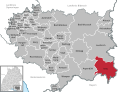
 Vereinbarte Verwaltungsgemeinschaft Leutkirch im Allgäu in RV.svg 718 × 550; 923 KB
-
 Vereinbarte Verwaltungsgemeinschaft Vogt in RV.svg 718 × 550; 923 KB
-
 Vereinbarte Verwaltungsgemeinschaft Wangen im Allgäu in RV.svg 718 × 550; 923 KB
-
 Vereinbarte Verwaltungsgemeinschaft Wilhelmsdorf in RV.svg 718 × 550; 923 KB
-
 Vogt in RV.svg 718 × 550; 923 KB
-
 Waldburg in RV.svg 718 × 550; 923 KB
-
 Wangen im Allgäu in RV.svg 718 × 550; 923 KB
-
 Weingarten in RV.svg 718 × 550; 923 KB
-
 Wilhelmsdorf in RV.svg 718 × 550; 923 KB
-
 Wolfegg in RV.svg 718 × 550; 923 KB
-
 Wolpertswende in RV.svg 718 × 550; 923 KB


