Category:Locator maps of counties of New York (state)
Jump to navigation
Jump to search
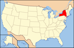
States of the United States: Alabama · Alaska · Arizona · Arkansas · California · Colorado · Connecticut · Delaware · Florida · Georgia · Hawaii · Idaho · Illinois · Indiana · Iowa · Kansas · Kentucky · Louisiana · Maine · Maryland · Massachusetts · Michigan · Minnesota · Mississippi · Missouri · Montana · Nebraska · Nevada · New Hampshire · New Jersey · New Mexico · New York · North Carolina · North Dakota · Ohio · Oklahoma · Oregon · Pennsylvania · Rhode Island · South Carolina · South Dakota · Tennessee · Texas · Utah · Vermont · Virginia · Washington · West Virginia · Wisconsin · Wyoming
| NO WIKIDATA ID FOUND! Search for Locator maps of counties of New York (state) on Wikidata | |
| Upload media |
English: Locator maps for counties in New York (state).
Subcategories
This category has the following 4 subcategories, out of 4 total.
Media in category "Locator maps of counties of New York (state)"
The following 132 files are in this category, out of 132 total.
-
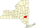
 Albany County in New York.svg 1,572 × 1,277; 590 KB
-
 Albany.PNG 274 × 210; 6 KB
-
 Allegany County in New York.svg 1,572 × 1,277; 590 KB
-
 Broome County in New York.svg 1,572 × 1,277; 591 KB
-
 Cattaraugus County in New York.svg 1,572 × 1,277; 591 KB
-
 Cayuga County in New York.svg 1,572 × 1,277; 591 KB
-
 Chautauqua County in New York.svg 1,572 × 1,277; 590 KB
-
 Chemung County in New York.svg 1,572 × 1,277; 590 KB
-
 Chenango County in New York.svg 1,572 × 1,277; 590 KB
-
 Clinton County in New York.svg 1,572 × 1,277; 591 KB
-
 Columbia County in New York.svg 1,572 × 1,277; 590 KB
-
 Cortland County in New York.svg 1,572 × 1,277; 590 KB
-
 Delaware County in New York.svg 1,572 × 1,277; 591 KB
-
 Dutchess County in New York.svg 1,572 × 1,277; 590 KB
-
 Erie County in New York.svg 1,572 × 1,277; 592 KB
-
 Essex County in New York.svg 1,572 × 1,277; 590 KB
-
 Franklin County in New York.svg 1,572 × 1,277; 590 KB
-
 Fulton County in New York.svg 1,572 × 1,277; 590 KB
-
 Genesee County in New York.svg 1,572 × 1,277; 590 KB
-
 Greene County in New York.svg 1,572 × 1,277; 590 KB
-
 Hamilton County in New York.svg 1,572 × 1,277; 590 KB
-
 Herkimer County in New York.svg 1,572 × 1,277; 591 KB
-
 Jefferson County in New York.svg 1,572 × 1,277; 590 KB
-
 Lewis County in New York.svg 1,572 × 1,277; 585 KB
-
 Livingston County in New York.svg 1,572 × 1,277; 591 KB
-
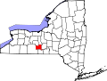
 Madison County in New York.svg 1,572 × 1,277; 591 KB
-
 Map of New York highlighting Albany County.svg 1,100 × 838; 66 KB
-
 Map of New York highlighting Allegany County.svg 1,100 × 838; 66 KB
-
 Map of New York highlighting Bronx County.svg 1,100 × 838; 66 KB
-
 Map of New York highlighting Broome County.svg 1,100 × 838; 66 KB
-
 Map of New York highlighting Capital District.svg 6,599 × 5,030; 125 KB
-
 Map of New York highlighting Capitol District.PNG 300 × 232; 10 KB
-
 Map of New York highlighting Cattaraugus County.svg 1,100 × 838; 66 KB
-
 Map of New York highlighting Cayuga County.svg 1,100 × 838; 66 KB
-
 Map of New York highlighting Chautauqua County.svg 1,100 × 838; 66 KB
-
 Map of New York highlighting Chemung County.svg 1,100 × 838; 66 KB
-
 Map of New York highlighting Chenango County.svg 1,100 × 838; 66 KB
-
 Map of New York highlighting Clinton County.svg 1,100 × 838; 66 KB
-
 Map of New York highlighting Columbia County.svg 1,100 × 838; 66 KB
-
 Map of New York highlighting Cortland County.svg 1,100 × 838; 66 KB
-
 Map of New York highlighting Delaware County.svg 1,100 × 838; 66 KB
-
 Map of New York highlighting Dutchess County.svg 1,100 × 838; 66 KB
-
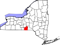
 Map of New York highlighting Erie County.svg 1,100 × 838; 66 KB
-
 Map of New York highlighting Essex County.svg 1,100 × 838; 66 KB
-
 Map of New York highlighting Franklin County.svg 1,100 × 838; 66 KB
-
 Map of New York highlighting Fulton County.svg 1,100 × 838; 66 KB
-
 Map of New York highlighting Genesee County.svg 1,100 × 838; 66 KB
-
 Map of New York highlighting Greene County.svg 1,100 × 838; 66 KB
-
 Map of New York highlighting Hamilton County.svg 1,100 × 838; 66 KB
-
 Map of New York highlighting Herkimer County.svg 1,100 × 838; 66 KB
-
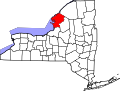
 Map of New York highlighting Hudson Valley 2.svg 512 × 390; 273 KB
-
 Map of New York highlighting Hudson Valley.svg 512 × 390; 285 KB
-
 Map of New York highlighting Jefferson County.svg 1,100 × 838; 66 KB
-
 Map of New York highlighting Kings County.svg 1,100 × 838; 66 KB
-
 Map of New York highlighting Lewis County.svg 1,100 × 838; 66 KB
-
 Map of New York highlighting Livingston County.svg 1,100 × 838; 66 KB
-
 Map of New York highlighting Madison County.svg 1,100 × 838; 66 KB
-
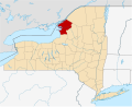
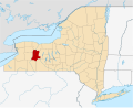
 Map of New York highlighting Monroe County.svg 1,100 × 838; 66 KB
-
 Map of New York highlighting Montgomery County.svg 1,100 × 838; 66 KB
-
 Map of New York highlighting Nassau County.png 300 × 232; 8 KB
-
 Map of New York highlighting Nassau County.svg 1,100 × 838; 66 KB
-
 Map of New York highlighting New York County.svg 1,100 × 838; 66 KB
-
 Map of New York highlighting Niagara County.svg 1,100 × 838; 66 KB
-
 Map of New York highlighting no county.svg 6,599 × 5,030; 113 KB
-
 Map of New York highlighting Oneida County.svg 1,100 × 838; 66 KB
-
 Map of New York highlighting Onondaga County.svg 1,100 × 838; 66 KB
-
 Map of New York highlighting Ontario County.svg 1,100 × 838; 66 KB
-
 Map of New York highlighting Orange County.svg 1,100 × 838; 66 KB
-
 Map of New York highlighting Orleans County.svg 1,100 × 838; 66 KB
-
 Map of New York highlighting Oswego County.svg 1,100 × 838; 66 KB
-
 Map of New York highlighting Otsego County.svg 1,100 × 838; 66 KB
-
 Map of New York highlighting Putnam County.svg 1,100 × 838; 66 KB
-
 Map of New York highlighting Queens County.svg 1,100 × 838; 66 KB
-
 Map of New York highlighting Rensselaer County.svg 1,100 × 838; 66 KB
-
 Map of New York highlighting Richmond County.svg 1,100 × 838; 66 KB
-
 Map of New York highlighting Rockland County.svg 1,100 × 838; 66 KB
-
 Map of New York highlighting Saratoga County.svg 1,100 × 838; 66 KB
-
 Map of New York highlighting Schenectady County.svg 1,100 × 838; 66 KB
-
 Map of New York highlighting Schoharie County.svg 1,100 × 838; 66 KB
-
 Map of New York highlighting Schuyler County.svg 1,100 × 838; 66 KB
-
 Map of New York highlighting Seneca County.svg 1,100 × 838; 66 KB
-
 Map of New York highlighting St. Lawrence County.svg 1,100 × 838; 66 KB
-
 Map of New York highlighting Steuben County.svg 1,100 × 838; 66 KB
-
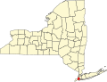
 Map of New York highlighting Suffolk County.png 300 × 232; 8 KB
-
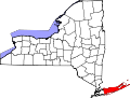 Map of New York highlighting Suffolk County.svg 1,100 × 838; 66 KB
-
 Map of New York highlighting Sullivan County.svg 1,100 × 838; 66 KB
-
 Map of New York highlighting Tioga County.svg 1,100 × 838; 66 KB
-
 Map of New York highlighting Tompkins County.svg 1,100 × 838; 66 KB
-
 Map of New York highlighting Ulster County.svg 1,100 × 838; 66 KB
-
 Map of New York highlighting Warren County.svg 1,100 × 838; 66 KB
-
 Map of New York highlighting Washington County.svg 1,100 × 838; 66 KB
-
 Map of New York highlighting Wayne County.svg 1,100 × 838; 66 KB
-
 Map of New York highlighting Westchester County.svg 1,100 × 838; 66 KB
-
 Map of New York highlighting Wyoming County.svg 1,100 × 838; 66 KB
-
 Map of New York highlighting Yates County.svg 1,100 × 838; 66 KB
-
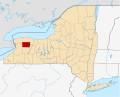
 Monroe County in New York.svg 1,572 × 1,277; 590 KB
-
 Montgomery County in New York.svg 1,572 × 1,277; 590 KB
-
 Nassau County in New York.svg 1,572 × 1,277; 484 KB
-
 New York Counties—Nassau.svg 655 × 500; 427 KB
-
 New York Counties—Suffolk.svg 655 × 500; 427 KB
-
 New York County in New York.svg 1,572 × 1,277; 590 KB
-
 Niagara County in New York.svg 1,572 × 1,277; 591 KB
-
 Oneida County in New York.svg 1,572 × 1,277; 591 KB
-
 Onondaga County in New York.svg 1,572 × 1,277; 590 KB
-
 Ontario County in New York.svg 1,572 × 1,277; 590 KB
-
 Orange County in New York.svg 1,572 × 1,277; 591 KB
-
 Orleans County in New York.svg 1,572 × 1,277; 590 KB
-
 Oswego County in New York.svg 1,572 × 1,277; 590 KB
-
 Otsego County in New York.svg 1,572 × 1,277; 591 KB
-
 Putnam County in New York.svg 1,572 × 1,277; 590 KB
-
 Richmond County in New York.svg 1,572 × 1,277; 589 KB
-
 Rockland County in New York.svg 1,572 × 1,277; 590 KB
-
 Saratoga County in New York.svg 1,572 × 1,277; 591 KB
-
 Schenectady County in New York.svg 1,572 × 1,277; 590 KB
-
 Schoharie County in New York.svg 1,572 × 1,277; 591 KB
-
 Schuyler County in New York.svg 1,572 × 1,277; 590 KB
-
 Seneca County in New York.svg 1,572 × 1,277; 590 KB
-
 St. Lawrence County in New York.svg 1,572 × 1,277; 591 KB
-
 Steuben County in New York.svg 1,572 × 1,277; 590 KB
-
 Sullivan County in New York.svg 1,572 × 1,277; 590 KB
-
 The Bronx County in New York.svg 1,572 × 1,277; 590 KB
-
 Tioga County in New York.svg 1,572 × 1,277; 591 KB
-
 Tompkins County in New York.svg 1,572 × 1,277; 590 KB
-
 Ulster County in New York.svg 1,572 × 1,277; 591 KB
-
 Warren County in New York.svg 1,572 × 1,277; 591 KB
-
 Washington County in New York.svg 1,572 × 1,277; 591 KB
-
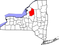
 Waterford Saratoga NY.png 778 × 814; 32 KB
-
 Wayne County in New York.svg 1,572 × 1,277; 590 KB
-
 Westchester County in New York.svg 1,572 × 1,277; 590 KB
-
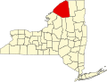
 Western New York.svg 905 × 676; 487 KB
-
 Wyoming County in New York.svg 1,572 × 1,277; 590 KB
-
 Yates County in New York.svg 1,572 × 1,277; 590 KB


