Category:Locator maps of counties of Texas
Jump to navigation
Jump to search

States of the United States: Alabama · Alaska · Arizona · Arkansas · California · Colorado · Connecticut · Delaware · Florida · Georgia · Hawaii · Idaho · Illinois · Indiana · Iowa · Kansas · Kentucky · Louisiana · Maine · Maryland · Massachusetts · Michigan · Minnesota · Mississippi · Missouri · Montana · Nebraska · Nevada · New Hampshire · New Jersey · New Mexico · New York · North Carolina · North Dakota · Ohio · Oklahoma · Oregon · Pennsylvania · Rhode Island · South Carolina · South Dakota · Tennessee · Texas · Utah · Vermont · Virginia · Washington · West Virginia · Wisconsin · Wyoming
| NO WIKIDATA ID FOUND! Search for Locator maps of counties of Texas on Wikidata | |
| Upload media |
English: Locator maps for counties in Texas.
Subcategories
This category has the following 2 subcategories, out of 2 total.
Media in category "Locator maps of counties of Texas"
The following 200 files are in this category, out of 433 total.
(previous page) (next page)-
Condados texas.PNG 628 × 600; 92 KB
-
Map of Texas highlighting Galveston County.png 300 × 284; 14 KB
-
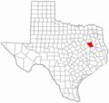
Anderson County Texas.png 300 × 284; 14 KB
-
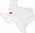
Andrews County Texas.png 300 × 284; 12 KB
-
Archer County Texas.png 300 × 284; 13 KB
-
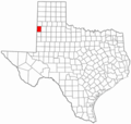
Bailey County Texas.png 300 × 284; 12 KB
-
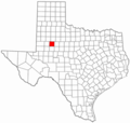
Borden County Texas.png 300 × 284; 12 KB
-
Great Texas Coastal Birding Trail Map.png 534 × 480; 11 KB
-
Hardeman County Texas.png 300 × 284; 13 KB
-
Hardin County Texas.png 300 × 284; 12 KB
-
Harris County Texas.png 300 × 284; 12 KB
-
Harrison County Texas.png 300 × 284; 12 KB
-
Hartley County Texas.png 300 × 284; 12 KB
-
Haskell County Texas.png 300 × 284; 12 KB
-
Hays County Texas.png 300 × 284; 13 KB
-
Hemphill County Texas.png 300 × 284; 13 KB
-
Henderson County Texas.png 300 × 284; 12 KB
-
Hidalgo County Texas.png 300 × 284; 13 KB
-
Hill County Texas.png 300 × 284; 13 KB
-
Hockley County Texas.png 300 × 284; 12 KB
-
Hood County Texas.png 300 × 284; 12 KB
-
Hopkins County Texas.png 300 × 284; 14 KB
-
Houston County Texas.png 300 × 284; 13 KB
-
Howard County Texas.png 300 × 284; 13 KB
-
Hudspeth County Texas.png 300 × 284; 13 KB
-
Hunt County Texas.png 300 × 284; 13 KB
-
Hutchinson County Texas.png 300 × 284; 12 KB
-
Irion County Texas.png 300 × 284; 12 KB
-
Jack County Texas.png 300 × 284; 12 KB
-
Jackson County Texas.png 300 × 284; 13 KB
-
Jasper County Texas.png 300 × 284; 13 KB
-
Jeff Davis County Texas.png 300 × 284; 12 KB
-
Jefferson County Texas.png 300 × 284; 13 KB
-
Jim Hogg County Texas.png 300 × 284; 12 KB
-
Jim Wells County Texas.png 300 × 284; 13 KB
-
Johnson County Texas.png 300 × 284; 13 KB
-
Jones County Texas.png 300 × 284; 12 KB
-
Karnes County Texas.png 300 × 284; 14 KB
-
Kaufman County Texas.png 300 × 284; 13 KB
-
Kendall County Texas.png 300 × 284; 12 KB
-
Kenedy County Texas.png 300 × 284; 12 KB
-
Kent County Texas.png 300 × 284; 12 KB
-
Kerr County Texas.png 300 × 284; 12 KB
-
Kimble County Texas.png 300 × 284; 13 KB
-
King County Texas.png 300 × 284; 12 KB
-
Kinney County Texas.png 300 × 284; 12 KB
-
Kleberg County Texas.png 300 × 284; 14 KB
-
Knox County Texas.png 300 × 284; 12 KB
-
La Salle County Texas.png 300 × 284; 12 KB
-
Lamar County Texas.png 300 × 284; 12 KB
-
Lamb County Texas.png 300 × 284; 12 KB
-
Lampasas County Texas.png 300 × 284; 13 KB
-
Lavaca County Texas.png 300 × 284; 13 KB
-
Lee County Texas.png 300 × 284; 12 KB
-
Leon County Texas.png 300 × 284; 12 KB
-
Liberty County Texas.png 300 × 284; 13 KB
-
Limestone County Texas.png 300 × 284; 12 KB
-
Lipscomb County Texas.png 300 × 284; 12 KB
-
Live Oak County Texas.png 300 × 284; 13 KB
-
Llano County Texas.png 300 × 284; 13 KB
-
Location of lynching in 1922 on a Map of Texas with year.png 2,155 × 2,048; 523 KB
-
Location of lynchings in 1922 on a Map of Texas.jpg 2,155 × 2,048; 545 KB
-
Lubbock County Texas.png 300 × 284; 12 KB
-
Lynn County Texas.png 300 × 284; 12 KB
-
Madison County Texas.png 300 × 284; 14 KB
-
Map of Texas highlighting Anderson County.svg 1,386 × 1,317; 222 KB
-
Map of Texas highlighting Andrews County.svg 1,386 × 1,317; 222 KB
-
Map of Texas highlighting Angelina County.svg 1,386 × 1,317; 222 KB
-
Map of Texas highlighting Aransas County.svg 1,386 × 1,317; 222 KB
-
Map of Texas highlighting Archer County.svg 1,386 × 1,317; 222 KB
-
Map of Texas highlighting Armstrong County.svg 1,386 × 1,317; 222 KB
-
Map of Texas highlighting Atascosa County.svg 1,386 × 1,317; 222 KB
-
Map of Texas highlighting Austin County.svg 1,386 × 1,317; 222 KB
-
Map of Texas highlighting Bailey County.svg 1,386 × 1,317; 222 KB
-
Map of Texas highlighting Bandera County.svg 1,386 × 1,317; 222 KB
-
Map of Texas highlighting Bastrop County.svg 1,386 × 1,317; 222 KB
-
Map of Texas highlighting Baylor County.svg 1,386 × 1,317; 222 KB
-
Map of Texas highlighting Bee County.svg 1,386 × 1,317; 222 KB
-
Map of Texas highlighting Bell County.svg 1,386 × 1,317; 222 KB
-
Map of Texas highlighting Bexar County.svg 1,386 × 1,317; 222 KB
-
Map of Texas highlighting Blanco County.svg 1,386 × 1,317; 222 KB
-
Map of Texas highlighting Borden County.svg 1,386 × 1,317; 222 KB
-
Map of Texas highlighting Bosque County.svg 1,386 × 1,317; 222 KB
-
Map of Texas highlighting Bowie County.svg 1,386 × 1,317; 222 KB
-
Map of Texas highlighting Brazoria County.svg 1,386 × 1,317; 222 KB
-
Map of Texas highlighting Brazos County.svg 1,386 × 1,317; 222 KB
-
Map of Texas highlighting Brewster County.svg 1,386 × 1,317; 222 KB
-
Map of Texas highlighting Briscoe County.svg 1,386 × 1,317; 222 KB
-
Map of Texas highlighting Brooks County.svg 1,386 × 1,317; 222 KB
-
Map of Texas highlighting Brown County.svg 1,386 × 1,317; 222 KB
-
Map of Texas highlighting Buchel County.svg 12,473 × 11,855; 353 KB
-
Map of Texas highlighting Burleson County.svg 1,386 × 1,317; 222 KB
-
Map of Texas highlighting Burnet County.svg 1,386 × 1,317; 222 KB
-
Map of Texas highlighting Caldwell County.svg 1,386 × 1,317; 222 KB
-
Map of Texas highlighting Calhoun County.svg 1,386 × 1,317; 222 KB
-
Map of Texas highlighting Callahan County.svg 1,386 × 1,317; 222 KB
-
Map of Texas highlighting Cameron County.svg 1,386 × 1,317; 222 KB
-
Map of Texas highlighting Camp County.svg 1,386 × 1,317; 222 KB
-
Map of Texas highlighting Carson County.svg 1,386 × 1,317; 222 KB
-
Map of Texas highlighting Cass County.svg 1,386 × 1,317; 222 KB
-
Map of Texas highlighting Castro County.svg 1,386 × 1,317; 222 KB
-
Map of Texas highlighting Chambers County.svg 1,386 × 1,317; 222 KB
-
Map of Texas highlighting Cherokee County.svg 1,386 × 1,317; 222 KB
-
Map of Texas highlighting Childress County.png 300 × 284; 12 KB
-
Map of Texas highlighting Childress County.svg 1,386 × 1,317; 222 KB
-
Map of Texas highlighting Clay County.svg 1,386 × 1,317; 222 KB
-
Map of Texas highlighting Cochran County.svg 1,386 × 1,317; 222 KB
-
Map of Texas highlighting Coke County.svg 1,386 × 1,317; 222 KB
-
Map of Texas highlighting Coleman County.svg 1,386 × 1,317; 222 KB
-
Map of Texas highlighting Collin County.svg 1,386 × 1,317; 222 KB
-
Map of Texas highlighting Collingsworth County.svg 1,386 × 1,317; 222 KB
-
Map of Texas highlighting Colorado County.svg 1,386 × 1,317; 222 KB
-
Map of Texas highlighting Comal County.svg 1,386 × 1,317; 222 KB
-
Map of Texas highlighting Comanche County.svg 1,386 × 1,317; 222 KB
-
Map of Texas highlighting Concho County.svg 1,386 × 1,317; 222 KB
-
Map of Texas highlighting Cooke County.svg 1,386 × 1,317; 222 KB
-
Map of Texas highlighting Coryell County.svg 1,386 × 1,317; 222 KB
-
Map of Texas highlighting Cottle County.svg 1,386 × 1,317; 222 KB
-
Map of Texas highlighting Crane County.svg 1,386 × 1,317; 222 KB
-
Map of Texas highlighting Crockett County.svg 1,386 × 1,317; 222 KB
-
Map of Texas highlighting Crosby County.svg 1,386 × 1,317; 222 KB
-
Map of Texas highlighting Culberson County.svg 1,386 × 1,317; 222 KB
-
Map of Texas highlighting Dallam County.svg 1,386 × 1,317; 222 KB
-
Map of Texas highlighting Dallas County.svg 1,386 × 1,317; 222 KB
-
Map of Texas highlighting Dawson County.svg 1,386 × 1,317; 222 KB
-
Map of Texas highlighting Deaf Smith County.svg 1,386 × 1,317; 222 KB
-
Map of Texas highlighting Delta County.svg 1,386 × 1,317; 222 KB
-
Map of Texas highlighting Denton County.svg 1,386 × 1,317; 222 KB
-
Map of Texas highlighting DeWitt County.svg 1,386 × 1,317; 222 KB
-
Map of Texas highlighting Dickens County.svg 1,386 × 1,317; 222 KB
-
Map of Texas highlighting Dimmit County.svg 1,386 × 1,317; 222 KB
-
Map of Texas highlighting Donley County.svg 1,386 × 1,317; 222 KB
-
Map of Texas highlighting Duval County.svg 1,386 × 1,317; 222 KB
-
Map of Texas highlighting Eastland County.svg 1,386 × 1,317; 222 KB
-
Map of Texas highlighting Ector County.svg 1,386 × 1,317; 222 KB
-
Map of Texas highlighting Edwards County.svg 1,386 × 1,317; 222 KB
-
Map of Texas highlighting El Paso County.svg 1,386 × 1,317; 222 KB
-
Map of Texas highlighting Ellis County.svg 1,386 × 1,317; 222 KB
-
Map of Texas highlighting Encinal County.svg 12,473 × 11,855; 315 KB
-
Map of Texas highlighting Erath County.svg 1,386 × 1,317; 222 KB
-
Map of Texas highlighting Falls County.svg 1,386 × 1,317; 222 KB
-
Map of Texas highlighting Fannin County.svg 1,386 × 1,317; 222 KB
-
Map of Texas highlighting Fayette County.svg 1,386 × 1,317; 222 KB
-
Map of Texas highlighting Fisher County.svg 1,386 × 1,317; 222 KB
-
Map of Texas highlighting Floyd County.svg 1,386 × 1,317; 222 KB
-
Map of Texas highlighting Foard County.svg 1,386 × 1,317; 222 KB
-
Map of Texas highlighting Foley County.svg 12,473 × 11,855; 320 KB
-
Map of Texas highlighting Fort Bend County.svg 1,386 × 1,317; 222 KB
-
Map of Texas highlighting Franklin County.svg 1,386 × 1,317; 222 KB
-
Map of Texas highlighting Freestone County.svg 1,386 × 1,317; 222 KB
-
Map of Texas highlighting Frio County.svg 1,386 × 1,317; 222 KB
-
Map of Texas highlighting Gaines County.svg 1,386 × 1,317; 222 KB
-
Map of Texas highlighting Galveston County.svg 1,386 × 1,317; 222 KB
-
Map of Texas highlighting Garza County.svg 1,386 × 1,317; 222 KB
-
Map of Texas highlighting Gillespie County.svg 1,386 × 1,317; 222 KB
-
Map of Texas highlighting Glasscock County.svg 1,386 × 1,317; 222 KB
-
Map of Texas highlighting Goliad County.svg 1,386 × 1,317; 222 KB
-
Map of Texas highlighting Gonzales County.svg 1,386 × 1,317; 222 KB
-
Map of Texas highlighting Gray County.svg 1,386 × 1,317; 222 KB
-
Map of Texas highlighting Grayson County.svg 1,386 × 1,317; 222 KB
-
Map of Texas highlighting Greer County.svg 12,473 × 11,855; 348 KB
-
Map of Texas highlighting Gregg County.svg 1,386 × 1,317; 222 KB
-
Map of Texas highlighting Grimes County.svg 1,386 × 1,317; 222 KB
-
Map of Texas highlighting Guadalupe County.svg 1,386 × 1,317; 222 KB
-
Map of Texas highlighting Hale County.svg 1,386 × 1,317; 222 KB
-
Map of Texas highlighting Hall County.svg 1,386 × 1,317; 222 KB
-
Map of Texas highlighting Hamilton County.svg 1,386 × 1,317; 222 KB
-
Map of Texas highlighting Hansford County.svg 1,386 × 1,317; 222 KB
-
Map of Texas highlighting Hardeman County.svg 1,386 × 1,317; 222 KB
-
Map of Texas highlighting Hardin County.svg 1,386 × 1,317; 222 KB
-
Map of Texas highlighting Harris County.svg 1,386 × 1,317; 222 KB
-
Map of Texas highlighting Harrison County.svg 1,386 × 1,317; 222 KB
-
Map of Texas highlighting Hartley County.svg 1,386 × 1,317; 222 KB
-
Map of Texas highlighting Haskell County.svg 1,386 × 1,317; 222 KB
-
Map of Texas highlighting Hays County.svg 1,386 × 1,317; 222 KB
-
Map of Texas highlighting Hemphill County.svg 1,386 × 1,317; 222 KB
-
Map of Texas highlighting Henderson County.svg 1,386 × 1,317; 222 KB
-
Map of Texas highlighting Hidalgo County.svg 1,386 × 1,317; 222 KB
-
Map of Texas highlighting Hill County.svg 1,386 × 1,317; 222 KB
-
Map of Texas highlighting Hockley County.svg 1,386 × 1,317; 222 KB
-
Map of Texas highlighting Hood County.svg 1,386 × 1,317; 222 KB
-
Map of Texas highlighting Hopkins County.svg 1,386 × 1,317; 222 KB
-
Map of Texas highlighting Houston County.svg 1,386 × 1,317; 222 KB
-
Map of Texas highlighting Howard County.svg 1,386 × 1,317; 222 KB
-
Map of Texas highlighting Hudspeth County.svg 1,386 × 1,317; 222 KB
-
Map of Texas highlighting Hunt County.svg 1,386 × 1,317; 222 KB
-
Map of Texas highlighting Hutchinson County.svg 1,386 × 1,317; 222 KB
-
Map of Texas highlighting Irion County.svg 1,386 × 1,317; 222 KB
-
Map of Texas highlighting Jack County.svg 1,386 × 1,317; 222 KB
-
Map of Texas highlighting Jackson County.svg 1,386 × 1,317; 222 KB
-
Map of Texas highlighting Jasper County.svg 1,386 × 1,317; 222 KB
-
Map of Texas highlighting Jeff Davis County.svg 1,386 × 1,317; 222 KB
-
Map of Texas highlighting Jefferson County.svg 1,386 × 1,317; 222 KB
-
Map of Texas highlighting Jim Hogg County.svg 1,386 × 1,317; 222 KB
-
Map of Texas highlighting Jim Wells County.svg 1,386 × 1,317; 222 KB
-
Map of Texas highlighting Johnson County.svg 1,386 × 1,317; 222 KB
-
Map of Texas highlighting Jones County.svg 1,386 × 1,317; 222 KB
-
Map of Texas highlighting Karnes County.svg 1,386 × 1,317; 222 KB
-
Map of Texas highlighting Kaufman County.svg 1,386 × 1,317; 222 KB
-
Map of Texas highlighting Kendall County.svg 1,386 × 1,317; 222 KB


