Category:Historical maps of ethnic groups in the Balkans
Jump to navigation
Jump to search
| Upload media | |||||
| |||||
Subcategories
This category has the following 16 subcategories, out of 16 total.
A
H
Y
Media in category "Historical maps of ethnic groups in the Balkans"
The following 104 files are in this category, out of 104 total.
-
 13001350ALBANIANMIGRATIONS.png 519 × 591; 386 KB
-

-
 Ethnographische Karte der Österreichischen Monarchie - zusammengesetzt.png 9,459 × 7,094; 97.28 MB
-
 Map of the Serb population, 1862, H. Thiers.png 1,500 × 1,313; 5.31 MB
-
 Südosteuropa BV042746389.jpg 6,326 × 4,432; 5.59 MB
-
 Makedonien Landschaft BV042751193.jpg 5,470 × 3,357; 2.89 MB
-
 Makedonien BV042760754.jpg 5,499 × 5,362; 4.01 MB
-
 Makedonien BV042760767.jpg 5,483 × 5,406; 4.04 MB
-
 1915 ethnographic map of the Adriatic Coast of Austria-Hungary.jpg 10,249 × 11,981; 37.7 MB
-
 A Synvet 1877.jpg 1,339 × 1,381; 857 KB
-
 A view on 6th to 8th century ethnic distribution in Romania.png 1,003 × 912; 58 KB
-
 20100217005035!A view on 6th to 8th cent.jpg 977 × 852; 98 KB
-
 Altserbien-und-Makedonien-map.jpg 2,829 × 1,385; 893 KB
-
 Anachronistic Map of the Balkans (English).svg 1,873 × 1,245; 2.79 MB
-
 AnachronisticMapBalkans.png 755 × 550; 160 KB
-
 Andree64-1.jpg 1,668 × 2,188; 1.55 MB
-
 AtlBalk1600.jpg 318 × 327; 171 KB
-
 AtlBalk800.jpg 318 × 327; 166 KB
-
 AtlBalk865.jpg 318 × 327; 183 KB
-
 Balk.Ethno-1861.jpg 6,280 × 5,072; 11.76 MB
-
 Balkan vlachs (3).jpg 764 × 636; 106 KB
-
 Balkanhalbinsel BV042762773.jpg 8,197 × 7,724; 5.66 MB
-
 Balkans-ethnic (1861) (2).jpg 1,864 × 1,915; 2.01 MB
-
 Balkans-ethnic (1861).jpg 6,280 × 5,072; 3.98 MB
-
 Balkans-ethnic (1877).jpg 2,020 × 2,084; 1.14 MB
-
 Balkans-ethnique.JPG 1,258 × 1,266; 457 KB
-
 Bulgar-Morava-map.jpg 2,855 × 3,200; 1.6 MB
-
 Bulgarians and Slavs VI-VII century-es.svg 985 × 710; 66 KB
-
 Bulgarians and Slavs VI-VII century-pt.svg 512 × 369; 43 KB
-
 Bulgarians in 1912.jpg 2,696 × 1,964; 2.05 MB
-
 CarlSaxET1877.jpg 3,100 × 2,968; 7.57 MB
-
 Carte ethnographique de la Péninsule balkanique, cropped.jpg 436 × 394; 305 KB
-
 Carte ethnographique des Macédo-Roumains (Koutzo-Valaques).jpg 4,843 × 3,861; 14.89 MB
-

-

-
 Dispersal of Slavs as of 1900 (1910 map).jpg 1,200 × 1,031; 212 KB
-
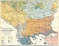
 Distribution of nationalities in South-Eastern Europe.jpg 3,894 × 3,118; 1.82 MB
-
 Distribution of races in the Balkans c.1910.jpg 1,237 × 868; 320 KB
-
 Dobrogea-Bugeac harta etnica (1861).JPG 1,722 × 1,516; 505 KB
-
 Dobroudja (carte ethnographique).JPG 1,996 × 2,408; 1.27 MB
-
 Edward Stanford 1877 - mistakes.JPG 1,350 × 1,589; 1.05 MB
-
 Edward Stanford 1877.jpg 1,350 × 1,287; 1.17 MB
-
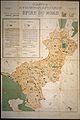 EpireDuNOrd1913.jpg 820 × 1,233; 145 KB
-
 Ernst-Ravenstein-Balkans-Ethnic-Map-1880.jpg 716 × 563; 160 KB
-
 Ethnic map Northern Dobruja 1861.jpg 1,086 × 645; 237 KB
-
 Ethnic map of Balkans - german 1876.jpg 2,028 × 2,004; 1.43 MB
-
 Ethnic map of Balkans - russian 1867.jpg 2,064 × 2,092; 1.75 MB
-
 Ethnic map of Balkans - russian 1890.jpg 1,590 × 1,461; 770 KB
-
 Ethnic map of Balkans Kiepert.1878.png 769 × 1,000; 1.16 MB
-
 Ethnigraphic map of Macedonia by Yordan Ivanov.jpg 3,513 × 2,550; 1.97 MB
-
 Ethnographic map Ami Boué, 1847.jpg 2,364 × 2,348; 1.83 MB
-
 Ethnographic map of austrian monarchy czoernig 1855.jpg 7,997 × 5,862; 23.73 MB
-
 Ethnographic map of Czoernig.jpg 1,202 × 910; 372 KB
-
 Ethnographic map of Europe and Asia minor, “Le Matin” 17.03.1919.JPG 1,730 × 1,536; 635 KB
-
 Ethnographic map of European Turkey from 1877 by Carl Sax.jpg 2,096 × 1,976; 1.37 MB
-
 Ethnographic map of Macedonia, G. Lejean (ca. 1861).jpg 408 × 283; 80 KB
-
 Ethnographic map of Slavs, Lubor Niederle.JPG 1,017 × 847; 366 KB
-
 Ethnographic map of the South Balkans, Pallas Nagy Lexikon, 1897.jpg 613 × 791; 580 KB
-
 Ethnographic map of the Southern Slavs, 1913 part.png 395 × 443; 414 KB
-
 Ethnographic map of the Southern Slavs, 1913.jpg 1,943 × 1,254; 1.19 MB
-
 Ethnographische Karte der Österreichischen Monarchie - Kartenteil 2.png 9,429 × 7,116; 81.38 MB
-
 Ethnographische Karte der Österreichischen Monarchie - Kartenteil 3.png 9,429 × 7,116; 71.65 MB
-
 Ethnographische Karte der Österreichischen Monarchie - Kartenteil 4.png 9,429 × 7,116; 67.8 MB
-
 Ethnographische Karte von Makedonien (1899).jpg 3,065 × 3,535; 1.14 MB
-

-
 Europe of to-day (1922) (14780196704).jpg 2,544 × 1,876; 776 KB
-
 Former ethnic border between Macedonians and Greeks till 1913.JPG 2,216 × 2,295; 1,011 KB
-
 Grcka kolonizacija 550 st. ere.jpg 1,200 × 902; 191 KB
-
 Greece ethnic 1897.JPG 2,268 × 2,358; 901 KB
-
 Greek colonies 550 BC (English) (simple map).svg 1,200 × 902; 873 KB
-
 Greek colonies 550 BC-hu.svg 1,200 × 902; 874 KB
-
 Hellenism in the Near East 1918.jpg 1,403 × 1,721; 862 KB
-
 Kanchov Macedonia Map.jpg 2,900 × 2,650; 2.01 MB
-

-
 Macedonia - Point of View of the Bulgarians.jpg 2,240 × 2,248; 999 KB
-
 Macedonia - Point of View of the Serbs.jpg 2,216 × 2,295; 992 KB
-
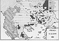
 MACEDONIAN SLAVS - Map the dark space in the middle - RacesofEasternEurope-1918-50.JPG 1,770 × 1,532; 698 KB
-
 MACEDONIAN SLAVS NOTED IN THIS MAP Races of Eastern Europe - A. Gross 1918, London.jpg 1,770 × 1,532; 1.25 MB
-
 Macedonians coloured on this map from 1922.jpg 1,810 × 1,474; 719 KB
-
 Macedonians on a french map.jpg 1,730 × 1,566; 675 KB
-

-
 NationalitiesOfSoutheasternEuropePallasNagyLexikon.jpg 695 × 1,136; 700 KB
-
 Partial Tribal ethnes Map prior to the expansion of Macedon (English).svg 517 × 340; 2.76 MB
-
 PreMacedon.png 907 × 647; 446 KB
-
 RizMap19.jpg 4,056 × 4,122; 5.67 MB
-
 RizMap20.jpg 5,000 × 5,708; 4.66 MB
-
 RizMap22.jpg 770 × 600; 172 KB
-
 RizMap23.jpg 3,200 × 3,110; 6.71 MB
-
 RizMap24.jpg 2,046 × 1,839; 2.78 MB
-
 Romanian Schools for Aromanians and Meglenoromanians.JPG 2,907 × 2,214; 1.15 MB
-
 Serbia ethnic 6 8 century-sr.png 638 × 1,146; 66 KB
-
 Serbia ethnic 6 8 century.png 638 × 1,146; 68 KB
-
 Serbien BV042763414.jpg 5,351 × 4,645; 3.55 MB
-
 Slav-7-8-obrez.png 3,051 × 3,359; 339 KB
-
 Slaven.jpg 3,216 × 2,754; 5.22 MB
-
 Southwestern Balkans 1890.JPG 2,985 × 2,124; 2.47 MB
-
 StariVlah (1861).jpg 2,900 × 1,598; 1.53 MB
-
 The Balkan Peninsula, Distribution of Races. EB 1911.png 1,057 × 1,510; 91 KB
-

-
 Yugo ethnic.gif 325 × 300; 15 KB
-
 Zones of civilization of the Balkan Peninsula LOC 2007627466.jpg 6,575 × 5,423; 5.23 MB
-
 Zones of civilization of the Balkan Peninsula LOC 2007627466.tif 6,575 × 5,423; 102.01 MB
-
 BASA-176K-2-804-87-Etnographical map of the Southern Slavs, 1913.JPG 5,749 × 3,584; 11.89 MB
-
 BASA-1932K-1-432-7-Map of Macedonia.jpg 4,946 × 3,173; 2.06 MB


.svg)


.jpg)

_(2).jpg)
.jpg)
.jpg)


.jpg)

.jpg)
.jpg)


.JPG)
.JPG)


.jpg)


.jpg)
_-_Kiepert.jpg)
_(14780196704).jpg)


_(simple_map).svg)


_NA_KOJA_SE_PRIKAZANI_MAKEDONCITE_KAKO_POSEBEN_NAROD_Ethnographical_Map_of_Central_and_South_Eastern_Europe_-_The_War_Office_1916,_London.jpg)


.svg)


.jpg)


