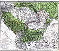
Category:Historical maps of ethnic groups in Bosnia and Herzegovina
Jump to navigation
Jump to search
Subcategories
This category has the following 3 subcategories, out of 3 total.
A
Y
Media in category "Historical maps of ethnic groups in Bosnia and Herzegovina"
The following 9 files are in this category, out of 9 total.
-
Balkans-ethnic (1861) (2).jpg 1,864 × 1,915; 2.01 MB
-
BosniaEthnic1910.jpg 1,163 × 1,600; 455 KB
-
Carte ethnographique de la Péninsule balkanique, cropped.jpg 436 × 394; 305 KB
-
Dispersal of Slavs as of 1900 (1910 map).jpg 1,200 × 1,031; 212 KB
-
Ethnographic map of Slavs, Lubor Niederle.JPG 1,017 × 847; 366 KB
-
Meyers b12 s0486a.jpg 2,048 × 1,683; 1.35 MB
-
Slaven.jpg 3,216 × 2,754; 5.22 MB
-
StariVlah (1861).jpg 2,900 × 1,598; 1.53 MB
-
Yugoslavia Ethnic 1940.jpg 2,416 × 2,252; 970 KB


