Category:Historical maps of ethnic groups in Albania
Jump to navigation
Jump to search
Media in category "Historical maps of ethnic groups in Albania"
The following 28 files are in this category, out of 28 total.
-
Albanien BV042747800.jpg 2,666 × 4,326; 2.16 MB
-
Carte ethnographique de l'Albanie LOC 88694253.jpg 3,857 × 6,515; 3.86 MB
-
Carte ethnographique de l'Albanie LOC 88694253.tif 3,857 × 6,515; 71.89 MB
-
Albania kosovo macedonia 6 8 century.png 597 × 968; 55 KB
-
Albania-ethnique1898.jpg 342 × 568; 81 KB
-
Altserbien-und-Makedonien-map.jpg 2,829 × 1,385; 893 KB
-
Anachronistic Map of the Balkans (English).svg 1,873 × 1,245; 2.79 MB
-
AnachronisticMapBalkans.png 755 × 550; 160 KB
-
Balkans-ethnic (1861) (2).jpg 1,864 × 1,915; 2.01 MB
-
Balkans-ethnique.JPG 1,258 × 1,266; 457 KB
-
Bulgarians in 1912.jpg 2,696 × 1,964; 2.05 MB
-
Carte ethnographique de l'Albanie - 1913.jpg 3,968 × 6,611; 5.14 MB
-
Carte ethnographique de la Péninsule balkanique, cropped.jpg 436 × 394; 305 KB
-
EpireDuNOrd1913.jpg 820 × 1,233; 145 KB
-
EthnicAlbania1911.jpg 400 × 540; 57 KB
-
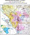
Ethnographic map of Epirus, based on P. Aravandinos, 1878.jpg 2,696 × 3,101; 2.55 MB
-
Ethnographic map of Macedonia, G. Lejean (ca. 1861).jpg 408 × 283; 80 KB
-
Ethnographic map of the central Balkans, ca. 1900.png 1,720 × 1,859; 6.42 MB
-
Ethnographic map of the South Balkans, Pallas Nagy Lexikon, 1897.jpg 613 × 791; 580 KB
-
Greece ethnic 1897.JPG 2,268 × 2,358; 901 KB
-
NationalitiesOfSoutheasternEuropePallasNagyLexikon.jpg 695 × 1,136; 700 KB
-
Religious map of Albania in 1915.png 481 × 709; 144 KB
-
RizMap22.jpg 770 × 600; 172 KB
-
Serbrumelia18thc.png 330 × 210; 35 KB
-
Southwestern Balkans 1890.JPG 2,985 × 2,124; 2.47 MB
-
Stammesgebiete Nordalbanien 1918.png 1,621 × 2,280; 1.92 MB
-
The Balkan Peninsula, Distribution of Races. EB 1911.png 1,057 × 1,510; 91 KB


