Category:Geological maps of Russia
Jump to navigation
Jump to search
Countries of Asia: Afghanistan · Armenia‡ · Azerbaijan‡ · Bangladesh · People's Republic of China · Cyprus‡ · East Timor · Egypt‡ · Georgia‡ · India · Indonesia‡ · Iran · Iraq · Israel · Japan · Kazakhstan‡ · Laos · Malaysia · Mongolia · Myanmar · Nepal · Pakistan · Philippines · Russia‡ · Saudi Arabia · South Korea · Sri Lanka · Syria · Tajikistan · Thailand · Turkey‡ · Vietnam
Limited recognition: Taiwan – Other territories: Hong Kong
‡: partly located in Asia
Limited recognition: Taiwan – Other territories: Hong Kong
‡: partly located in Asia
Countries of Europe: Albania · Andorra · Armenia‡ · Austria · Azerbaijan‡ · Belgium · Bosnia and Herzegovina · Bulgaria · Croatia · Cyprus‡ · Czech Republic · Denmark · Estonia · Finland · France‡ · Georgia‡ · Germany · Greece · Hungary · Iceland · Republic of Ireland · Italy · Kazakhstan‡ · Latvia · Liechtenstein · Lithuania · Luxembourg · Moldova · Montenegro · Netherlands‡ · Norway · Poland · Portugal‡ · Romania · Russia‡ · Serbia · Slovakia · Slovenia · Spain‡ · Sweden · Switzerland · Turkey‡ · Ukraine · United Kingdom
Specific status: Svalbard
‡: partly located in Europe
Specific status: Svalbard
‡: partly located in Europe
Subcategories
This category has the following 3 subcategories, out of 3 total.
Media in category "Geological maps of Russia"
The following 35 files are in this category, out of 35 total.
-
 Baikal-1.png 536 × 376; 55 KB
-
 Brockhaus and Efron Encyclopedic Dictionary b54 050-3.jpg 1,877 × 2,300; 1.58 MB
-
 Brockhaus and Efron Encyclopedic Dictionary b54 066-1.jpg 2,552 × 3,001; 1.96 MB
-
 Brockhaus and Efron Encyclopedic Dictionary b54 066-2.jpg 3,187 × 2,188; 1.92 MB
-
 CAOB formation Hypothesis 1.png 456 × 945; 170 KB
-
 CAOB formation hypothesis 1.png 456 × 945; 175 KB
-
 EB1911 Russia - geological map.jpg 840 × 1,165; 368 KB
-
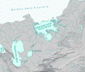
 Elkon-deposits.gif 193 × 250; 34 KB
-
 Extent of Siberian traps-it.svg 1,897 × 1,082; 3.75 MB
-
 Extent of Siberian traps-ru.svg 1,897 × 1,082; 3.75 MB
-
 Geologic Map of the Urals (compiled in 1930).jpg 600 × 682; 175 KB
-
 Geological map east sibiria.jpg 5,987 × 4,556; 1,006 KB
-
 Geological map of the CAOB.png 1,755 × 821; 2.3 MB
-
 Hypothesis 2 Sengor.png 2,132 × 958; 400 KB
-
 Ice Age glacial lakes of Siberia and Central Asia - de.svg 1,238 × 1,046; 3.79 MB
-
 Ice Age glacial lakes of Siberia and Central Asia - ru.svg 1,238 × 1,046; 4.19 MB
-
 Kuril-Kamchatka Trench USGS.png 911 × 1,063; 1.06 MB
-
 Location Map of the CAOB.png 1,441 × 691; 466 KB
-
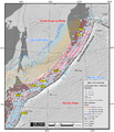
 Morhostructural map of the south-eastern White Sea coast.jpg 8,961 × 7,015; 3.02 MB
-
 Razrez1.jpg 636 × 492; 118 KB
-
 Russian Geologic Regions Detailed.svg 2,100 × 1,346; 5.39 MB
-
 Russian Geologic Regions.svg 2,100 × 1,346; 5.37 MB
-
 Russland BV043569922.jpg 1,879 × 1,418; 426 KB
-
 SeismichnostRussia.jpg 1,600 × 1,053; 618 KB
-
 Shoksha deposits.png 559 × 423; 119 KB
-
 Siberiakratonet.jpg 374 × 284; 58 KB
-
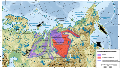
 Siberian oil fields.jpg 2,022 × 1,985; 324 KB
-
 Sibiria craton NO.jpg 377 × 272; 28 KB
-
 West Siberia oil and gas fields.png 588 × 787; 175 KB
-
 West Siberia structural map.png 490 × 769; 189 KB
-
 Байкальская рифтовая зона.jpg 820 × 539; 223 KB
-
 БСЭ1. Геологические карты 2.jpg 881 × 1,389; 712 KB
-
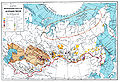
 Золотоносные месторождения России.svg 1,052 × 744; 342 KB
-
 Карта сейсмичности в России.jpg 1,600 × 1,048; 285 KB
-
 Сейсмичность.jpg 1,600 × 1,048; 507 KB


.jpg)


