Category:Geological maps of Japan
Jump to navigation
Jump to search
Subcategories
This category has the following 7 subcategories, out of 7 total.
Media in category "Geological maps of Japan"
The following 54 files are in this category, out of 54 total.
-
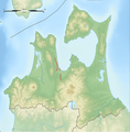
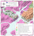
Aomori Bay West Coast Fault Zone.png 1,720 × 1,753; 3.21 MB
-
Bosotriplejunction.svg 349 × 537; 570 KB
-
Butsuzo Tectonic Line.png 1,101 × 619; 403 KB
-
Die japanischen Inseln. Eine topographisch-geologische Übersicht (1890) (20918698142).jpg 3,574 × 2,942; 2.83 MB
-
Fault model of 1703 Genroku earthquake.jpg 765 × 900; 112 KB
-
Fault model of 1923 Kanto earthquake.jpg 767 × 900; 163 KB
-
Fault model of 1944 Tonankai Earthquake.jpg 693 × 508; 76 KB
-
Fault model of 1946 Nankai Earthquake.jpg 770 × 549; 100 KB
-
Faults of Mid-Awaji island and 2013 earthquake.png 1,240 × 1,240; 1.19 MB
-
Geological structure of East Asia-ko.jpg 1,440 × 1,440; 84 KB
-
Great Kanto Earthquake 1923 & 1703 focal area map.png 400 × 300; 65 KB
-
Hazard Map of Mt.Fuji common l.jpg 1,701 × 2,378; 2.72 MB
-
Hida belt.png 640 × 640; 73 KB
-
Hida marginal Tectonic Line.png 1,008 × 569; 413 KB
-
Hyuganada earthquake map.jpg 781 × 1,008; 122 KB
-
Izu-Ogasawara trench topographic.png 800 × 1,000; 240 KB
-
Japan separation.png 1,500 × 1,056; 3.32 MB
-
Kanto area fault.gif 680 × 541; 181 KB
-
Kanto area seismic activity.gif 680 × 541; 165 KB
-
Kanto fragment map.png 500 × 500; 22 KB
-
Kashiwazaki Kariwa Fault Lines.PNG 510 × 770; 48 KB
-
Kuril-Kamchatka Trench USGS.png 911 × 1,063; 1.06 MB
-
Locality maps and geology in Tambasasayama.webp 1,995 × 2,069; 365 KB
-
Map of of the Kuju and Hanamure volcanic field.jpg 8,675 × 6,306; 8.08 MB
-
Map of Tachikawa Fault Group.png 1,210 × 1,376; 2.86 MB
-
MapNankaiTrough.jpg 300 × 240; 35 KB
-
Methane hydrate around Japan Ilands.PNG 1,800 × 1,800; 817 KB
-
Millennium-Eruption-map.png 1,208 × 1,078; 213 KB
-
Nankai trough topographic.png 800 × 600; 196 KB
-
Niigata-Kobe tectonic zone topographic.png 750 × 500; 167 KB
-
Okinawa trench and Okinawa trough topographic.png 800 × 800; 192 KB
-
Okinawa trough topographic.png 800 × 800; 170 KB
-
Predicative map of Mt.Fuji volcanic-ash-fall.jpg 720 × 550; 363 KB
-
RuptureAreasNankaiMegathrust 2013.png 1,336 × 774; 408 KB
-
RuptureAreasNankaiMegathrust.png 2,103 × 1,439; 373 KB
-
Sagami trough topographic.png 600 × 500; 121 KB
-
Sakurajima LavaMap E.jpg 722 × 637; 76 KB
-
SeismicAreas JapanTrenchEarthquakes (ko).svg 1,182 × 1,536; 163 KB
-
SeismicAreas JapanTrenchEarthquakes for wikipedia thai.png 1,000 × 1,300; 175 KB
-
SeismicAreas JapanTrenchEarthquakes.png 1,000 × 1,300; 210 KB
-
Seismicity of Eastern margin of the Japan Sea 1.jpg 799 × 1,100; 83 KB
-
Seismicity of Eastern margin of the Japan Sea 2.jpg 799 × 1,100; 98 KB
-
Seismicity of Eastern margin of the Japan Sea 3.jpg 799 × 1,100; 119 KB
-
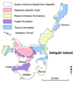
Simplified Geological Map of Ishigaki Island.png 500 × 556; 1.06 MB
-
Simplified Geological Map of northern Okinawa Island.png 524 × 476; 976 KB
-
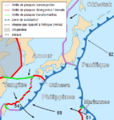
Tectonic map of Japan-fr.png 433 × 457; 82 KB
-
Tectonic map of southwest Japan.png 877 × 585; 251 KB
-
Tectonic plates around Japan.png 500 × 500; 77 KB
-
Tectonic plates under Japan.png 281 × 489; 29 KB
-
The Quarterly journal of the Geological Society of London (14338219411).jpg 1,175 × 1,987; 501 KB
-
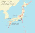
البراكين النشطة في اليابان.png 650 × 623; 83 KB
-
上町断層帯.gif 596 × 570; 23 KB
-
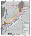
見落とされていた可能性がある海底活断層.PNG 510 × 770; 59 KB
