Category:Geological maps of Ukraine
Jump to navigation
Jump to search
Media in category "Geological maps of Ukraine"
The following 21 files are in this category, out of 21 total.
-
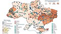
 02020 Metallogenic provinces.jpg 975 × 628; 326 KB
-
 02020 Mineral resources.jpg 1,898 × 1,080; 367 KB
-
 1845-Murchisonmap.jpg 3,868 × 4,056; 17.3 MB
-
 1845-russian-geology-map.png 4,895 × 3,965; 8.78 MB
-

-
 1866 Volyn geological map.PNG 1,375 × 802; 2.13 MB
-
 01900 Karte des Königreichs Galizien und Lodomerien von Karol Lange.jpg 960 × 766; 202 KB
-
 Boltysh crater location map.png 632 × 322; 16 KB
-
 Geol map.png 3,000 × 2,701; 1.57 MB
-
 Mémoires de la Société géologique de France BHL42352651.jpg 4,747 × 3,435; 1.61 MB
-
 Poivtsev RecentGD 5-RP-base-cover.jpg 6,293 × 1,542; 4.38 MB
-
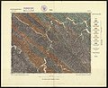
 Stratotipe cross-section of menilite svite.jpg 1,476 × 750; 493 KB
-
 Ukraine BV042516110.jpg 4,213 × 3,218; 1.1 MB
-
 Ukraine BV042516125.jpg 4,198 × 3,275; 1.09 MB
-
 Ukraine geology (de).png 1,239 × 847; 450 KB
-
 Ukraine geology-fr.png 1,245 × 852; 135 KB
-
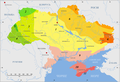 Ukraine geology.png 1,245 × 852; 485 KB
-
 Ukraine-Skole-Fragmgeomap.jpg 4,415 × 4,222; 2.75 MB
-
 West oil and gas region.jpg 695 × 1,017; 174 KB
-
-
 БСЭ1. Геологические карты 1.jpg 1,472 × 1,989; 1.41 MB


_-_BL.jpg)


.png)


,_Turka_(IX_.8),_Bolech%C3%B3w_(XI._8)_(79888982).jpg)
