Category:Geological maps of the Netherlands
Jump to navigation
Jump to search
Subcategories
This category has the following 3 subcategories, out of 3 total.
Media in category "Geological maps of the Netherlands"
The following 58 files are in this category, out of 58 total.
-
Avalonia Baltica geologi.png 949 × 898; 737 KB
-
Benelux geol.svg 662 × 971; 1.01 MB
-
BNA-DIG-KOSTBARE-0068-II.jpg 7,405 × 5,784; 4.73 MB
-
Bouguer-zwaartekrachtanomalie Nederland.svg 540 × 540; 416 KB
-
Broad Fourteens Basin map NL.svg 491 × 420; 1.67 MB
-
Broad Fourteens Basin map.png 867 × 742; 141 KB
-
France geological map-fr.svg 1,636 × 1,753; 3.27 MB
-
French Hercynian massifs BR.svg 850 × 590; 274 KB
-
French Hercynian massifs EN.svg 850 × 590; 274 KB
-
French Hercynian massifs NL.svg 850 × 590; 273 KB
-
Gemeenten relief 1400px.gif 1,391 × 1,702; 1.05 MB
-
Geoide nederland.png 1,829 × 1,927; 56 KB
-
Geologie rond Tilburg-D. Edelman-Regionale breukenkaart rond Tilburg.png 1,013 × 1,371; 73 KB
-
Geoviden-1-2011-Nordsøens-geologi.png 1,024 × 880; 212 KB
-
Grondsoorten Windesheim omgeving.jpg 1,662 × 900; 472 KB
-
Groningen - geologische kaart 1837 Het Maar.jpg 660 × 1,463; 378 KB
-
Hercynian structures Europe NL.svg 850 × 555; 131 KB
-
Hercynian structures Europe-en.svg 850 × 555; 131 KB
-
Hercynian structures Europe-es.svg 2,239 × 1,455; 516 KB
-
Hercynian structures Europe-it.svg 850 × 555; 104 KB
-
Moerassen in NL 100 nc.jpg 704 × 720; 113 KB
-
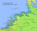
Nordsee plus 1m.png 1,500 × 1,283; 567 KB
-
Nw europe grav plot 2.png 742 × 841; 880 KB
-
Nw europe grav plot.png 475 × 548; 318 KB
-
Overview of seismicity in the Netherlands.png 1,600 × 2,204; 3.54 MB
-
P18-field map.svg 233 × 187; 1.51 MB
-
Rijswijk Hydrocarbon Licenseblock NL.svg 392 × 350; 1.48 MB
-
Rijswijk Oilfield NL.png 1,444 × 1,346; 2.85 MB
-
Roerdal graben map DE.svg 724 × 558; 596 KB
-
Roerdal graben map EN.svg 724 × 558; 572 KB
-
Roerdal graben map NL.svg 724 × 558; 573 KB
-
Structuurkaart Groningenveld.png 1,909 × 1,442; 764 KB
-
The Roer Valley rift system and bouguer anomalies.png 640 × 436; 593 KB
-
Varisztidák.png 603 × 288; 116 KB
-
Verbreiding Appelscha Formatie 150dpi.png 1,145 × 1,715; 153 KB
-
Verbreiding Beegden Formatie 150dpi.png 1,145 × 1,716; 239 KB
-
Verbreiding Breda Formatie 150dpi.png 1,145 × 1,715; 135 KB
-
Verbreiding Drente Formatie 150dpi.png 1,145 × 1,715; 165 KB
-
Verbreiding Echteld Formatie 150dpi.png 1,145 × 1,715; 158 KB
-
Verbreiding Eem Formatie 150dpi.png 1,145 × 1,715; 186 KB
-
Verbreiding Kiezeloöliet Formatie 150dpi.png 1,145 × 1,715; 159 KB
-
Verbreiding Kreftenheye Formatie 150dpi.png 1,145 × 1,715; 172 KB
-
Verbreiding Maassluis Formatie 150dpi.png 1,145 × 1,715; 154 KB
-
Verbreiding Naaldwijk Formatie 150dpi.png 1,145 × 1,715; 160 KB
-
Verbreiding Nieuwkoop Formatie.png 1,145 × 1,715; 230 KB
-
Verbreiding Oosterhout Formatie 150dpi.png 1,147 × 1,715; 180 KB
-
Verbreiding Peize Formatie 150dpi.png 1,145 × 1,715; 172 KB
-
Verbreiding Sterksel Formatie.png 1,145 × 1,715; 190 KB
-
Verbreiding Stramproy Formatie 150dpi.png 1,145 × 1,715; 169 KB
-
Verbreiding Urk Formatie 150dpi.png 1,145 × 1,715; 174 KB
-
Verbreiding Waalre Formatie 150dpi.png 1,145 × 1,715; 177 KB
-
West Netherlands Basin map.svg 392 × 350; 1.51 MB


