Category:Geological maps of Namibia
Jump to navigation
Jump to search
Countries of Africa: Algeria · Botswana · Cameroon · Cape Verde · Chad · Democratic Republic of the Congo · Egypt‡ · Eritrea · Ethiopia · Guinea · Madagascar · Mali · Mauritania · Morocco · Namibia · Niger · Nigeria · Rwanda · Senegal · South Africa · South Sudan · Sudan · Tanzania · Tunisia
Other areas: Canary Islands · Mayotte · Réunion
‡: partly located in Africa
Other areas: Canary Islands · Mayotte · Réunion
‡: partly located in Africa
Subcategories
This category has only the following subcategory.
V
Media in category "Geological maps of Namibia"
The following 5 files are in this category, out of 5 total.
-
 Bushman Fold Train DE.png 2,512 × 3,894; 5.62 MB
-
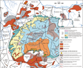
 Damara-Orogen mit Damara-Gürtel, Kaoko-Gürtel und Gariep-Gürtel.png 1,024 × 1,300; 822 KB
-
 Erongo Geology.png 4,731 × 3,891; 3.13 MB
-
 Geologische Karte Brandberg.png 2,963 × 1,938; 1.08 MB
-
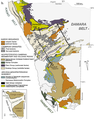
 Geomap Zentralnamibia.png 1,890 × 2,799; 3.41 MB


