Category:Geological maps of Eritrea
Jump to navigation
Jump to search
Countries of Africa: Algeria · Botswana · Cameroon · Cape Verde · Chad · Democratic Republic of the Congo · Egypt‡ · Eritrea · Ethiopia · Guinea · Madagascar · Mali · Mauritania · Morocco · Namibia · Niger · Nigeria · Rwanda · Senegal · South Africa · South Sudan · Sudan · Tanzania · Tunisia
Other areas: Canary Islands · Mayotte · Réunion
‡: partly located in Africa
Other areas: Canary Islands · Mayotte · Réunion
‡: partly located in Africa
Subcategories
This category has only the following subcategory.
M
Media in category "Geological maps of Eritrea"
The following 4 files are in this category, out of 4 total.
-
 Afar Geologic Map.jpg 1,182 × 1,685; 599 KB
-
 Afar rock types.png 403 × 590; 80 KB
-
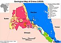 Geological Map of Eritrea.jpg 4,953 × 3,509; 1.68 MB
-
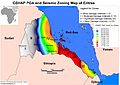 GSHAP Peak Ground Acceleration and Seismic Zoning map of Eritrea.jpg 4,953 × 3,509; 1.66 MB


