Category:Eastern Sierra
Jump to navigation
Jump to search
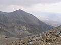
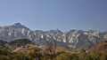
English: The Eastern Sierra is the eastern side of the Sierra Nevada mountain range, in Inyo, Mono, and Alpine Counties, California. The region is in the transition zone to the Great Basin Desert.
Subcategories
This category has the following 33 subcategories, out of 33 total.
A
B
C
- Carson Peak (13 F)
- Conway Summit (29 F)
D
- Devils Gate (2 F)
- Donohue Pass (24 F)
F
H
J
L
- Lone Pine Peak (9 F)
M
- Mono Pass (6 F)
- Mount Gibbs (6 F)
O
S
- Sunyaev–Zel'dovich Array (1 F)
T
- Tinnemaha Creek (2 F)
U
W
- Mount Williamson (12 F)
Pages in category "Eastern Sierra"
The following 2 pages are in this category, out of 2 total.
Media in category "Eastern Sierra"
The following 167 files are in this category, out of 167 total.
-
 170828-FS-Inyo-PRW-MountRitter (36911169891).jpg 3,264 × 2,448; 2.86 MB
-

-
 20140420-0864 Mono Lake.JPG 6,016 × 4,000; 5.5 MB
-
 4NOV2006 LARGE.jpg 1,201 × 901; 604 KB
-
 A Glorious Greeting (24993846503).jpg 4,709 × 2,992; 5.63 MB
-
 Aerial view - Bishop, C.jpg 720 × 478; 140 KB
-

-
 Aspen row mountainside.jpg 4,800 × 3,200; 11.9 MB
-
 Astragalus purshii milkvetch seedpuffs.jpg 3,361 × 3,189; 6.85 MB
-
 Baby quail hiding.jpg 2,230 × 1,688; 1.35 MB
-
 Basin Mountain.jpg 725 × 544; 72 KB
-
 Basin mountainCA.jpg 1,021 × 262; 40 KB
-
 Beaver-cut aspen Lundy Canyon.jpg 3,000 × 2,000; 2.69 MB
-
 Beetle tracks under pinyon bark.jpg 3,888 × 2,592; 4.34 MB
-
 Below Rock Island Pass looking south - panoramio.jpg 2,272 × 1,704; 1.8 MB
-
 Benton Hot Springs.JPG 2,048 × 1,280; 326 KB
-
 Big Pine landscape.jpg 3,008 × 2,000; 3.16 MB
-
 Big Pine volcanic field - cinder cone near Fish Springs, California.JPG 3,456 × 2,592; 4.15 MB
-
 Big Pine.jpg 2,048 × 1,536; 988 KB
-
 Big Virginia Lake, California.jpg 5,598 × 3,732; 17.92 MB
-
 Birch Mountain and the approaching rain.jpg 800 × 600; 78 KB
-

-
 Black Mountain shot from the South.JPG 1,632 × 1,224; 870 KB
-
 Bloody Canyon, Sierra Nevada, California - NARA - 519603.jpg 3,000 × 1,220; 1.03 MB
-
 Boundary Peak past Crowley Lake and ridge.jpg 3,340 × 2,050; 1.56 MB
-
 California - Mono Lake - NARA - 543453.jpg 2,027 × 3,000; 1.02 MB
-
 CALIFORNIA-SIERRA NATIONAL FOREST - NARA - 542606.jpg 3,000 × 2,021; 768 KB
-
 CALIFORNIA-SIERRA NATIONAL FOREST - NARA - 542614.jpg 1,976 × 3,000; 1.92 MB
-
 CALIFORNIA-SIERRA NATIONAL FOREST - NARA - 542616.jpg 3,000 × 2,003; 1.67 MB
-
 CALIFORNIA-SIERRA NATIONAL FOREST - NARA - 542623.jpg 1,978 × 3,000; 1.32 MB
-
 Carson Mountain Sunrise, Sierra Nevadas 5-15 (19423676170).jpg 2,800 × 1,861; 1.48 MB
-
 Carson Valley, Nevada.jpg 1,280 × 854; 701 KB
-

-
 Conquering Hero-1-.jpg 590 × 393; 45 KB
-
 Coyote flats near sunset from Lower Rock Creek.JPG 2,560 × 1,600; 1.82 MB
-
 Crown-ray cloud shadow Owens Valley.jpg 3,000 × 2,400; 1.98 MB
-
 Decay house and Sierra Nevada Mountains - Flickr - daveynin.jpg 3,456 × 2,304; 2.04 MB
-
 Drain - Trompe l'oeil mural by John Pugh.jpg 800 × 522; 257 KB
-
 DunderbergPeak past GreenCreek from BigMeadow SofBridgeport.jpg 3,888 × 2,592; 3.85 MB
-
 East side Sierra.jpg 2,048 × 1,352; 486 KB
-
 East Sierras - Flickr - GregTheBusker.jpg 5,184 × 3,456; 2.34 MB
-
 East Walker River.jpg 3,648 × 2,736; 1.79 MB
-
 Eastern Brook Lake.jpg 4,032 × 3,024; 3.75 MB
-
 Eastern Sierra Alternative Banner 1.jpg 3,008 × 430; 796 KB
-
 Eastern Sierra Alternative Banner 2.jpg 5,616 × 803; 1.94 MB
-
 Riprapwithslickrock.jpg 800 × 600; 240 KB
-
 Eastern Sierra Nevada Foothills Near Big Pine California 04 30 2022 1.jpg 6,048 × 8,064; 37.72 MB
-
 Eastern Sierra Nevada Foothills Near Big Pine California 04 30 2022 2.jpg 6,048 × 8,064; 34.31 MB
-
 Eastern Sierra Nevada Foothills Near Big Pine California 04 30 2022 3.jpg 8,064 × 6,048; 32.81 MB
-
 Eastern Sierra Nevada Foothills Near Big Pine California 04 30 2022 4.jpg 6,048 × 8,064; 34.41 MB
-
 Eastern Sierra sunrise (13791092633).jpg 2,732 × 1,600; 1.69 MB
-
 Eastern Sierra with Mount Whitney.jpg 2,688 × 1,425; 955 KB
-
 Eastern Sierras (13791397014).jpg 2,400 × 1,600; 1.35 MB
-
 Eastern Sierras (149259391).jpeg 1,366 × 2,048; 886 KB
-
 Eastern Sierras II (13791088683).jpg 2,400 × 1,600; 1.19 MB
-
 Entering Inyo National Forest - Flickr - daveynin.jpg 3,456 × 2,304; 2.77 MB
-
 Extinct Volcano near Mono Lake, California - NARA - 519602.jpg 3,000 × 1,206; 1.16 MB
-
 Extinct Volcanoes. Near Mono Lake, California - NARA - 519497.jpg 3,000 × 2,253; 1.38 MB
-
 Fall Colors, Rock Creek Road, Sierra Nevada, CA 9-16 (29402006653).jpg 2,800 × 1,920; 3.07 MB
-
 Fresh Snow Sunrise - Flickr - Jaykhuang.jpg 2,000 × 1,335; 3.55 MB
-
 Glass-mountains.jpg 4,000 × 3,000; 1.6 MB
-
 Granite Mountain, Mono County, California - granitic outcrop with tree.JPG 3,167 × 2,592; 4.07 MB
-
 Highway 395 Near Bishop.jpg 750 × 498; 113 KB
-
 CAMP INDEPENDENCE, SIERRA NEVADA, CALIFORNIA - NARA - 524155.jpg 3,000 × 2,475; 3.62 MB
-
 June snow on White Mtns.jpg 5,360 × 2,060; 2.34 MB
-
 KEARSAGE MINING COMPANY, KEARSAGE, CALIFORNIA - NARA - 524152.jpg 3,000 × 2,498; 4.63 MB
-
 KEARSARGE MINING COMPANY, KEARSARGE, CALIFORNIA - NARA - 524263.jpg 3,000 × 2,507; 5.31 MB
-
 Kennedy Lake, Kennedy Peak, and Soda Canyon from Leavitt Peak.jpg 3,694 × 1,223; 4.62 MB
-
 Kerrick Meadow - panoramio - Kurt Minard (1).jpg 2,272 × 1,704; 2.29 MB
-
 Kerrick Meadow - panoramio - Kurt Minard (2).jpg 2,272 × 1,704; 1.93 MB
-
 Kerrick Meadow - panoramio - Kurt Minard (3).jpg 2,272 × 1,704; 2.19 MB
-
 Kerrick Meadow - panoramio - Kurt Minard (4).jpg 2,272 × 1,704; 2.32 MB
-
 Kerrick Meadow - panoramio - Kurt Minard (5).jpg 2,272 × 1,704; 1.41 MB
-
 Kerrick Meadow - panoramio - Kurt Minard (6).jpg 2,272 × 1,704; 1.59 MB
-
 Kerrick Meadow - panoramio - Kurt Minard (7).jpg 2,272 × 1,704; 1.9 MB
-
 Kerrick Meadow - panoramio - Kurt Minard (8).jpg 2,272 × 1,704; 1.7 MB
-
 Kerrick Meadow - panoramio - Kurt Minard.jpg 2,272 × 1,704; 2.49 MB
-
 Kerrick Meadow - panoramio.jpg 2,272 × 1,704; 2.4 MB
-
 Kings Canyon-Bishop Pass Aah04.jpg 1,693 × 1,099; 515 KB
-
 Last snow, Eastern Sierra Nevada, CA 5-15 (21142042529).jpg 2,800 × 2,321; 1.02 MB
-

-
 Lone Pine Peak (links) 3945m en Mount Whitney 4421m (centraal) - 8-10-2012 14-09-42.jpg 4,285 × 2,413; 7.58 MB
-
 Lower Rock Creek rock in meltout flow.jpg 3,640 × 2,480; 4.26 MB
-
 Lundy Canyon 2019.jpg 3,638 × 1,012; 1.63 MB
-
 Lundy Canyon Beaver Dam.jpg 2,816 × 2,112; 5.69 MB
-
 Mammoth Yosemite Airport 09.JPG 4,363 × 2,773; 4.89 MB
-
 Mammoth-creek-glass-mountains.jpg 768 × 1,024; 93 KB
-
 Manifest Glory by burnintree.jpg 1,322 × 938; 426 KB
-

-

-
-

-
 Manzanar (2011).JPG 3,072 × 2,304; 862 KB
-
 Manzanar (2013) 01.JPG 3,147 × 2,516; 4.46 MB
-
 Manzanar (2013) 02.JPG 1,522 × 2,509; 1.78 MB
-
 Manzanar (2013) 03.JPG 4,512 × 3,000; 5.7 MB
-
 Manzanar (2013) 04.JPG 4,512 × 3,000; 5.62 MB
-
 Manzanar (2013) 05.JPG 2,953 × 1,994; 2.9 MB
-
 Manzanar shrine.jpg 1,028 × 805; 360 KB
-
 MARSOC mule Packing.jpeg 2,336 × 3,504; 1.65 MB
-
 Middle Palisade on 2020-06-18.png 4,032 × 3,024; 20.09 MB
-
 Minarets silhouette evening.jpg 3,000 × 2,100; 2.31 MB
-

-

-
 Mono Lake - Bodie and Benton Rail Road monument.JPG 3,064 × 2,046; 2.91 MB
-
 Mono Lake South Tufa at Sunset.jpg 5,653 × 3,974; 3.55 MB
-
 Mono Lake Winter 2017.jpg 750 × 498; 77 KB
-
 Mono Lake, California, by Carol M. Highsmith.jpg 7,240 × 5,433; 21.56 MB
-
 Mount brewer.jpg 1,643 × 1,276; 626 KB
-
 Mount Jepson and Mount Sill.jpg 1,605 × 1,118; 682 KB
-
 Mountain-mahogany backlit slope.jpg 1,400 × 1,600; 1.36 MB
-
 Mt morgan.jpg 7,762 × 4,008; 6.7 MB
-
 Mt Whitney from Alabama Hills-wideshot.jpg 1,140 × 580; 119 KB
-
 Mt. Jepson.jpg 1,276 × 731; 369 KB
-
 Mts. Jepson and Sill.jpg 1,761 × 1,313; 1.13 MB
-
 Olancha Peak from Bald Mountain.jpg 942 × 600; 121 KB
-
 Old wagon rd track detail.jpg 1,600 × 1,080; 1.05 MB
-
 Old wagon road downhill to Paradise and MtTom.jpg 2,560 × 1,600; 2.15 MB
-
 Onion-valley.jpg 4,000 × 3,000; 2.03 MB
-
 Owens River and Owens Valley (California) – from space (ISS).jpg 2,899 × 1,031; 1.38 MB
-
 Owens Tui Chub habitat.jpg 346 × 503; 102 KB
-
 Owens Valley from Swall corner winter.jpg 2,590 × 3,620; 4.33 MB
-
 Owens Valley Sh-p6250166.jpg 1,024 × 768; 126 KB
-
 Owens-Lake-from-Horseshoe-Meadows-Road.jpg 690 × 530; 217 KB
-
 Panum Crater winter.jpg 3,008 × 2,000; 3.17 MB
-

-
 Pic24-gibbs.jpg 1,600 × 1,200; 421 KB
-
 Powerlines Ridgecrest.jpg 1,080 × 890; 113 KB
-
 RAINBOW ABOVE POWER LINES NEAR MONO LAKE - NARA - 543130.jpg 3,000 × 2,050; 1.09 MB
-
 Range of light east sierras.png 2,048 × 1,280; 2.76 MB
-
 Road to June Lake, Sierra Nevada, CA 2016 (28162554952).jpg 2,800 × 2,178; 2.89 MB
-
 Sawmill Point, California.jpg 908 × 853; 309 KB
-
 Sawmill Point.jpg 2,647 × 1,479; 1.17 MB
-
 SCE Hydro Bishop.jpg 2,288 × 1,712; 2.17 MB
-
 Sherwin Summit Plaque.jpg 2,560 × 1,920; 1.7 MB
-
 Shorn sheep herd in meadow.jpg 3,200 × 1,900; 3.14 MB
-
 Sierra Crest past Twin Lakes from Big Meadow.jpg 2,790 × 1,740; 1.46 MB
-
 Sierra Nevada and Owens Valley CA1.jpg 2,103 × 1,504; 3.28 MB
-
 Sierra Nevada near Bridgeport, California-1000px.jpeg 1,000 × 286; 33 KB
-
 SierraEscarpmentCA.jpg 2,359 × 600; 424 KB
-
 Silver Lake During Spring 2012.jpg 6,112 × 1,646; 9.08 MB
-

-

-
-
 Sunrise light on Wheeler Crest frosted rocks.jpg 3,888 × 2,592; 3.89 MB
-
 Sunset from the Minarets Vista viewpoint near Mammoth Lakes.jpg 3,443 × 2,045; 1.89 MB
-
 Tinemaha Reservoir.jpg 1,183 × 600; 246 KB
-
 Town of June Lake.JPG 2,304 × 1,728; 1.04 MB
-
 Trail Crest on Mount Whitney trail.jpg 2,272 × 1,704; 1.62 MB
-
 US-395 Mammoth to Bishop (January 2008) 01.JPG 3,072 × 2,304; 1.52 MB
-
 US-395 Mammoth to Bishop (January 2008) 04.JPG 3,072 × 2,304; 1.61 MB
-
 US-395 Mammoth to Bishop (January 2008) 06.JPG 3,072 × 2,304; 1.7 MB
-
 US-395 Mammoth to Bishop (January 2008) 07.JPG 3,072 × 2,304; 1.48 MB
-
 US-395 Mammoth to Bishop (January 2008) 08.JPG 3,072 × 2,304; 1.4 MB
-
 US-395 Mammoth to Bishop (January 2008) 09.JPG 3,072 × 2,304; 1.99 MB
-
 US-395 Mammoth to Bishop (January 2008) 10.JPG 3,072 × 2,304; 1.41 MB
-
 US-395 Mammoth to Bishop (January 2008) 11.JPG 3,072 × 2,304; 1.68 MB
-
 US-395 Mammoth to Bishop (January 2008) 12.JPG 3,072 × 2,304; 1.3 MB
-
 US-395 Mammoth to Bishop (January 2008) 13.JPG 3,072 × 2,304; 1.42 MB
-
 US-395 Mammoth to Bishop (January 2008) 14.JPG 3,072 × 2,304; 1.42 MB
-
 US-395 Mammoth to Bishop (January 2008) 15.JPG 3,072 × 2,304; 1.3 MB
-
 VIEW OF SIERRA NEVADA NEAR CAMP INDEPENDENCE, CALIFORNIA - NARA - 524186.jpg 3,000 × 2,495; 3.9 MB
-
 Waterfall from N into Lundy Canyon.jpg 2,560 × 1,600; 3.75 MB
-
 Wheeler Crest lit mist snowSlope.jpg 2,560 × 1,600; 1.23 MB
-
 Wheeler flatirons pastPinyons.jpg 3,504 × 2,336; 4.42 MB
-
 White cloud past cliffs Lundy Canyon.jpg 2,736 × 1,824; 3.37 MB
-
 White Mountain.jpg 4,068 × 513; 1.35 MB
.jpg)


.jpg)


.jpg)


.jpg)

.jpg)
.jpeg)
.jpg)


.jpg)


.jpg)
.jpg)
.jpg)
.jpg)
.jpg)
.jpg)
.jpg)
.jpg)


.jpg)
_3945m_en_Mount_Whitney_4421m_(centraal)_-_8-10-2012_14-09-42.jpg)


.JPG)
_01.JPG)
_02.JPG)
_03.JPG)
_04.JPG)
_05.JPG)


_NEAR..._-_NARA_-_543129.jpg)


.jpg)


_01.JPG)
_04.JPG)
_06.JPG)
_07.JPG)
_08.JPG)
_09.JPG)
_10.JPG)
_11.JPG)
_12.JPG)
_13.JPG)
_14.JPG)
_15.JPG)


_%E2%80%93_from_space_(ISS).jpg)