Category:Columbia River Gorge
Jump to navigation
Jump to search
canyon along the border of Oregon and Washington in the United States  | |||||
| Upload media | |||||
| Instance of | |||||
|---|---|---|---|---|---|
| Located in protected area | |||||
| Location |
| ||||
| Located in or next to body of water | |||||
| official website | |||||
 | |||||
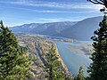
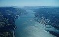
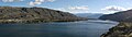
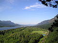
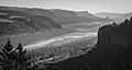
English: The Columbia River Gorge — in Oregon and Washington (state).
- The major canyon formed by the Columbia River cutting westward through the Cascade Range to reach the Pacific Ocean.
Subcategories
This category has the following 44 subcategories, out of 44 total.
B
- Bonneville Landslide (12 F)
C
- Cape Horn (Oregon) (40 F)
- Cascades Rapids (32 F)
- Catherine Creek Day Use Area (1 P, 57 F)
- Coyote Wall (18 F)
D
- Dalles Mountain Ranch (8 F)
- Dog Mountain (Washington) (16 F)
E
F
G
- Greenleaf Peak (1 P, 5 F)
H
- Hood River (river) (11 F)
L
M
O
P
- Pillars of Hercules, Oregon (45 F)
R
S
T
- Table Mountain (Skamania County, Washington) (1 P, 22 F)
- Tooth Rock Tunnel (28 F)
V
W
- Wind Mountain (Washington) (10 F)
Pages in category "Columbia River Gorge"
This category contains only the following page.
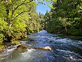
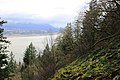
Media in category "Columbia River Gorge"
The following 188 files are in this category, out of 188 total.
-
 Wpdms nasa topo columbia river gorge.jpg 1,710 × 1,704; 322 KB
-
 1961 08 Sugar Smacks (49811882576).jpg 1,468 × 942; 351 KB
-
 2017 09 05-02.36.00.461-CDT.jpg 960 × 720; 81 KB
-
 2017 09 05-20.07.21.116-CDT.jpg 640 × 480; 23 KB
-
 2017 09 08-10.44.10.854-CDT.jpg 3,024 × 4,032; 1.14 MB
-
 2017 09 08-16.10.52.270-CDT.jpg 1,452 × 1,936; 146 KB
-
 2017 09 08-16.12.55.819-CDT.jpg 1,452 × 1,936; 164 KB
-
 2017-11-11 Cascade Locks 08.jpg 3,648 × 2,736; 2.19 MB
-
 20170716- DSC6121 (35638361453).jpg 6,000 × 4,000; 12.11 MB
-
 20170716-DSC 4832 (35611123224).jpg 5,668 × 3,779; 9.43 MB
-
 20190405 FS CRGNSA Rockfall is a hazard on many Gorge trails.jpg 960 × 1,280; 375 KB
-
4th Of July Fireworks Celebration, Columbia River, Hood River, Oregon, USA..webm 19 min 49 s, 640 × 480; 88 MB
-

-
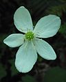 Anemone 01 (5859575399).jpg 2,135 × 2,664; 870 KB
-
-

-

-
 Bonneville Fish Hatchery - Gillnetting on the Columbia 1864 (cropped).JPG 2,816 × 1,408; 5.38 MB
-
 Bonneville Fish Hatchery - Gillnetting on the Columbia 1864.JPG 2,864 × 1,704; 5.43 MB
-

-
 Canon EOS 50D at work (2017-05-27).jpg 3,264 × 2,448; 7.63 MB
-
 Cape Horn in WA (51190850738).jpg 4,800 × 1,280; 3.73 MB
-
 Cape Horn, Columbia River, Washington, nd (WASTATE 467).jpeg 400 × 512; 49 KB
-
 Cascade Columbia River.jpg 550 × 458; 73 KB
-
 Colrivgorg.JPG 2,816 × 2,112; 2.4 MB
-
 Columbia Gorge (10488706433).jpg 2,048 × 1,536; 909 KB
-
 Columbia Gorge (497010422).jpg 1,704 × 1,176; 1.42 MB
-
 Columbia Gorge (497038365).jpg 1,709 × 1,175; 2.07 MB
-
 Columbia Gorge (497041775).jpg 1,710 × 1,176; 2.1 MB
-
 Columbia Gorge east of Hood River (4332506595).jpg 3,272 × 768; 873 KB
-
 Columbia Gorge near Mosier Tunnels (10488522405).jpg 2,048 × 1,536; 949 KB
-
 Columbia Gorge near Mosier Tunnels (10488703273).jpg 2,048 × 1,536; 1,015 KB
-
 Columbia Gorge Wildflowers (16495132044).jpg 3,568 × 5,284; 20.41 MB
-
 Columbia River (201830373).jpeg 2,048 × 1,264; 720 KB
-
 Columbia River (30963195).jpeg 2,048 × 1,338; 679 KB
-

-
 Columbia River (Hood River, Oregon).jpg 4,608 × 3,072; 5.35 MB
-
 Columbia River 2369.JPG 4,272 × 2,848; 7.05 MB
-
 Columbia River 2370.JPG 4,272 × 2,848; 7.78 MB
-
 Columbia River 2373 panorama.jpg 11,257 × 2,430; 11.05 MB
-
 Columbia River 2373.JPG 4,272 × 2,848; 8.01 MB
-
 Columbia River 2635.JPG 4,272 × 2,848; 6.04 MB
-
 Columbia River 2637.JPG 4,272 × 2,848; 5.76 MB
-
 Columbia River 2638.JPG 4,272 × 2,848; 6.16 MB
-
 Columbia River 2639.JPG 4,272 × 2,848; 5.75 MB
-
 Columbia River 3730.JPG 2,848 × 4,272; 6.68 MB
-
 Columbia River from Mitchell Point Overlook 01.jpg 4,288 × 2,848; 6.91 MB
-
 Columbia River from Mosier Tunnels (10488724943).jpg 2,048 × 1,536; 959 KB
-
 Columbia River Gorge (1).jpg 720 × 480; 211 KB
-
 Columbia River Gorge (20083928729).jpg 3,264 × 1,840; 2.38 MB
-
 Columbia River Gorge (5769476274) (2).jpg 4,752 × 3,168; 7.18 MB
-
 Columbia River Gorge (8237577409).jpg 2,880 × 2,160; 959 KB
-
 Columbia River Gorge (8237577829).jpg 2,880 × 2,160; 987 KB
-
 Columbia River Gorge (8237589231).jpg 3,191 × 1,949; 750 KB
-
 Columbia River Gorge (8237606103).jpg 2,880 × 2,160; 1.55 MB
-
 Columbia River Gorge (8237608445).jpg 2,880 × 2,160; 1.23 MB
-
 Columbia River Gorge (8237750209).jpg 2,880 × 2,160; 676 KB
-
 Columbia River Gorge (8237754323).jpg 2,880 × 2,160; 1.15 MB
-
 Columbia River Gorge (8238652750).jpg 2,880 × 2,160; 1.24 MB
-
 Columbia River Gorge (8238654848).jpg 2,880 × 2,160; 1.33 MB
-
 Columbia River Gorge (8238657092).jpg 2,984 × 2,084; 1.15 MB
-
 Columbia River Gorge (8238657450).jpg 2,880 × 2,160; 1.13 MB
-
 Columbia River Gorge (8238660716).jpg 2,160 × 2,880; 1.4 MB
-
 Columbia River Gorge (8238661088).jpg 2,880 × 2,160; 2.37 MB
-
 Columbia River Gorge (right).jpg 8,697 × 2,876; 4.51 MB
-
 Columbia River Gorge - panoramio.jpg 1,280 × 960; 274 KB
-
 Columbia River Gorge 1973 & 2012 (8091526374).jpg 800 × 272; 46 KB
-
 Columbia River Gorge area, Oregon, ca 1913 (BAR 134).jpeg 393 × 512; 51 KB
-
-
 COLUMBIA RIVER GORGE BETWEEN THE DALLES AND THE HOOD RIVER - NARA - 548143.jpg 3,000 × 2,030; 843 KB
-
 COLUMBIA RIVER GORGE BETWEEN THE DALLES AND THE HOOD RIVER - NARA - 548144.jpg 3,000 × 2,031; 918 KB
-
 COLUMBIA RIVER GORGE BETWEEN THE DALLES AND THE HOOD RIVER - NARA - 548172.jpg 3,000 × 2,027; 729 KB
-
 Columbia River Gorge Crown Point January 2017.jpg 750 × 498; 62 KB
-
 Columbia River Gorge from Benson Plateau-Columbia River Gorge (23563091099).jpg 1,346 × 906; 725 KB
-
 Columbia River Gorge from Mitchell Point, Oregon.jpg 2,580 × 1,932; 537 KB
-
 Columbia River Gorge from near Mosier, Oregon.jpg 1,236 × 927; 145 KB
-
 COLUMBIA RIVER GORGE IN THE EARLY MORNING LIGHT - NARA - 548199.jpg 3,000 × 2,024; 811 KB
-
 Columbia River Gorge in WA - 53678136426.jpg 2,048 × 1,536; 2.65 MB
-
 Columbia River Gorge in WA - 53678590500.jpg 2,048 × 1,536; 2.26 MB
-
 Columbia River Gorge in WA.jpg 2,048 × 1,536; 4.19 MB
-
 Columbia River Gorge January 2017.jpg 750 × 498; 118 KB
-
 Columbia River Gorge NASA.jpg 2,650 × 990; 1.45 MB
-
 Columbia River Gorge Pano - Flickr - Joe Parks.jpg 3,732 × 2,068; 4.98 MB
-
 Columbia River Gorge viewed from Vantage Bridge.jpg 6,000 × 4,000; 15.29 MB
-
 Columbia River Gorge, ca 1913 (BAR 130).jpeg 768 × 585; 97 KB
-
 Columbia River Gorge, Nov 2009-27.jpg 4,256 × 2,828; 4.79 MB
-
 Columbia River Gorge, Oregon (BAR 290).jpeg 390 × 511; 69 KB
-
 Columbia River Gorge, Tour Busses, swag seller (2542776614).jpg 1,600 × 1,200; 399 KB
-
 Columbia River Gorge, unidentified location (4558554376).jpg 768 × 585; 58 KB
-

-
 Columbia River Stream from Crown Point, Oregon (BAR 162).jpeg 765 × 599; 152 KB
-
 Columbia river sunset (22234094230).jpg 4,545 × 2,920; 5.55 MB
-
 Columbia River, Oregon (4904286337).jpg 2,720 × 2,541; 695 KB
-
 Columbia River, Washington, ca 1913 (BAR 222).jpeg 764 × 605; 133 KB
-
 ColumbiaGorge.JPG 2,848 × 2,128; 575 KB
-
 ColumbiaRGorgePano.jpg 2,688 × 1,200; 1.7 MB
-
 ColumbiarivergorgeJRH.jpg 800 × 600; 208 KB
-
 ColumbiaRiverGorgePanorama.jpg 13,736 × 3,292; 9.19 MB
-
 ColumbiaRiverPIC.jpg 600 × 449; 26 KB
-
 ColyerColumbia76.jpg 609 × 177; 79 KB
-
 Couple on hill overlooking Columbia River Gorge 01.jpg 1,236 × 927; 367 KB
-
 Dry Creek waterfall.jpg 4,608 × 3,456; 7.79 MB
-

-
 Early Sign Of Spring (245787953).jpeg 2,000 × 1,525; 252 KB
-
 FMIB 41476 Gorge of the Columbia--Home of the Fishwheel.jpeg 1,264 × 737; 287 KB
-
-
 Foggy morning at the Gorge (Unsplash).jpg 4,000 × 6,000; 7.28 MB
-
 Forest heights.jpg 2,736 × 2,495; 2.52 MB
-
 G262 Columbia River Gorge by Gifford & Prentiss (21879360474).jpg 4,781 × 3,688; 7.2 MB
-
 Garry Oak forest.jpg 3,024 × 4,032; 5.02 MB
-

-
 Gorge hike.jpg 960 × 717; 117 KB
-
 Gorge of Columbia NASA view.jpg 4,168 × 1,588; 1.14 MB
-

-
 Hassalo running Cascades of Columbia river, May 26, 1881.JPG 800 × 491; 59 KB
-
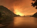
 Haze from Tunnel Five Fire as seen from Angel's Rest on July 4, 2023.jpg 2,635 × 1,976; 553 KB
-
 HCRH Stream, Dan Kaplan (5352563770).jpg 2,592 × 3,872; 6 MB
-
 Herbst im Pierce National Wildlife Refuge am Columbia Rivert.jpg 4,032 × 3,024; 3 MB
-
 Home guard on the Columbia River (3387045927).jpg 4,044 × 2,939; 1.24 MB
-
 Hood river.JPG 800 × 600; 141 KB
-
 HoodRiverOregon.jpg 2,037 × 1,269; 1.87 MB
-
 Koberg Beach State Recreation Site.jpg 3,097 × 2,529; 5.58 MB
-
 Lake entiat pano.jpg 2,087 × 600; 365 KB
-
 Little White Salmon River in WA.jpg 2,048 × 1,536; 3.7 MB
-

-
 Looking out over the Columbia River Valley.jpg 761 × 443; 123 KB
-
 LyleWashingtonView.jpg 2,601 × 1,000; 602 KB
-
 Middle Cascades, Columbia River LCCN2007662709.tif 5,127 × 4,147; 20.28 MB
-
 Morning mist in Columbia Gorge (4332507297).jpg 1,024 × 770; 182 KB
-
 Moss-covered tree, Oregon.jpg 1,944 × 2,592; 2.03 MB
-
 Mount Hood and the Columbia River.jpg 4,032 × 3,024; 2.31 MB
-
 Mount Jefferson from Mount St. Helens.jpg 3,008 × 2,000; 4.61 MB
-
 Mt. Adams from the south.JPG 4,000 × 3,000; 2.95 MB
-
 Multnomah Falls (5652025597) (2).jpg 4,752 × 3,168; 7.75 MB
-
 Multnomah Falls Area (5769489354) (2).jpg 4,752 × 3,168; 5.03 MB
-
 Multnomah OR July 14 2004.jpg 2,048 × 1,536; 614 KB
-
 Nancy Russell on Cape Horn Trail.jpg 498 × 748; 51 KB
-
 Native American Salmon Market, Columbia River 2006 (6506685843).jpg 1,178 × 868; 309 KB
-
 Natural West - Flickr - Thomas James Caldwell.jpg 3,967 × 2,114; 1.03 MB
-
 Cascades of the Columbia (NYPL Hades-280603-1253671).tiff 4,418 × 3,264; 41.27 MB
-
 On the Historic Columbia River Hwy. Trail near Hood River, OR..jpeg 2,592 × 1,936; 1.83 MB
-

-
 Panorama of Columbia River Shore - Hood River - Oregon - USA.jpg 4,912 × 1,080; 2.25 MB
-
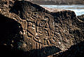 Petroglyphs in the Columbia River Gorge.jpg 1,500 × 1,013; 886 KB
-
 Polystichum munitum (Jami Dwyer) 001.jpg 984 × 938; 732 KB
-

-
 Railroad Incline at the Cascades.png 3,000 × 1,719; 2.94 MB
-
 Rainbow above a vintage bus overlooking rolling hills.jpg 1,236 × 927; 278 KB
-
 Rocky beach, Columbia River Gorge (BAR 35).jpeg 768 × 590; 104 KB
-

-
 Sand Island, Columbia River (7990157411).jpg 2,448 × 1,683; 2 MB
-
 Skamania County, WA, USA - panoramio (7).jpg 2,592 × 1,936; 1.96 MB
-
 Smoke from Tunnel Five Fire as seen from Angel's Rest on July 4, 2023.png 4,032 × 3,024; 8.13 MB
-
 Stanley Rock.jpg 4,473 × 2,982; 1.68 MB
-
 Starvcrk2.jpg 1,280 × 960; 502 KB
-
 Steamboat Hassalo running Cascades.jpg 1,772 × 1,087; 598 KB
-
 Steamboat on the Columbia River, Oregon, 1909 (AL+CA 1752).jpg 768 × 489; 47 KB
-
 Steamboat Venture over Cascade Rapids, 1858.jpg 548 × 1,268; 421 KB
-
 Stumps at Cascade Rapids.jpg 700 × 458; 157 KB
-
 Sunday Stroll (25391819798).jpg 4,486 × 2,991; 6.73 MB
-
 Sunset on the Gorge.jpg 5,585 × 3,721; 17.24 MB
-
 THE COLUMBIA RIVER GORGE NEAR CORBETT - NARA - 548025.jpg 3,000 × 2,026; 772 KB
-

-

-

-

-

-

-

-

-
 The Shire.jpg 1,000 × 667; 675 KB
-
 Tony Webster Columbia River Oregon 18541625222.jpg 3,264 × 2,012; 4.35 MB
-
 Train passing Mitchell Point Overlook 02.jpg 4,288 × 2,848; 6.34 MB
-
 Train passing Mitchell Point Overlook 03.jpg 4,288 × 2,848; 6.37 MB
-

-

-
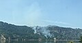 Tunnel Five Fire.jpg 2,764 × 1,462; 922 KB
-
 Usgs deschutes watershed.png 911 × 1,325; 215 KB
-

-

-

-
 View from Upper Cascades, Columbia River, 1882 (AL+CA 4328).jpg 768 × 490; 48 KB
-
 View of Columbia River from Larch Mountain Trail 441, near Multnomah Falls.jpg 2,048 × 1,536; 1.21 MB
-
 View on the Columbia River, Nr. Cascade Locks, O.R. & N. Ry..jpg 3,693 × 3,148; 1.43 MB
-
 Washington side of Columbia Gorge (4332509363).jpg 1,024 × 770; 431 KB
-

-

-
 Windmills along the Columbia River Gorge.jpg 4,288 × 2,848; 5.2 MB

.jpg)


.jpg)
.jpg)

.jpg)
.jpg)

.jpg)
.jpg)
.JPG)

.jpg)
.jpg)
.jpeg)


.jpg)
.jpg)
.jpg)
.jpg)
.jpg)
.jpg)
.jpg)
.jpeg)
.jpeg)
_(hooDA0025).jpg)
.jpg)


.jpg)
.jpg)
.jpg)
_(2).jpg)
.jpg)
.jpg)
.jpg)
.jpg)
.jpg)
.jpg)
.jpg)
.jpg)
.jpg)
.jpg)
.jpg)
.jpg)
.jpg)

.jpeg)


.jpg)


.jpeg)

.jpeg)
.jpg)
.jpg)
.jpeg)
.jpeg)
.jpg)
.jpg)
.jpeg)


.jpeg)


.jpg)

.jpg)

_(hooDA0023).jpg)

_(mulDA0035).jpg)


.jpg)

.jpg)


.jpg)

.jpg)


_(2).jpg)
_(2).jpg)


.jpg)


.jpg)

_001.jpg)
.jpg)


.jpeg)
.jpeg)
.jpg)
.jpg)


.jpg)


.jpg)


.jpg)
_(14596637449).jpg)
_(14596656898).jpg)
_(14596657728).jpg)
.jpg)


.jpg)
.jpg)


.jpg)
.jpg)
.jpg)
.jpg)


.jpg)
.jpg)
.jpg)

.jpg)
.jpg)
.jpg)
.jpg)
Categories:
- Columbia River along the Oregon-Washington border
- Cascade Range
- Multnomah County, Oregon
- Hood River County, Oregon
- Wasco County, Oregon
- Clark County, Washington
- Skamania County, Washington
- Klickitat County, Washington
- Geomorphology of Washington (state)
- Geomorphology of Oregon
- Canyons in Oregon
- Canyons in Washington (state)
- Lewis and Clark National Historic Trail
- Lewis and Clark Trail
- Lewis and Clark Expedition
- Columbia River Basalt Group
- Columbia River Gorge National Scenic Area
- Geotourism in Oregon
- Geotourism in Washington (state)