Category:Lewis and Clark Expedition
Appearance
American overland expedition to the Pacific coast | |||||
| Upload media | |||||
| Instance of |
| ||||
|---|---|---|---|---|---|
| Facet of |
| ||||
| Named after | |||||
| Location |
| ||||
| Commissioned by | |||||
| Start point |
| ||||
| Start time |
| ||||
| End time |
| ||||
| Budget |
| ||||
 | |||||
Subcategories
This category has the following 54 subcategories, out of 54 total.
*
A
C
- Camp Disappointment (6 F)
- Canyon Ferry Dam (8 F)
- The Captains' Return (2 F)
F
- Fort Atkinson (Nebraska) (7 F)
- Fort Belle Fontaine (12 F)
- Fort Clatsop (50 F)
- Fort Mandan (13 F)
G
H
K
- Knife River (11 F)
L
M
- Medal of Honor Tree 20 (2 F)
N
P
R
- Rock Fort Campsite (3 F)
S
- Seaman (dog) (4 F)
- Sergeant Floyd Monument (19 F)
T
- Tucannon River (5 F)
V
W
Pages in category "Lewis and Clark Expedition"
The following 2 pages are in this category, out of 2 total.
Media in category "Lewis and Clark Expedition"
The following 124 files are in this category, out of 124 total.
-
Bonneville Fish Hatchery - Lewis & Clark marker.JPG 3,264 × 2,448; 2.49 MB
-
Branding iron replica from Lewis and Clark Expedition.JPG 4,000 × 3,000; 2.9 MB
-
Camp Disappointment.JPG 3,072 × 2,048; 4.19 MB
-
CampDissapointmentA.jpg 250 × 164; 14 KB
-
CampDissapointmentB.jpg 250 × 164; 16 KB
-
CampDissapointmentC.png 719 × 509; 238 KB
-
CampDissapointmentD.png 731 × 510; 280 KB
-
CampDissapointmentE.png 366 × 504; 192 KB
-
CampDissapointmentF.png 753 × 510; 280 KB
-
Captain Clark and his men building a line of huts LCCN2001699654.jpg 1,536 × 1,179; 341 KB
-
Captain Clark and his men shooting bears LCCN2001699664.jpg 1,536 × 1,040; 285 KB
-
Captain Lewis & Clark holding a council with the Indians LCCN2001699652.jpg 1,536 × 1,002; 271 KB
-
Captain Lewis shooting an Indian LCCN2001699660.jpg 1,536 × 1,213; 317 KB
-
Carte Lewis-Clark Expedition-en.png 849 × 530; 193 KB
-
Carte Lewis-Clark Expedition-es.svg 906 × 593; 763 KB
-
Carte Lewis-Clark Expedition-fr.svg 906 × 593; 368 KB
-
Carte Lewis-Clark Expedition.png 849 × 530; 204 KB
-
Children's stories of American progress (1886) (14596736358).jpg 1,496 × 2,230; 947 KB
-
Chinook Point.jpg 250 × 170; 18 KB
-
Columbia Gorge Interpretive Center - Stevenson, Washington.jpg 3,264 × 2,448; 1.68 MB
-
Corps of Discovery II monument @ Chamberlain.jpg 4,080 × 3,072; 4.6 MB
-
Detail Lewis & Clark at Three Forks.jpg 1,409 × 1,600; 734 KB
-
Dugouts 2017-09- 244.jpg 4,608 × 3,072; 3.19 MB
-
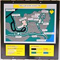
Map of Lewis and Clark National Historic Park.JPG 2,120 × 2,101; 1.58 MB
-
Fort de Cavagnial.jpg 442 × 331; 74 KB
-
GassBearPix1807.jpg 483 × 319; 145 KB
-
Gates effect.jpg 529 × 1,837; 1.38 MB
-
Giant Springs Trout 16.JPG 1,794 × 1,089; 824 KB
-
Great Falls of Columbia River.png 1,804 × 845; 2.38 MB
-
GREAT FALLS PORTAGE, CASCADE COUNTY, MONTANA.jpg 2,784 × 1,848; 438 KB
-
Hat Rock.JPG 502 × 347; 67 KB
-
Illiana Antique Power Exhibition speaker.png 2,000 × 1,500; 5.06 MB
-
Inskip-Ruins-2009.jpg 1,280 × 960; 1.72 MB
-
Jefferson Medal given to a Chief by Lewis and Clark.png 871 × 1,211; 523 KB
-
Journallewisandclarke 06 lewis-clark 64kb.ogg 10 min 36 s; 3.24 MB
-
Kart Lewis-Clark ekspedisjo.jpg 849 × 530; 81 KB
-
Karta Lewis-Clark.png 849 × 530; 187 KB
-
Karte Lewis-und-Clark-Expedition.jpg 2,333 × 1,513; 1.87 MB
-
Karte Lewis-und-Clark-Expedition.png 849 × 530; 231 KB
-
LePage-LewisandClark.jpg 504 × 773; 81 KB
-
Lewis & Clark Camps near Souix City PA130666.JPG 3,072 × 2,304; 1.12 MB
-
Lewis & Clark Mosaic image.png 2,640 × 3,100; 19.37 MB
-
Lewis & Clark PA140773.JPG 3,048 × 1,807; 660 KB
-
Lewis and Clark at the mouth of the Columbia River) 1805 LCCN2006683399.jpg 1,536 × 1,156; 224 KB
-
Lewis and Clark by Charles M Russell 1918.jpeg 700 × 378; 195 KB
-
Lewis and Clark Expedition map (uk).svg 906 × 593; 333 KB
-
Lewis and Clark Expedition map.svg 906 × 593; 321 KB
-
Lewis and Clark Expidition Map.jpg 7,000 × 3,043; 6.32 MB
-
Lewis and Clark Expo Map.jpg 400 × 305; 56 KB
-
Lewis and Clark Meeting the Flatheads in Ross Hole, September 4, 1805.jpg 1,614 × 768; 194 KB
-
Lewis and Clark Reach Shoshone Camp Led by Sacajawea.jpg 4,000 × 2,451; 2.15 MB
-
Lewis and Clark Route.png 390 × 584; 300 KB
-
Lewis and Clark Salt Works Information sign.png 2,048 × 1,536; 5.85 MB
-
Lewis and Clark Statue.jpg 3,024 × 4,032; 3.26 MB
-
Lewis and Clark Window 01 - South Nave Bay C - National Cathedral - DC.JPG 1,000 × 1,500; 237 KB
-
Lewis and Clark Window 02 - South Nave Bay C - National Cathedral - DC.JPG 1,000 × 1,500; 302 KB
-
Lewis and clark-expedition.jpg 3,000 × 2,346; 2.17 MB
-
Lewis and Clark.jpg 398 × 300; 32 KB
-
Lewis Clark marker Pittsb jeh.jpg 3,600 × 3,200; 1.48 MB
-
Lewis, Clark, York, Sacagawea, and dog Seaman.jpg 4,032 × 3,024; 1.7 MB
-
LewisAndClark-AlpowaSummitWA-US12 (30971475634).jpg 2,400 × 1,800; 1.64 MB
-
Lewisclarkroute-klondike.jpg 3,264 × 2,448; 1.32 MB
-
Loc-archives map hood river john day 1854 mini.jpg 638 × 479; 91 KB
-
Meeting place of LewisClark and Indians.jpg 1,280 × 960; 541 KB
-
Milkriverpan.jpg 10,610 × 2,570; 4.44 MB
-
Missouri - Fort Osage - 20220518123222.jpg 3,024 × 4,032; 2.85 MB
-
Nasa-archives columbia thedalles rockcreek 1997.jpg 500 × 400; 96 KB
-
Nasa-archives deschutes drainage 1994.jpg 500 × 400; 104 KB
-
Noaa-archives map miller island 1983.jpg 639 × 479; 101 KB
-
Nodaway-lewis.jpg 889 × 843; 140 KB
-
Nodaway-missouri.jpg 3,072 × 2,304; 2.75 MB
-
Ohs-archives deschutes and columbia 1910.jpg 600 × 369; 35 KB
-
Oregon Trail and route of Lewis and Clarke.png 1,714 × 924; 379 KB
-
Journals of the Lewis and Clark Expedition 1804-1806.pdf 847 × 1,318, 250 pages; 10.35 MB
-
Patrick Gass from Centennial History of Oregon.png 1,053 × 1,497; 803 KB
-
Patrick Gass.png 516 × 740; 243 KB
-
Lewis and Clark at Three Forks by Edgar S. Paxson, 1912.jpg 1,115 × 500; 365 KB
-
Pintle mounted gun on the "White" pirogue.JPG 2,048 × 1,536; 628 KB
-
Provincias Ynternas Nueva España 1817.jpg 8,866 × 7,520; 8.11 MB
-
Riverfront Park (Leavenworth, Kansas).jpg 2,848 × 4,288; 6.88 MB
-
Lewis and Clark on the Lower Columbia; 1905, Charles M. Russell.jpg 1,080 × 841; 376 KB
-
Sacagawea Detail Lewis & Clark at Three Forks (cropped).jpg 573 × 674; 154 KB
-
Salmon River.JPG 2,816 × 2,112; 2.5 MB
-
Salmon-river-1.jpg 315 × 475; 34 KB
-
Seaman at Fort Mandan.jpg 483 × 539; 167 KB
-
SeasideL&C.jpg 2,205 × 2,825; 4.32 MB
-
SIOUX CHIEF.JPG 1,252 × 2,000; 1.72 MB
-
Snake River below Lewiston.jpg 560 × 448; 101 KB
-
Theb1883.jpg 1,640 × 1,072; 1.07 MB
-
Traveler's Rest State Park view of mountains 1 20121228.JPG 4,000 × 3,000; 3.79 MB
-
Traveler's Rest, Lolo.jpg 4,031 × 3,137; 1.53 MB
-
TravelersRest1958.jpg 350 × 233; 14 KB
-
Travois Trail To Blue Mountains - Plowed field is the trail from the West.jpg 4,320 × 3,240; 5.49 MB
-
Tucannon-valley-lewis-clark-lunch-site.JPG 1,359 × 1,075; 299 KB
-
Univ-utah-archives map fort dalles klickitat 1859.jpg 640 × 480; 153 KB
-
Upper MO quillwork pre1804 UPenn.jpg 136 × 720; 132 KB
-
US $10 1901.jpg 1,967 × 843; 777 KB
-
Uw-archives map columbia river 1855.jpg 640 × 480; 93 KB
-
Uw-archives map columbia the dalles 1887.jpg 640 × 480; 63 KB
-
Uw-archives map recon deschutes 1858.jpg 640 × 480; 114 KB
-
Uw-archives map recon john day 1858.jpg 640 × 480; 106 KB
-
Waynetown, Brattan Plaque P6280065.jpg 3,072 × 2,304; 1.41 MB
-
Willardalexander2 copy.jpg 195 × 292; 37 KB
-
William Brattan, L&C Exped Member P6280075.jpg 2,048 × 1,536; 579 KB
-
Wpdms nasa topo milk river.jpg 300 × 250; 45 KB
-
Wsu-archives map washington oregon 1853.jpg 640 × 480; 126 KB
-
Youngs River - Clatsop County, Oregon.jpg 600 × 354; 44 KB
-
Inscription Giant Springs.JPG 1,712 × 2,288; 2.14 MB


