Category:Hood River County, Oregon
Appearance
Counties of Oregon: Baker · Benton · Clackamas · Clatsop · Columbia · Coos · Crook · Curry · Deschutes · Douglas · Gilliam · Grant · Harney · Hood River · Jackson · Jefferson · Josephine · Klamath · Lake · Lane · Lincoln · Linn · Malheur · Marion · Morrow · Multnomah · Polk · Sherman · Tillamook · Umatilla · Union · Wallowa · Wasco · Washington · Wheeler · Yamhill
county in Oregon, United States | |||||
| Upload media | |||||
| Instance of | |||||
|---|---|---|---|---|---|
| Named after | |||||
| Location | Oregon | ||||
| Capital | |||||
| Inception |
| ||||
| Population |
| ||||
| Area |
| ||||
| Different from | |||||
| official website | |||||
 | |||||
Subcategories
This category has the following 24 subcategories, out of 24 total.
B
- Badger Creek Wilderness (2 F)
C
E
G
- Gorton Creek Bridge (5 F)
H
I
- Interstate 80N in Oregon (3 F)
L
M
O
P
R
- Hood River (river) (11 F)
W
- Warren Falls (2 F)
Media in category "Hood River County, Oregon"
The following 51 files are in this category, out of 51 total.
-
20111110-OC-AMW-0043 - Flickr - USDAgov.jpg 4,704 × 3,504; 6.51 MB
-
2017 09 08-10.57.40.237-CDT.jpg 2,016 × 1,512; 378 KB
-
2017-06-25 Hood River Valley 01.jpg 4,032 × 3,024; 1.65 MB
-
2017-06-25 Hood River Valley 02.jpg 4,032 × 3,024; 1.65 MB
-
2017-06-25 Hood River Valley 03.jpg 4,032 × 3,024; 2.04 MB
-
Apple growing in the Pacific northwest (1911) (19557472960).jpg 1,792 × 2,914; 1.2 MB
-
Arcyria versicolor W. Phillips 434297.jpg 1,448 × 1,448; 1.37 MB
-
Arcyria versicolor W. Phillips 434298.jpg 2,171 × 2,227; 1.44 MB
-
Arcyria versicolor W. Phillips 434299.jpg 2,246 × 1,901; 1.76 MB
-
Arcyria versicolor W. Phillips 434300.jpg 2,595 × 2,281; 2.23 MB
-
BNSF Railway at Drano Lake - Columbia River, Washington-Oregon Border (22144413044).jpg 5,708 × 3,662; 22.68 MB
-
Columbia River at Washington-Oregon Border (1291216943).jpg 1,200 × 1,600; 204 KB
-
Columbia River Gorge - panoramio (1).jpg 2,048 × 1,536; 442 KB
-
Columbia River Gorge - panoramio (2).jpg 3,072 × 4,608; 11.53 MB
-
CRH MP 58 oblique.jpg 1,944 × 2,592; 3.75 MB
-
CRH MP 58.jpg 1,944 × 2,592; 3.75 MB
-
Fifteenmile Creek Watershed.png 1,425 × 1,124; 1.63 MB
-
Hills and Clouds at Sunset - Hood River - Oregon - USA - 01.jpg 2,736 × 3,648; 2.15 MB
-
Hood River County, Oregon, Farm Family Listening to the Radio - NARA - 6788418.jpg 2,400 × 3,150; 940 KB
-
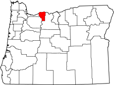
Hood River County.gif 776 × 554; 21 KB
-
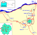
Hood river map.gif 450 × 300; 11 KB
-
Hood River, OR 97031, USA - panoramio.jpg 2,048 × 1,536; 389 KB
-
I-84 Slide (12523443174).jpg 2,560 × 1,920; 2.91 MB
-
Ingresso della cittadina da Sud.jpg 4,608 × 2,592; 2.03 MB
-
Logging north of Mt Hood (34552263761).jpg 3,264 × 2,448; 2.18 MB
-
Map mount hood vicinity.png 564 × 526; 13 KB
-
Milky Way Wheelie (14964347624).jpg 4,544 × 7,554; 28.74 MB
-
Mount Hood, Sans Snow, OR 9-13 (29923834235).jpg 2,000 × 1,058; 654 KB
-
Mount Hood-Oregon by-Daniel-J-McKeown 100 3804.JPG 2,080 × 1,544; 712 KB
-
Mt Hood from Trillium Lake (4858985830).jpg 720 × 480; 203 KB
-
Mt. Hood from the Fruit Loop.jpg 2,048 × 1,324; 787 KB
-
Nathaniel Coe, Black and white sketch, c. 1850.jpg 413 × 528; 52 KB
-
Nude doorwaygirl.jpg 1,555 × 2,323; 4.02 MB
-
Odell Oregon.jpg 4,661 × 1,752; 2.64 MB
-
Oregon Punchbowl (207883009).jpeg 1,080 × 663; 288 KB
-
Sahara Marie.jpg 3,024 × 4,032; 1.67 MB
-
Selective cut north of Mt Hood (34552266261).jpg 3,264 × 2,448; 2.77 MB
-
Seneca Fouts Memorial State Natural Area.jpg 1,024 × 684; 205 KB
-
SP 9219 eastbound at Heather, OR on July 29, 1987 (32484241503).jpg 1,241 × 1,942; 2.57 MB
-
Stevenson, Washington on Columbia River (1292078764).jpg 1,200 × 1,600; 185 KB
-
Sunflower in garden (21544523888).jpg 3,748 × 5,599; 14.12 MB
-
Timberline Trail north side.jpg 600 × 893; 127 KB
-
Twister Falls.jpg 3,872 × 2,592; 4.05 MB
-
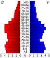
USA Hood, Oregon age pyramid.svg 520 × 600; 7 KB
-
Viento picnic area.jpg 2,048 × 1,360; 1.25 MB
-
View on top - panoramio.jpg 4,608 × 2,592; 1.82 MB
-
Went around Mount Hood (1679532964).jpg 1,094 × 754; 104 KB

