Category:Black and white photographs of West Yorkshire
Jump to navigation
Jump to search
Ceremonial counties of England: Bedfordshire · Berkshire · Buckinghamshire · Cambridgeshire · Cheshire · Cornwall · Cumbria · Derbyshire · Devon · Dorset · Durham · East Riding of Yorkshire · East Sussex · Essex · Gloucestershire · Greater London · Greater Manchester · Hampshire · Herefordshire · Hertfordshire · Isle of Wight · Kent · Lancashire · Leicestershire · Lincolnshire · Merseyside · Norfolk · North Yorkshire · Northamptonshire · Northumberland · Nottinghamshire · Oxfordshire · Rutland · Shropshire · Somerset · South Yorkshire · Staffordshire · Suffolk · Surrey · Tyne and Wear · Warwickshire · West Midlands · West Sussex · West Yorkshire · Wiltshire · Worcestershire
City-counties: Bristol ·
Former historic counties:
Other former counties:
City-counties: Bristol ·
Former historic counties:
Other former counties:

Subcategories
This category has the following 5 subcategories, out of 5 total.
Media in category "Black and white photographs of West Yorkshire"
The following 170 files are in this category, out of 170 total.
-
 "Beeline" at Ilkley - geograph.org.uk - 914856.jpg 440 × 640; 63 KB
-
 128 Bradford Road - geograph.org.uk - 462938.jpg 352 × 640; 64 KB
-
 1909 school feast Joshua Biltcliffe Upper Cumberworth West Yorkshire England.jpg 1,412 × 885; 863 KB
-
 Amanda's (9159645519).jpg 1,680 × 1,621; 1.32 MB
-
 Armitage Bridge Mills - steam engine - geograph.org.uk - 3337026.jpg 640 × 388; 71 KB
-
 Back from the dead - geograph.org.uk - 1344279.jpg 640 × 500; 56 KB
-
 Barker's Tannery, Otley - geograph.org.uk - 377368.jpg 431 × 640; 43 KB
-
 Barker's Tannery, Otley - geograph.org.uk - 659500.jpg 437 × 640; 43 KB
-
 Beam engine, Ledgard Bridge Mills - geograph.org.uk - 1112982.jpg 423 × 640; 65 KB
-
 Below Old Royd Lock, Rochdale Canal - geograph.org.uk - 398952.jpg 640 × 465; 101 KB
-

-
 Blackshaw Head, Yorkshire - geograph.org.uk - 648375.jpg 640 × 533; 80 KB
-
 Booth Wood Dam (B&W).jpg 1,024 × 773; 246 KB
-

-
 Bridge MDL 1-16 - George Street - geograph.org.uk - 903364.jpg 640 × 569; 229 KB
-
 Burgers, Curries; Cobblers (15236008917).jpg 3,282 × 2,626; 4.7 MB
-
 C and J Hirst, Sunnybank Mills - geograph.org.uk - 1046812.jpg 640 × 420; 73 KB
-
 Canal boating as a spectator-sport - geograph.org.uk - 1414589.jpg 640 × 572; 87 KB
-
 Car No 180 at Golf House - geograph.org.uk - 1344326.jpg 640 × 465; 72 KB
-
 Cars do not stop by request - geograph.org.uk - 1336238.jpg 640 × 468; 29 KB
-
 Churchyard Bottom, Heptonstall - geograph.org.uk - 512771.jpg 640 × 527; 101 KB
-
 Clayton West station, Yorkshire - geograph.org.uk - 579819.jpg 640 × 533; 92 KB
-
 Converted chapel, Leeds Road, Liversedge - geograph.org.uk - 6354579.jpg 2,000 × 1,202; 1.36 MB
-
 Corporation Mill, Sowerby Bridge - geograph.org.uk - 696116.jpg 640 × 622; 102 KB
-

-

-
 Cranberry Dam - geograph.org.uk - 1319713.jpg 640 × 502; 46 KB
-
 Cross Stone Church - geograph.org.uk - 668838.jpg 640 × 597; 67 KB
-
 Cullingworth - Baptist Sunday School 1898 - geograph.org.uk - 369373.jpg 640 × 621; 205 KB
-
 Cullingworth - small mill building - geograph.org.uk - 369352.jpg 560 × 640; 50 KB
-
 Cullingworth Mills - geograph.org.uk - 369394.jpg 635 × 589; 56 KB
-
 Cullingworth Mills - geograph.org.uk - 369397.jpg 636 × 610; 51 KB
-

-
 Dalton Mill (8172846582).jpg 2,873 × 2,611; 3.18 MB
-
 Dalton Mills (8183261188).jpg 2,321 × 2,321; 2.15 MB
-
 Denby Dale viaduct (explored) - Flickr - Shever ^ Kimmrs.jpg 5,184 × 3,456; 5.5 MB
-
 Denton Bridge, River Wharfe - geograph.org.uk - 579800.jpg 640 × 533; 160 KB
-

-

-
 Feltham car by the Corn Exchange - geograph.org.uk - 1330490.jpg 640 × 484; 62 KB
-

-
 Flints Reservoir - geograph.org.uk - 660916.jpg 640 × 544; 88 KB
-
 Former trolleybus turntable (2) - geograph.org.uk - 645435.jpg 640 × 544; 65 KB
-

-
 Forster Square station, Bradford - geograph.org.uk - 639184.jpg 640 × 558; 65 KB
-

-
 George Street Mills - geograph.org.uk - 402534.jpg 640 × 419; 52 KB
-
 Goods Lane - Railway Street - geograph.org.uk - 1853884.jpg 640 × 480; 69 KB
-
 Great Horton Methodist Church (9085953029).jpg 2,712 × 1,931; 2.65 MB
-
 Church, Apperley Bridge, Bradford (2489860531).jpg 2,292 × 3,056; 3.05 MB
-
 Hallas Hall Farm - geograph.org.uk - 372455.jpg 639 × 620; 62 KB
-
 Heath House Mill - geograph.org.uk - 403379.jpg 640 × 417; 33 KB
-
 Hebden Old Bridge - geograph.org.uk - 1507951.jpg 640 × 511; 71 KB
-
 Hebden Water below Gibson Mill - geograph.org.uk - 1395323.jpg 640 × 557; 116 KB
-
 Heptonstall bells 1912.jpg 720 × 480; 73 KB
-
 Heptonstall, Yorkshire - geograph.org.uk - 512739.jpg 640 × 521; 95 KB
-
 Hole Bottom Lane and 'The' chimney - geograph.org.uk - 656912.jpg 640 × 542; 71 KB
-
 Hollin Park near Denholme - geograph.org.uk - 372450.jpg 623 × 640; 114 KB
-
 Hollin Park near Denholme - geograph.org.uk - 372451.jpg 537 × 606; 67 KB
-

-
 Holme, West Yorkshire, Winter 1978.jpg 1,612 × 1,024; 1.29 MB
-
 Holmfirth, Yorkshire - geograph.org.uk - 411534.jpg 640 × 623; 102 KB
-
 Holmfirth, Yorkshire - geograph.org.uk - 620766.jpg 640 × 543; 73 KB
-

-

-

-
 Kirkby Mill at South Kirkby, West Yorkshire, England.jpg 1,022 × 690; 686 KB
-
 Lad Stone Rock - geograph.org.uk - 1621478.jpg 640 × 513; 70 KB
-

-

-
 Low Lane (7159921538).jpg 4,101 × 3,153; 5.66 MB
-
 Low Westwood Mills - geograph.org.uk - 508312.jpg 640 × 430; 50 KB
-
 Lumbutts village - geograph.org.uk - 661665.jpg 640 × 535; 63 KB
-
 Michael Seatter.jpg 1,296 × 899; 202 KB
-

-
 Mill, Cornholme (3360253117).jpg 2,443 × 1,803; 2.31 MB
-
 Mock Hall Farm, Leeds Road - geograph.org.uk - 6347897.jpg 2,000 × 1,287; 1.2 MB
-
 Model engineers - geograph.org.uk - 719617.jpg 640 × 566; 86 KB
-
 Morane MS.502 F-BEJQ YEA 30.05.55 edited-3.jpg 1,024 × 724; 632 KB
-
 Mytholmroyd station - geograph.org.uk - 660879.jpg 640 × 549; 79 KB
-
 Near Holme House - geograph.org.uk - 391300.jpg 640 × 588; 187 KB
-
 Newland Hall.jpeg 697 × 538; 78 KB
-
 No 602 at Thwaite Gate - geograph.org.uk - 1325129.jpg 640 × 504; 49 KB
-

-
-

-
 On the Briggate crossover - geograph.org.uk - 1330674.jpg 640 × 486; 90 KB
-
 On the street where I live (9248052807).jpg 2,242 × 2,242; 1.96 MB
-
 Otley bus station, Yorkshire - geograph.org.uk - 625415.jpg 640 × 538; 46 KB
-
 Over Wood, Hebden Dale, Yorkshire - geograph.org.uk - 321189.jpg 640 × 516; 125 KB
-
 Parkwood Mills - geograph.org.uk - 1046842.jpg 640 × 427; 48 KB
-
 Passing Parkside - geograph.org.uk - 1336207.jpg 640 × 469; 39 KB
-
 Pennine bus route - geograph.org.uk - 646706.jpg 640 × 536; 73 KB
-
 Preparing to leave Beza Road, Leeds - against the sunlight (29343290804).jpg 4,608 × 1,908; 3.23 MB
-

-
 Railway bridge (1845198000).jpg 3,872 × 2,592; 4.24 MB
-
 Ramsden Mills, Linthwaite - geograph.org.uk - 487009.jpg 640 × 406; 55 KB
-

-

-

-

-
 Rocks at Otley Chevin - geograph.org.uk - 1395836.jpg 640 × 442; 40 KB
-
 Rocks at Otley Chevin - geograph.org.uk - 1395841.jpg 640 × 455; 82 KB
-
 Ruin (5380951087).jpg 2,445 × 1,759; 2.36 MB
-

-

-

-

-
 Sands Lock No 32, Rochdale Canal - geograph.org.uk - 373727.jpg 640 × 492; 128 KB
-
 Shay House Farm - geograph.org.uk - 658909.jpg 640 × 502; 61 KB
-
 Shelf Moor (2947067439).jpg 1,396 × 2,095; 1.37 MB
-
 Sovereign Street PW Yard, Leeds - geograph.org.uk - 1344299.jpg 640 × 444; 52 KB
-
 Special cars at Temple Newsam - geograph.org.uk - 1344313.jpg 479 × 640; 83 KB
-
 St Stephen West Bowling (101).JPG 5,184 × 3,456; 7.99 MB
-
 St Stephen West Bowling (102).JPG 3,216 × 4,908; 7.24 MB
-
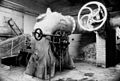
 Steam engine at Craven Mills - geograph.org.uk - 388255.jpg 640 × 431; 66 KB
-
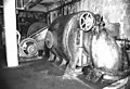
 Steam engine at Craven mills - geograph.org.uk - 388263.jpg 640 × 419; 63 KB
-

-

-
-
 Steam engine, Parkwood Mills - geograph.org.uk - 489384.jpg 640 × 400; 55 KB
-
 Steam engine, Upper Mills - geograph.org.uk - 1356711.jpg 422 × 640; 66 KB
-

-
 Stepping stones over Hebden Water - geograph.org.uk - 1395310.jpg 640 × 488; 92 KB
-
 Steps up from Wood Fall Beck - geograph.org.uk - 655862.jpg 640 × 639; 167 KB
-
 Stoodley Pike - geograph.org.uk - 661619.jpg 640 × 517; 63 KB
-

-
 Terminus Fisheries (9159648345).jpg 1,868 × 2,483; 2.57 MB
-
-

-
 The beam loft, Ledgard Bridge Mills - geograph.org.uk - 1112994.jpg 640 × 492; 65 KB
-
 The F. A. Chimney - geograph.org.uk - 656877.jpg 640 × 529; 61 KB
-

-
 The porch of Heptonstall Old Church - geograph.org.uk - 1522280.jpg 640 × 531; 70 KB
-

-
 The Surprise View - geograph.org.uk - 1395847.jpg 640 × 487; 94 KB
-
 The Te Deum stone - geograph.org.uk - 661613.jpg 640 × 555; 93 KB
-
 The very last football special - geograph.org.uk - 1336195.jpg 640 × 494; 37 KB
-
 The Withens, Cold Edge, Yorkshire (2) - geograph.org.uk - 579795.jpg 640 × 533; 78 KB
-
 The Withens, Cold Edge, Yorkshire - geograph.org.uk - 375785.jpg 640 × 543; 83 KB
-
 Titanic Mill - geograph.org.uk - 403391.jpg 640 × 432; 67 KB
-
 Tong Church (St. James) - geograph.org.uk - 390372.jpg 452 × 640; 196 KB
-
 Towards the woods - geograph.org.uk - 1336251.jpg 640 × 456; 35 KB
-
 Tram on New York Street - geograph.org.uk - 1330554.jpg 640 × 477; 86 KB
-
 Under dwellings, Holmfirth, Yorkshire - geograph.org.uk - 620718.jpg 640 × 527; 82 KB
-
 Up the Lane (7172201210).jpg 3,108 × 3,100; 5.17 MB
-
 Upper Dwellings, Holmfirth, Yorkshire - geograph.org.uk - 620478.jpg 640 × 551; 85 KB
-
 Using the Halton crossover - geograph.org.uk - 1344349.jpg 640 × 510; 58 KB
-
 View from Gallows Bridge (8145704221).jpg 2,977 × 3,867; 5.39 MB
-
 View from the Calderdale Way - geograph.org.uk - 669970.jpg 640 × 576; 75 KB
-

-
 View over Copley - geograph.org.uk - 1621474.jpg 640 × 500; 59 KB
-
 View over Ripponden - geograph.org.uk - 1503774.jpg 640 × 521; 90 KB
-
 View over Todmorden from 936237 - geograph.org.uk - 661740.jpg 640 × 560; 108 KB
-
 View south from 099344 - geograph.org.uk - 658917.jpg 640 × 501; 69 KB
-
 View towards Yeoman Hill - geograph.org.uk - 1513695.jpg 640 × 504; 53 KB
-
 Waiting for a ride - geograph.org.uk - 718876.jpg 640 × 516; 96 KB
-
 Wakefield Road, Liversedge - geograph.org.uk - 6354576.jpg 2,000 × 1,172; 1.14 MB
-
 Walled stile at Aldersley, Yorkshire - geograph.org.uk - 658904.jpg 640 × 586; 127 KB
-
 Warland Upper Lock No 35, Rochdale Canal - geograph.org.uk - 373695.jpg 640 × 484; 128 KB
-
 Water turbine, Upper Mills - geograph.org.uk - 1356694.jpg 640 × 432; 72 KB
-
-
 Watering Trough - geograph.org.uk - 978154.jpg 640 × 485; 106 KB
-
 Weir, River Wharfe, Otley, Yorkshire - geograph.org.uk - 373223.jpg 640 × 517; 128 KB
-
 Whitcliffe Road Bridge, Spen Valley Greenway - geograph.org.uk - 6405653.jpg 2,000 × 1,367; 2.03 MB
-
 White Lion (15603318509).jpg 2,887 × 3,622; 5.1 MB
-
 Whitwood Sewage Pumping Station - geograph.org.uk - 447982.jpg 640 × 417; 55 KB
-
 Wilsden, from Norr Hill - geograph.org.uk - 658921.jpg 640 × 497; 59 KB
-
 Wyke-viaduct-by-Dr-Neil-Clifton.jpg 640 × 537; 59 KB
-
 Catherine House Farm - geograph.org.uk - 660923.jpg 640 × 522; 73 KB


.jpg)


.jpg)


.jpg)


.jpg)
.jpg)
_-_Flickr_-_Shever_%5E_Kimmrs.jpg)


_-_geograph.org.uk_-_645435.jpg)


.jpg)
.jpg)


.jpg)


.jpg)


.jpg)


.jpg)

.jpg)


.jpg)


.jpg)


.JPG)
.JPG)


.jpg)

_-_geograph.org.uk_-_668851.jpg)


_-_geograph.org.uk_-_579795.jpg)


_-_geograph.org.uk_-_390372.jpg)


.jpg)


.jpg)


.jpg)


