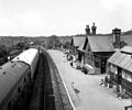
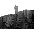
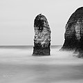
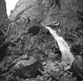
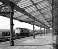
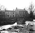
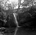
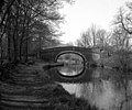
Category:Black and white photographs of North Yorkshire
Jump to navigation
Jump to search
Ceremonial counties of England: Bedfordshire · Berkshire · Buckinghamshire · Cambridgeshire · Cheshire · Cornwall · Cumbria · Derbyshire · Devon · Dorset · Durham · East Riding of Yorkshire · East Sussex · Essex · Gloucestershire · Greater London · Greater Manchester · Hampshire · Herefordshire · Hertfordshire · Isle of Wight · Kent · Lancashire · Leicestershire · Lincolnshire · Merseyside · Norfolk · North Yorkshire · Northamptonshire · Northumberland · Nottinghamshire · Oxfordshire · Rutland · Shropshire · Somerset · South Yorkshire · Staffordshire · Suffolk · Surrey · Tyne and Wear · Warwickshire · West Midlands · West Sussex · West Yorkshire · Wiltshire · Worcestershire
City-counties: Bristol ·
Former historic counties:
Other former counties:
City-counties: Bristol ·
Former historic counties:
Other former counties:
Subcategories
This category has the following 4 subcategories, out of 4 total.
Media in category "Black and white photographs of North Yorkshire"
The following 184 files are in this category, out of 184 total.
-
20170721112810 IMG 0786-01.jpg 1,280 × 1,280; 699 KB
-
25123 Skipton.jpg 1,024 × 768; 365 KB
-
46229 DUCHESS OF HAMILTON passes Skipton (cropped).jpg 850 × 638; 249 KB
-
46229 DUCHESS OF HAMILTON passes Skipton.jpg 1,024 × 768; 308 KB
-
47436 passes Hellifield station.jpg 1,024 × 768; 326 KB
-
All Saints' Church frescos, Hemsley, North Yorkshire, England.jpg 910 × 1,489; 1.54 MB
-
An unofficial swimming pool - geograph.org.uk - 632169.jpg 640 × 556; 138 KB
-
Barden Tower - geograph.org.uk - 1606532.jpg 640 × 554; 84 KB
-
Barden Tower - geograph.org.uk - 715687.jpg 640 × 534; 109 KB
-
Barden Tower, Wharfedale, Yorkshire - geograph.org.uk - 635821.jpg 640 × 569; 96 KB
-
Battersby Station 1772365 e3a08028.jpg 640 × 369; 119 KB
-
Bay Horse, Kirk Deighton (6th February 2013) 002.JPG 3,872 × 2,176; 1.55 MB
-
Bleak Landscape (21331130488).jpg 5,184 × 3,456; 3.74 MB
-
BocheBusterCatterick12December1940.jpg 800 × 604; 57 KB
-
BocheBusterShellHoistCatterick12December1940.jpg 800 × 606; 69 KB
-
Bolton Abbey by Roger Fenton, 1850s.png 1,968 × 1,560; 5.51 MB
-
Boosbeck railway station 1854554 f07b9d0b.jpg 640 × 427; 109 KB
-
Bordley, Yorkshire - geograph.org.uk - 646652.jpg 640 × 518; 88 KB
-
Bridge over Suffield Hill at Hackness, North Yorkshire, England.jpg 1,537 × 989; 1.24 MB
-
Brompton - KMB - 16001000127704.jpg 539 × 780; 60 KB
-
Burdale Station (remains) - geograph.org.uk - 1937288.jpg 640 × 408; 120 KB
-
Carving on Selby Abbey (6956965951).jpg 2,432 × 3,807; 4.35 MB
-
Cavendish Pavilion, Bolton Abbey - geograph.org.uk - 580029.jpg 640 × 523; 145 KB
-
Cononley Lead Mine, Yorkshire - geograph.org.uk - 627045.jpg 640 × 507; 64 KB
-
Cononley Lead Mine, Yorkshire - geograph.org.uk - 627048.jpg 640 × 566; 87 KB
-
Cover Bridge, Yorkshire - geograph.org.uk - 716257.jpg 640 × 554; 87 KB
-
Coxwold Church, 1935 - geograph.org.uk - 1161480.jpg 406 × 600; 91 KB
-
D 025922.png 600 × 370; 162 KB
-
D 025924.png 600 × 370; 210 KB
-
D 025925.png 600 × 370; 159 KB
-
D 025933.png 600 × 370; 176 KB
-
Diesel locomotive at Grosmont - geograph.org.uk - 1545158.jpg 640 × 502; 80 KB
-
Diesel locomotive at Grosmont - geograph.org.uk - 1545170.jpg 640 × 512; 86 KB
-
E50638 E59380 E59245 and E50637 Skipton.jpg 1,024 × 768; 381 KB
-
Eller Beck, Skipton - geograph.org.uk - 704432.jpg 640 × 588; 69 KB
-
Embsay station, Yorkshire - geograph.org.uk - 624792.jpg 640 × 508; 61 KB
-
Embsay station, Yorkshire - geograph.org.uk - 694694.jpg 640 × 533; 74 KB
-
Ethel's Tower - geograph.org.uk - 1621462.jpg 640 × 536; 48 KB
-
Ethel's Tower - geograph.org.uk - 1621466.jpg 640 × 543; 52 KB
-
Ethel's Tower - geograph.org.uk - 659034.jpg 640 × 428; 35 KB
-
Farnhill, Leeds and Liverpool Canal - geograph.org.uk - 1414534.jpg 640 × 479; 66 KB
-
Farnhill, Leeds and Liverpool Canal - geograph.org.uk - 1414539.jpg 640 × 488; 60 KB
-
Flamborough Stack (683604).jpeg 900 × 900; 113 KB
-
FMIB 53462 Dam at Egton.jpeg 2,184 × 1,348; 687 KB
-
Fountains Abbey - geograph.org.uk - 1588911.jpg 640 × 550; 75 KB
-
Fountains Abbey - geograph.org.uk - 1588915.jpg 640 × 498; 52 KB
-
Fountains Abbey, seen over the water - geograph.org.uk - 636748.jpg 640 × 536; 91 KB
-
Fountains Abbey, Yorkshire - geograph.org.uk - 579803.jpg 640 × 536; 107 KB
-
Gordale Scar, Yorkshire - geograph.org.uk - 522790.jpg 640 × 619; 160 KB
-
Grosmont Level Crossing - geograph.org.uk - 5697761.jpg 1,024 × 686; 139 KB
-
Grosmont station, Yorkshire - geograph.org.uk - 560849.jpg 640 × 575; 89 KB
-
Haddlesey Old Lock, River Aire, Yorkshire - geograph.org.uk - 214913.jpg 640 × 458; 103 KB
-
Haddlesey Weir, River Aire, Yorkshire - geograph.org.uk - 377362.jpg 640 × 508; 114 KB
-
Halifax crew before take-off WWII IWM D 6028.jpg 536 × 800; 50 KB
-
Halifax pilot WWII IWM D 6051.jpg 800 × 528; 51 KB
-
Hellifield station (2) - geograph.org.uk - 628209.jpg 640 × 528; 64 KB
-
Hellifield station (3) - geograph.org.uk - 628214.jpg 640 × 536; 92 KB
-
Hellifield station - geograph.org.uk - 628201.jpg 640 × 586; 91 KB
-
Houses by the River Wharfe, Linton - geograph.org.uk - 645870.jpg 640 × 608; 102 KB
-
How Stean Beck, Yorkshire - geograph.org.uk - 579809.jpg 640 × 536; 161 KB
-
Hunmanby (2034197027).jpg 1,024 × 768; 407 KB
-
Hunmanby signal box.jpg 1,024 × 768; 324 KB
-
Hunmanby, Hungate c.1900 (archive ref PO-1-71-11) (24623447874).jpg 870 × 550; 77 KB
-
Hutton-le-Hole Village - geograph.org.uk - 1031097.jpg 640 × 588; 142 KB
-
Industrial view in Skipton, 1982 - geograph.org.uk - 1600393.jpg 640 × 532; 67 KB
-
IWM H37175 Kirkham Priory D-Day preparation inspections.jpg 800 × 514; 43 KB
-
Janet's Foss, near Gordale Bridge - geograph.org.uk - 656193.jpg 640 × 624; 111 KB
-
Junction at Grosmont, Yorkshire - geograph.org.uk - 560869.jpg 640 × 497; 96 KB
-
Packhorse bridge, Linton, Wharfedale - geograph.org.uk - 644228.jpg 640 × 506; 86 KB
-
Linton Falls and the Tin Bridge - geograph.org.uk - 645859.jpg 640 × 498; 75 KB
-
Linton Falls, Wharfedale, Yorkshire - geograph.org.uk - 644211.jpg 640 × 529; 76 KB
-
Linton Mills - geograph.org.uk - 416609.jpg 640 × 421; 60 KB
-
Linton Mills - geograph.org.uk - 416712.jpg 640 × 428; 57 KB
-
Linton, Wharfedale - geograph.org.uk - 644397.jpg 640 × 529; 78 KB
-
Lock No 38, Leeds and Liverpool Canal - geograph.org.uk - 652359.jpg 640 × 558; 62 KB
-
Lock No 39, Leeds Liverpool Canal - geograph.org.uk - 652358.jpg 640 × 500; 92 KB
-
Looking towards Gordale Scar - geograph.org.uk - 513159.jpg 640 × 514; 94 KB
-
Malham Cove, Yorkshire - geograph.org.uk - 513163.jpg 640 × 516; 86 KB
-
Mastiles Lane, Yorkshire - geograph.org.uk - 656307.jpg 640 × 521; 78 KB
-
Menagerie.wombwells.1910.jpg 400 × 262; 15 KB
-
Moorcock Inn, Garsdale Head, Yorkshire, England - 1900-05.jpg 1,023 × 633; 446 KB
-
Newport (Tees-side) Locomotive Depot geograph-2873857-by-Ben-Brooksbank.jpg 2,394 × 1,448; 1.59 MB
-
Newport (Yorks.) Locomotive Depot 2074079 50725582.jpg 640 × 364; 57 KB
-
Old Loftsome Toll Bridge - geograph.org.uk - 437269.jpg 640 × 365; 47 KB
-
Old Lupat Factory.jpg 390 × 343; 110 KB
-
On a Hillside (40300704320).jpg 3,216 × 2,136; 1.5 MB
-
On the Pennine Way - panoramio.jpg 2,592 × 3,888; 1.48 MB
-
Ornamental water at Studley Royal - geograph.org.uk - 579805.jpg 640 × 523; 100 KB
-
Pen-y-Ghent in winter clothing - geograph.org.uk - 624071.jpg 640 × 533; 70 KB
-
Pinker's Pond - geograph.org.uk - 716262.jpg 640 × 513; 66 KB
-
Public footpath, Middleham - geograph.org.uk - 716265.jpg 640 × 623; 82 KB
-
Railway viaduct over the River Aire - geograph.org.uk - 652417.jpg 640 × 521; 77 KB
-
Ribblehead station - geograph.org.uk - 694637.jpg 640 × 456; 63 KB
-
River Leven Viewed Upstream - geograph.org.uk - 105125.jpg 640 × 482; 100 KB
-
River Skell near Fountains Abbey - geograph.org.uk - 1588921.jpg 640 × 502; 68 KB
-
Roall Pumping Station - geograph.org.uk - 1117941.jpg 640 × 427; 58 KB
-
Royal Baths, Harrogate - geograph.org.uk - 689723.jpg 640 × 533; 67 KB
-
Rush Grass in Heather Moorland, Urra Moor - geograph.org.uk - 634810.jpg 640 × 427; 274 KB
-
Scalby Mills, Scarborough North Yorkshire England 1901 - 1910.jpg 1,449 × 937; 850 KB
-
Selby Abbey (140793075).jpeg 2,048 × 1,365; 527 KB
-
Selby Abbey (24733599259).jpg 4,746 × 3,164; 5.43 MB
-
Selby Abbey (25713290950).jpg 5,184 × 3,456; 8.67 MB
-
Selby Abbey after the fire of 1909.jpg 1,632 × 2,186; 2.04 MB
-
Selby Abbey Exterior (8009858306).jpg 5,184 × 3,456; 5.95 MB
-
Sherburn-in-Elmet - KMB - 16001000127844.jpg 542 × 790; 61 KB
-
Site of Thornton-in-Craven station - geograph.org.uk - 632130.jpg 640 × 489; 83 KB
-
Skipton station - geograph.org.uk - 718083.jpg 640 × 567; 77 KB
-
South Bay pool, Scarborough - geograph.org.uk - 718281.jpg 640 × 540; 48 KB
-
South Cliff Lift, Scarborough - geograph.org.uk - 718288.jpg 640 × 575; 84 KB
-
St Gregory's Minster, 1935 - geograph.org.uk - 1161476.jpg 640 × 454; 114 KB
-
Steam engine Linton Mills - geograph.org.uk - 1160071.jpg 640 × 416; 67 KB
-
Steam engine, Cross Lane Mills - geograph.org.uk - 1356641.jpg 640 × 423; 59 KB
-
Steam engine, Linton Mills - geograph.org.uk - 1115143.jpg 640 × 405; 59 KB
-
Steam pumping engine, Roall - geograph.org.uk - 1117938.jpg 429 × 640; 64 KB
-
Strid Woods, Wharfedale, Yorkshire - geograph.org.uk - 648348.jpg 640 × 618; 104 KB
-
Tarn Foot, Malham Tarn, Yorkshire - geograph.org.uk - 513160.jpg 640 × 501; 86 KB
-
The A56 at Thornton-in-Craven - geograph.org.uk - 643548.jpg 640 × 492; 63 KB
-
The Battlements - geograph.org.uk - 4278409.jpg 574 × 383; 42 KB
-
The Spa, Scarborough - geograph.org.uk - 718286.jpg 640 × 547; 68 KB
-
The Spa, Scarborough - geograph.org.uk - 718294.jpg 640 × 514; 79 KB
-
The straight and narrow way... - geograph.org.uk - 645440.jpg 640 × 544; 72 KB
-
The Tower (2) - geograph.org.uk - 636744.jpg 640 × 520; 87 KB
-
The Tower (of Mystery^) - geograph.org.uk - 636742.jpg 640 × 536; 96 KB
-
Thornton-in-Craven, Yorkshire - geograph.org.uk - 643532.jpg 640 × 523; 80 KB
-
View across Linton Green, Wharfedale - geograph.org.uk - 644232.jpg 640 × 533; 63 KB
-
View east from Embsay station - geograph.org.uk - 694649.jpg 640 × 538; 88 KB
-
Wainman's Pinnacle - geograph.org.uk - 1621458.jpg 640 × 532; 40 KB
-
Wainman's Pinnacle - geograph.org.uk - 659049.jpg 640 × 460; 34 KB
-
Water wheel at Darley Mill, Yorkshire - geograph.org.uk - 718089.jpg 640 × 555; 101 KB
-
Welte Organ Scarborough.jpg 1,758 × 2,404; 3.12 MB
-
West Burton, Yorkshire - geograph.org.uk - 625427.jpg 640 × 538; 63 KB
-
Whitby Abbey east end of the chancel.JPG 5,616 × 3,744; 3.24 MB
-
White Cross - geograph.org.uk - 978087.jpg 640 × 548; 99 KB
-
York Minster the Five Sisters by George Washington Wilson 1865.jpg 3,099 × 4,000; 3.04 MB
-
Aysgarth Upper Falls - geograph.org.uk - 643338.jpg 640 × 541; 113 KB
-
Aysgarth Upper Falls, Wensleydale - geograph.org.uk - 643335.jpg 640 × 547; 111 KB


