
Category:Black and white photographs of Surrey
Ceremonial counties of England: Bedfordshire · Berkshire · Buckinghamshire · Cambridgeshire · Cheshire · Cornwall · Cumbria · Derbyshire · Devon · Dorset · Durham · East Riding of Yorkshire · East Sussex · Essex · Gloucestershire · Greater London · Greater Manchester · Hampshire · Herefordshire · Hertfordshire · Isle of Wight · Kent · Lancashire · Leicestershire · Lincolnshire · Merseyside · Norfolk · North Yorkshire · Northamptonshire · Northumberland · Nottinghamshire · Oxfordshire · Rutland · Shropshire · Somerset · South Yorkshire · Staffordshire · Suffolk · Surrey · Tyne and Wear · Warwickshire · West Midlands · West Sussex · West Yorkshire · Wiltshire · Worcestershire
City-counties: Bristol ·
Former historic counties: Middlesex ·
Other former counties:
City-counties: Bristol ·
Former historic counties: Middlesex ·
Other former counties:

Subcategories
This category has only the following subcategory.
Media in category "Black and white photographs of Surrey"
The following 200 files are in this category, out of 281 total.
(previous page) (next page)-
 "Elderly man at fence - A summer afternoon in Surrey" - Upper Street, Shere, Surrey.jpg 2,000 × 2,045; 2.1 MB
-
-
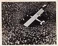
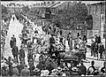
 20 Weald Way Caterham, with Meteorite car, 1924 - geograph.org.uk - 6953065.jpg 3,336 × 2,005; 2.23 MB
-
 4 sub emu2.jpg 640 × 534; 74 KB
-
 4 sub emu3.jpg 640 × 506; 89 KB
-

-
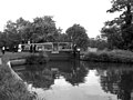
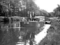
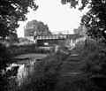
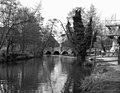
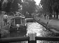
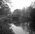
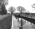
 Above Thames Lock, Wey Navigation, Surrey - geograph.org.uk - 629187.jpg 640 × 571; 112 KB
-
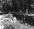
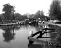
 Above Unstead Lock - geograph.org.uk - 1415316.jpg 640 × 484; 90 KB
-
 Approaching Redhill station - geograph.org.uk - 546718.jpg 640 × 511; 89 KB
-

-

-
 April sunshine beside the Wey Navigation - geograph.org.uk - 1414881.jpg 640 × 507; 113 KB
-
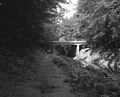
 Ash (road) bridge, Basingstoke Canal - geograph.org.uk - 476697.jpg 640 × 491; 111 KB
-
 Ash Lock, Basingstoke Canal - geograph.org.uk - 476730.jpg 640 × 508; 131 KB
-
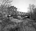
 Ash Railway Bridge, Basingstoke Canal - geograph.org.uk - 476703.jpg 640 × 487; 131 KB
-
 Ash Railway Bridge, Basingstoke Canal - geograph.org.uk - 584325.jpg 640 × 549; 138 KB
-

-
 Ash Vale Road Bridge, Basingstoke Canal - geograph.org.uk - 584317.jpg 640 × 517; 127 KB
-
 Bell Weir Lock, River Thames - geograph.org.uk - 372665.jpg 640 × 472; 109 KB
-
 Betchworth, Surrey - geograph.org.uk - 514578.jpg 640 × 513; 77 KB
-
 Bisley Tramway bridge, Basingstoke Canal - geograph.org.uk - 476444.jpg 640 × 470; 134 KB
-
 Bisley Tramway Bridge, Basingstoke Canal - geograph.org.uk - 518188.jpg 640 × 548; 164 KB
-

-
 Bodryn Cottage and Forge Cottage, Middle Street, Shere, England 1938 - 9-013.jpg 1,676 × 1,004; 985 KB
-
-
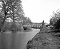
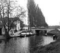
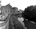
 Bridge Street Bridge, Guildford, Surrey - geograph.org.uk - 620788.jpg 640 × 545; 102 KB
-
 Broad Oak Bridge, Wey Navigation - geograph.org.uk - 620883.jpg 640 × 496; 79 KB
-
 Brookwood Bottom Lock, Basingstoke Canal - geograph.org.uk - 582848.jpg 640 × 538; 135 KB
-
 Brookwood Bridge, Basingstoke Canal - geograph.org.uk - 582844.jpg 640 × 538; 161 KB
-
-
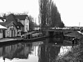
 Brookwood, Lock No 13, Basingstoke Canal - geograph.org.uk - 582854.jpg 640 × 574; 154 KB
-
 Cart Bridge, Wey Navigation, Surrey - geograph.org.uk - 621452.jpg 640 × 500; 98 KB
-
 Catteshall Lock, River Wey, Surrey - geograph.org.uk - 619659.jpg 640 × 534; 88 KB
-
-
 Chertsey Lock and Bridge - geograph.org.uk - 628234.jpg 640 × 544; 59 KB
-
 Chertsey Lock, River Thames - geograph.org.uk - 372200.jpg 640 × 513; 113 KB
-
 Chertsey Road Bridge, Basingstoke Canal - geograph.org.uk - 582068.jpg 640 × 514; 141 KB
-
-
 Chipstead station, Surrey - geograph.org.uk - 566720.jpg 640 × 525; 92 KB
-

-
 Chipstead Valley Road - geograph.org.uk - 639392.jpg 640 × 570; 83 KB
-
 Chobham Road Bridge, Basingstoke Canal - geograph.org.uk - 582080.jpg 640 × 499; 152 KB
-
 Clifton Arms, Caterham, Surrey - geograph.org.uk - 350345.jpg 640 × 546; 105 KB
-
-

-

-
 Coxes Lock and Mill, Wey Navigation - geograph.org.uk - 480537.jpg 640 × 511; 85 KB
-
 Coxes Mill and Lock, Wey Navigation - geograph.org.uk - 480529.jpg 640 × 533; 113 KB
-

-

-

-
 Deepcut Bridge, Basingstoke Canal - geograph.org.uk - 583739.jpg 640 × 519; 124 KB
-
 Deepcut Lock No 18, Basingstoke Canal - geograph.org.uk - 582867.jpg 640 × 512; 146 KB
-
 Deepcut Lock No 19, Basingstoke Canal - geograph.org.uk - 582957.jpg 640 × 529; 143 KB
-
 Deepcut Lock No 21, Basingstoke Canal - geograph.org.uk - 582965.jpg 640 × 506; 132 KB
-
 Deepcut Lock No 22, Basingstoke Canal - geograph.org.uk - 582985.jpg 640 × 533; 154 KB
-
 Deepdene station, Dorking - geograph.org.uk - 1541681.jpg 640 × 538; 88 KB
-
 Deepdene station, Dorking - geograph.org.uk - 1541696.jpg 640 × 540; 94 KB
-
 Deepdene station, Dorking - geograph.org.uk - 1541785.jpg 640 × 513; 78 KB
-
 Deepdene station, Dorking, Surrey - geograph.org.uk - 558420.jpg 640 × 528; 104 KB
-
-

-
 Derelict houseboats above Lock No 1 - geograph.org.uk - 674415.jpg 640 × 502; 105 KB
-

-

-

-
 Descending New Haw Lock, Wey Navigation - geograph.org.uk - 480554.jpg 640 × 498; 114 KB
-
 Eastern bridge over Desborough Cut - geograph.org.uk - 619335.jpg 640 × 512; 65 KB
-
 Effingham Junction station - geograph.org.uk - 570214.jpg 640 × 528; 122 KB
-
 Elmore Pond, Chipstead, Surrey - geograph.org.uk - 390983.jpg 640 × 520; 128 KB
-
 Entering Molesey Lock - geograph.org.uk - 546726.jpg 640 × 546; 82 KB
-
 Epsom Downs station - geograph.org.uk - 1541858.jpg 640 × 541; 66 KB
-
 Epsom Downs station - geograph.org.uk - 559775.jpg 640 × 517; 79 KB
-
 Epsom Downs station, Surrey - geograph.org.uk - 559624.jpg 640 × 536; 92 KB
-
 Epsom-station-1919.jpg 700 × 523; 124 KB
-
 Farncombe Boat house, River Wey, Surrey - geograph.org.uk - 480120.jpg 640 × 565; 141 KB
-
-

-
 Fire engine, church parade, Leatherhead, Surrey, 1928.jpg 1,624 × 1,218; 332 KB
-

-

-
 Footbridge to D'Oyly Carte Island - geograph.org.uk - 619350.jpg 640 × 548; 78 KB
-
 Friday Street, Surrey (2) - geograph.org.uk - 573173.jpg 640 × 500; 119 KB
-
 Friday Street, Surrey - geograph.org.uk - 573171.jpg 640 × 550; 139 KB
-
 Frimley Aqueduct, Basingstoke Canal - geograph.org.uk - 583743.jpg 640 × 508; 153 KB
-
 Glebe Water, Godstone, Surrey - geograph.org.uk - 589348.jpg 640 × 549; 148 KB
-
 Godalming Town Bridge, River Wey, Surrey - geograph.org.uk - 480112.jpg 640 × 518; 107 KB
-
-
 Godalming Wharf, River Wey, Surrey - geograph.org.uk - 629169.jpg 640 × 532; 65 KB
-
 Godalming Wharf, River Wey, Surrey - geograph.org.uk - 629179.jpg 640 × 548; 88 KB
-

-

-

-
 Greatbottom Flash, Basingstoke Canal - geograph.org.uk - 584290.jpg 640 × 549; 134 KB
-
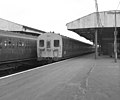
 Guildford Station - geograph.org.uk - 571204.jpg 640 × 499; 74 KB
-
 Guildford station, Surrey - geograph.org.uk - 571178.jpg 640 × 480; 88 KB
-
 Hampton Court station - geograph.org.uk - 572088.jpg 640 × 502; 101 KB
-
 Hampton Court station - geograph.org.uk - 572091.jpg 640 × 549; 87 KB
-
 Heath Vale Bridge - geograph.org.uk - 584304.jpg 640 × 556; 155 KB
-
 Heath Vale Bridge, Basingstoke Canal - geograph.org.uk - 584297.jpg 640 × 513; 158 KB
-
 Hermitage Road Bridge, Basingstoke Canal - geograph.org.uk - 582837.jpg 640 × 540; 150 KB
-

-
 High Bridge, Wey Navigation, Surrey - geograph.org.uk - 621457.jpg 640 × 513; 99 KB
-
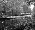
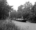
 Houseboat, Basingstoke Canal - geograph.org.uk - 582109.jpg 640 × 480; 141 KB
-
-

-

-
 Houseboats on the Basingstoke Canal - geograph.org.uk - 581589.jpg 640 × 564; 154 KB
-
 Isn't this the way it should be... - geograph.org.uk - 510030.jpg 640 × 554; 125 KB
-

-
 Kiln Bridge, Basingstoke Canal - geograph.org.uk - 582740.jpg 640 × 529; 172 KB
-
 Lake and Open Air Theatre at Claremont - geograph.org.uk - 122718.jpg 2,526 × 3,672; 1.93 MB
-

-
 Leigh Place Pond, Godstone, Surrey - geograph.org.uk - 589351.jpg 640 × 554; 178 KB
-
 Leroy's Boathouse, River Wey, Guildford - geograph.org.uk - 510145.jpg 640 × 541; 150 KB
-

-

-
 Lych Gate, St James' Church, Shere, England 1938 - 10-005.jpg 1,684 × 1,043; 834 KB
-
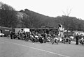
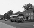
 Maidstone buses at Chelsham Garage - geograph.org.uk - 460115.jpg 640 × 511; 77 KB
-
 Middle Street, Shere, England 1938 - 9-014.jpg 1,684 × 1,004; 777 KB
-
 Middle Street, Shere, England 1938 - 9-015.jpg 1,688 × 1,004; 873 KB
-
 Middle Street, Shere, England 1938 - 9-016.jpg 1,684 × 1,004; 769 KB
-
 Middle Street, Shere, Surrey, England 1938 - 9-007.jpg 1,687 × 1,023; 855 KB
-
 Middle Street, Shere, Surrey, England 1938 - 9-010.jpg 1,684 × 1,023; 711 KB
-

-
-

-
 Miniature railway at Upper Warlingham - geograph.org.uk - 661930.jpg 640 × 522; 92 KB
-
 Molesey Weir, River Thames - geograph.org.uk - 619250.jpg 640 × 503; 68 KB
-
 Monument Bridge, Basingstoke Canal - geograph.org.uk - 581873.jpg 640 × 529; 151 KB
-
-

-

-

-
 Mytchett Lake, Basingstoke Canal - geograph.org.uk - 584038.jpg 640 × 522; 105 KB
-
 Mytchett Place Bridge, Basingstoke Canal - geograph.org.uk - 518245.jpg 640 × 498; 169 KB
-

-
 New Haw Lock, Wey Navigation - geograph.org.uk - 624425.jpg 640 × 519; 70 KB
-
 New Haw Lock, Wey Navigation, Surrey - geograph.org.uk - 480517.jpg 640 × 515; 87 KB
-
 Newark Lock, Wey Navigation - geograph.org.uk - 621645.jpg 640 × 535; 114 KB
-
 Newark Lock, Wey Navigation, Surrey - geograph.org.uk - 567895.jpg 640 × 570; 142 KB
-
 Newark Lock, Wey Navigation,Surrey - geograph.org.uk - 480474.jpg 640 × 634; 125 KB
-
 Newark New Bridge, Wey Navigation. - geograph.org.uk - 621468.jpg 640 × 509; 110 KB
-
 Nonsuch Mansion b&w Surrey.jpg 5,570 × 3,714; 7.08 MB
-
 Old cottages at Leigh, Surrey - geograph.org.uk - 530631.jpg 640 × 505; 87 KB
-
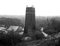 Old limekiln, Betchworth, Surrey - geograph.org.uk - 442370.jpg 640 × 492; 69 KB
-
-
 Old Windsor Lock, River Thames - geograph.org.uk - 372684.jpg 640 × 511; 148 KB
-
 Outside Hampton Court station - geograph.org.uk - 568440.jpg 640 × 505; 93 KB
-
 Outwood Post Mill, Surrey - geograph.org.uk - 480511.jpg 640 × 474; 70 KB
-
 Papercourt Lock, River Wey, Surrey - geograph.org.uk - 480467.jpg 640 × 519; 91 KB
-

-
 Parley Drive Bridge, Basingstoke Canal - geograph.org.uk - 582179.jpg 640 × 539; 126 KB
-
 Penton Hook Lock, River Thames - geograph.org.uk - 629055.jpg 640 × 528; 85 KB
-
 Penton Hook Lock. River Thames - geograph.org.uk - 372359.jpg 640 × 500; 138 KB
-
 Pyrford Lock, Wey Navigation - geograph.org.uk - 1414954.jpg 640 × 503; 73 KB
-
 Pyrford Lock, Wey Navigation, Surrey - geograph.org.uk - 480496.jpg 640 × 480; 102 KB
-

-
 Redhill station, Surrey - geograph.org.uk - 619653.jpg 640 × 501; 55 KB
-
 Restoring the Deepcut flight Basingstoke Canal.jpg 640 × 549; 178 KB
-
 River Wey at Guildford, Surrey - geograph.org.uk - 480126.jpg 640 × 500; 103 KB
-
 River Wey at Weybridge - geograph.org.uk - 1604498.jpg 640 × 542; 112 KB
-
 River Wey, Guildford - geograph.org.uk - 510472.jpg 640 × 512; 118 KB
-
 River Wey, Guildford, Surrey - geograph.org.uk - 620797.jpg 640 × 544; 86 KB
-

-
 Rose Cottage, Shottermill 04.jpg 4,128 × 3,096; 4.67 MB
-
 Scotland Bridge, Basingstoke Canal - geograph.org.uk - 581592.jpg 640 × 560; 166 KB
-

-
 Sergeant Green's funeral, Epsom 1919.jpg 582 × 423; 141 KB
-
 Sheerwater Bridge, Basingstoke Canal - geograph.org.uk - 581861.jpg 640 × 523; 175 KB
-
 Sheets Heath Bridge, Basingstoke Canal - geograph.org.uk - 476394.jpg 518 × 640; 161 KB
-
 Sheets Heath Bridge, Basingstoke Canal - geograph.org.uk - 517861.jpg 640 × 531; 175 KB
-
 Shepperton Lock, River Thames - geograph.org.uk - 619651.jpg 640 × 504; 58 KB
-
 Shepperton Lock, River Thames - geograph.org.uk - 629105.jpg 640 × 534; 81 KB
-
 Shepperton Lock, River Thames - geograph.org.uk - 629264.jpg 640 × 526; 89 KB
-
 Shepperton station - geograph.org.uk - 566694.jpg 640 × 522; 112 KB
-
 Shere Lane, Shere, Surrey, England 1938 - 9-012.jpg 1,663 × 1,023; 793 KB
-
 Small pond in the centre of Godstone - geograph.org.uk - 691479.jpg 640 × 568; 129 KB
-
 South of Redhill station - geograph.org.uk - 620775.jpg 640 × 512; 57 KB
-
 St. Bartholomew's Church, Leigh, Surrey - geograph.org.uk - 530647.jpg 640 × 510; 100 KB
-

-
 St. John's Bottom Lock No 7 - geograph.org.uk - 582192.jpg 640 × 514; 146 KB
-
 St. John's Lock No 10, Basingstoke Canal - geograph.org.uk - 582733.jpg 640 × 533; 182 KB
-
 St. John's Lock No 8, Basingstoke Canal - geograph.org.uk - 582200.jpg 640 × 502; 145 KB
-
 St. John's Lock No 9, Basingstoke Canal - geograph.org.uk - 582206.jpg 640 × 529; 172 KB
-
-

-
 Staines railway bridge - geograph.org.uk - 629062.jpg 640 × 543; 69 KB
-
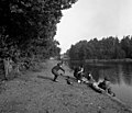
 Steam launch at Laleham, River Thames - geograph.org.uk - 372291.jpg 640 × 478; 101 KB
-
 Step Bridge, Basingstoke Canal - geograph.org.uk - 582090.jpg 640 × 510; 133 KB
-
 Stoke Bridge, Wey Navigation, Surrey - geograph.org.uk - 620825.jpg 640 × 493; 82 KB
-
 Stoke Lock, Wey Navigation - geograph.org.uk - 620854.jpg 640 × 518; 71 KB
-
 Stoke Lock, Wey Navigation, Surrey - geograph.org.uk - 480134.jpg 640 × 517; 110 KB
-
 Stoke Lock, Wey Navigation, Surrey - geograph.org.uk - 480142.jpg 640 × 519; 127 KB
-
 Stoke Lock, Wey Navigation, Surrey - geograph.org.uk - 620864.jpg 640 × 515; 91 KB
-

-
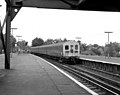
 Tadpole unit at guildford.jpg 640 × 563; 92 KB
-
 Tanyard Bridge, Wey Navigation, Surrey - geograph.org.uk - 621458.jpg 640 × 544; 109 KB
-
 Tattenham Corner station in 1979 - geograph.org.uk - 559798.jpg 640 × 510; 76 KB
-


_bridge,_Basingstoke_Canal_-_geograph.org.uk_-_476697.jpg)


_bus_terminus_-_geograph.org.uk_-_1636978.jpg)


_-_geograph.org.uk_-_573173.jpg)


