Category:Black and white photographs of Greater Manchester
Jump to navigation
Jump to search
Ceremonial counties of England: Bedfordshire · Berkshire · Buckinghamshire · Cambridgeshire · Cheshire · Cornwall · Cumbria · Derbyshire · Devon · Dorset · Durham · East Riding of Yorkshire · East Sussex · Essex · Gloucestershire · Greater London · Greater Manchester · Hampshire · Herefordshire · Hertfordshire · Isle of Wight · Kent · Lancashire · Leicestershire · Lincolnshire · Merseyside · Norfolk · North Yorkshire · Northamptonshire · Northumberland · Nottinghamshire · Oxfordshire · Rutland · Shropshire · Somerset · South Yorkshire · Staffordshire · Suffolk · Surrey · Tyne and Wear · Warwickshire · West Midlands · West Sussex · West Yorkshire · Wiltshire · Worcestershire
City-counties: Bristol ·
Former historic counties:
Other former counties:
City-counties: Bristol ·
Former historic counties:
Other former counties:

Media in category "Black and white photographs of Greater Manchester"
The following 199 files are in this category, out of 199 total.
-

-

-
 04.03.67 G. Aillières à Wigan (1967) - 53Fi547 (cropped).jpg 1,025 × 1,127; 150 KB
-
 04.03.67 G. Aillières à Wigan (1967) - 53Fi547.jpg 2,259 × 1,503; 410 KB
-
 25198 25298 and class 108 M52020 M51935 at Manchester Victoria.jpg 1,024 × 768; 414 KB
-
 45076 and 25301 at Manchester Victoria.jpg 1,024 × 768; 366 KB
-
 A taste of things to come, in Manchester - geograph.org.uk - 689989.jpg 800 × 766; 102 KB
-

-
 Abney Hall lake 1913.jpg 659 × 495; 129 KB
-

-
 Albion Mills, Hazel Grove - geograph.org.uk - 377560.jpg 640 × 405; 51 KB
-
 Altrincham station - geograph.org.uk - 696458.jpg 640 × 545; 94 KB
-
 Altrincham station - geograph.org.uk - 696691.jpg 640 × 533; 85 KB
-

-

-

-

-
 Aytoun Street, Manchester - geograph.org.uk - 696346.jpg 640 × 521; 79 KB
-
 Balloon Street, Manchester - geograph.org.uk - 676356.jpg 640 × 545; 56 KB
-
 Balloon Street, Manchester - geograph.org.uk - 679058.jpg 640 × 529; 71 KB
-
 Besses o' th' Barn station - geograph.org.uk - 1626155.jpg 640 × 571; 59 KB
-
 Besses o' th' Barn station - geograph.org.uk - 690370.jpg 640 × 545; 53 KB
-

-

-
 Big city life (4277148054).jpg 478 × 801; 268 KB
-
 Boat House Moorings, Worsley (8128276792).jpg 3,112 × 4,648; 4.41 MB
-
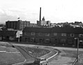
 Boiler house, Parsonage Colliery - geograph.org.uk - 1358010.jpg 640 × 427; 59 KB
-
 The former St Andrews Church, Bowkers Row, Bolton (7182324986).jpg 3,034 × 4,034; 1.53 MB
-
 Bowdon Church Altrincham - geograph.org.uk - 765866.jpg 640 × 493; 76 KB
-
 Bowker Vale station - geograph.org.uk - 676515.jpg 640 × 539; 55 KB
-
 Bowker Vale station - geograph.org.uk - 676531.jpg 640 × 528; 49 KB
-
 Bridge 5, Ashton Canal, Manchester - geograph.org.uk - 592218.jpg 640 × 541; 110 KB
-
 Bridgewater Canal at Barton 1891.jpg 2,197 × 1,463; 502 KB
-

-
 Brooklands station - geograph.org.uk - 697127.jpg 640 × 509; 54 KB
-
 Buckley Mill, Rochdale.jpg 640 × 487; 54 KB
-
 Bury (Bolton Street) railway station 1954623 014957cf.jpg 640 × 412; 57 KB
-
 Bury Interchange station - geograph.org.uk - 676550.jpg 640 × 528; 49 KB
-
 Bury Socialist outburst on a 4F 0-6-0 in 1963 geograph-2794861-by-Ben-Brooksbank.jpg 2,148 × 1,447; 1.44 MB
-

-

-
 Chadkirk Chapel, c.1895.jpg 2,560 × 1,920; 1.89 MB
-
 Cheetham Street, Rochdale, Lancashire - geograph.org.uk - 344627.jpg 640 × 492; 80 KB
-
 City Exhibition Hall, Manchester (2) - geograph.org.uk - 579634.jpg 640 × 515; 87 KB
-
 Claylands Head, Milnrow, Lancashire, 1964 - geograph.org.uk - 337841.jpg 640 × 503; 119 KB
-

-

-
 Colby Street, Rochdale, Lancashire - geograph.org.uk - 566163.jpg 640 × 505; 119 KB
-
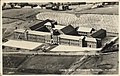 Counthill School newly built.jpg 1,066 × 675; 505 KB
-
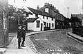 Crab lane in 1908.jpg 976 × 639; 232 KB
-
 Creams Paper Mill - geograph.org.uk - 1227307.jpg 640 × 419; 82 KB
-
 Crumpsall Station (2) - geograph.org.uk - 689144.jpg 640 × 529; 65 KB
-
 Crumpsall station (3) - geograph.org.uk - 689225.jpg 640 × 513; 62 KB
-
 Crumpsall station - geograph.org.uk - 1625918.jpg 640 × 498; 56 KB
-
 Crumpsall station - geograph.org.uk - 689141.jpg 640 × 535; 61 KB
-
 D376- un quartier ouvrier à manchester - Liv4-Ch02.png 954 × 821; 188 KB
-
 Dane Road station - geograph.org.uk - 706932.jpg 640 × 512; 56 KB
-
 Dane Road station - geograph.org.uk - 706933.jpg 640 × 529; 62 KB
-
 Deansgate station - geograph.org.uk - 708313.jpg 640 × 505; 63 KB
-
 Debdale Park station - geograph.org.uk - 1619508.jpg 640 × 543; 70 KB
-
 Demolition in Snow Hill, Manchester - geograph.org.uk - 676375.jpg 640 × 528; 53 KB
-

-
 DLR train at Debdale Park Manchester.jpg 640 × 537; 72 KB
-

-
 Douglas C-47B G-AMVL Transair Ringway 07.02.53 edited-2.jpg 1,062 × 667; 356 KB
-
 Drake Street corner, Rochdale - geograph.org.uk - 721960.jpg 640 × 558; 77 KB
-
 Farnworth Station - geograph.org.uk - 993801.jpg 568 × 640; 108 KB
-

-
 Frozen Canal (6857072009).jpg 3,290 × 4,370; 4.29 MB
-
 Frozen Canal (6857073827).jpg 3,290 × 4,370; 4.68 MB
-
 GMEX, with car park - geograph.org.uk - 708305.jpg 640 × 558; 53 KB
-

-
 Guide Bridge station (2) - geograph.org.uk - 678167.jpg 640 × 518; 78 KB
-
 Haigh windpump.jpg 424 × 640; 44 KB
-
 Heaton Park station - geograph.org.uk - 1625963.jpg 640 × 519; 78 KB
-
 Heaton Park station - geograph.org.uk - 1625979.jpg 640 × 534; 69 KB
-
 Heaton Park station - geograph.org.uk - 690339.jpg 640 × 541; 86 KB
-

-
-

-
 Little Underbank, Stockport 1906.jpg 656 × 881; 204 KB
-

-
 Littleborough, Lancashire - geograph.org.uk - 632425.jpg 640 × 508; 85 KB
-
 London Road, Manchester - geograph.org.uk - 709305.jpg 640 × 518; 64 KB
-

-
 Looking North from Bowker Vale - geograph.org.uk - 689230.jpg 640 × 518; 60 KB
-

-
 Looking up Penn Street, Rochdale - geograph.org.uk - 721896.jpg 640 × 550; 57 KB
-

-
 Looking West at Heaton Park station - geograph.org.uk - 690342.jpg 640 × 520; 82 KB
-
 Lower Mosley Street, Manchester - geograph.org.uk - 716249.jpg 640 × 522; 63 KB
-
 Manchester Dry Dock - geograph.org.uk - 453189.jpg 640 × 443; 57 KB
-
 Manchester Dry Docks - geograph.org.uk - 377435.jpg 418 × 640; 66 KB
-
 Manchester Dry Docks. - geograph.org.uk - 377466.jpg 640 × 424; 58 KB
-
 Manchester London Road stn, old postcard.JPG 1,614 × 1,014; 2.46 MB
-
 Manchester Victoria Station, with 2-6-4T pilot 1963 - geograph.org.uk - 4320472.jpg 2,259 × 1,457; 1.48 MB
-
 St Chrysostom's Church, pre 1904.jpg 1,280 × 885; 399 KB
-
 St John's Church, Manchester, circa 1900.jpg 825 × 1,024; 113 KB
-

-
 Manchesterlondonroad old postcard.jpg 700 × 466; 84 KB
-
 Marple Hall, c 1893.jpg 2,523 × 1,714; 1.44 MB
-
 Marple Locks - geograph.org.uk - 1240349.jpg 431 × 640; 69 KB
-
 Marple Locks - geograph.org.uk - 1240374.jpg 453 × 640; 65 KB
-
 Marple Locks, Peak Forest Canal - geograph.org.uk - 595245.jpg 640 × 492; 72 KB
-
 Marple Locks, Peak Forest Canal - geograph.org.uk - 595297.jpg 640 × 494; 73 KB
-
 Metrolink ramp alongside GMEX - geograph.org.uk - 711922.jpg 640 × 521; 63 KB
-

-

-
 Navigation Road - geograph.org.uk - 696726.jpg 640 × 553; 77 KB
-
 Navigation Road station - geograph.org.uk - 696706.jpg 640 × 563; 69 KB
-
 Navigation Road station - geograph.org.uk - 696739.jpg 640 × 459; 56 KB
-
 New Hey Station.jpg 640 × 481; 121 KB
-
 Ogden Reservoir, Newhey, Lancashire - geograph.org.uk - 344181.jpg 640 × 464; 77 KB
-
 Old Trafford station - geograph.org.uk - 708285.jpg 640 × 519; 88 KB
-
 Oxford Street, Manchester - geograph.org.uk - 708413.jpg 640 × 524; 59 KB
-
 Paratroopers and Whitley at RAF Ringway Jan 1941 IWM H 6527.jpg 800 × 592; 73 KB
-
 Parker Street, Manchester - geograph.org.uk - 676372.jpg 640 × 559; 68 KB
-

-
 Penn Street, Rochdale, Lancashire - geograph.org.uk - 721196.jpg 640 × 544; 68 KB
-
 Platform 4, Manchester Victoria - geograph.org.uk - 697132.jpg 640 × 508; 62 KB
-

-

-
-
 Platform 9, Manchester Victoria - geograph.org.uk - 697134.jpg 640 × 522; 64 KB
-
 Prestolee Aqueduct - geograph.org.uk - 718131.jpg 640 × 559; 82 KB
-
 Prestwich Station - geograph.org.uk - 1626204.jpg 640 × 546; 49 KB
-
 Princess Street in black ^ white - panoramio.jpg 4,000 × 3,000; 4.67 MB
-
 Reflections (8128247757).jpg 4,612 × 1,818; 3.24 MB
-
 Remains of Dee Mill, Shaw. - geograph.org.uk - 371298.jpg 640 × 439; 59 KB
-
 River Mersey, Cheadle - panoramio.jpg 2,048 × 1,536; 1.18 MB
-

-
 Rochdale railway station - Geograph 466679 by Dr Neil Clifton.jpg 640 × 470; 81 KB
-
 Rochdale Town Centre, June 1949 - geograph.org.uk - 304774.jpg 640 × 506; 121 KB
-
 Rochdale Weir, River Roch - geograph.org.uk - 632407.jpg 640 × 544; 78 KB
-
 Roman Lakes - geograph.org.uk - 1515605.jpg 640 × 519; 36 KB
-
 Romiley station, Cheshire - geograph.org.uk - 676805.jpg 640 × 544; 91 KB
-
 Romiley station, Cheshire - geograph.org.uk - 676811.jpg 640 × 499; 92 KB
-
 Rooley Moor Road at Lanehead - geograph.org.uk - 645471.jpg 640 × 522; 65 KB
-
 Sale station - geograph.org.uk - 706372.jpg 640 × 522; 62 KB
-
 Sale station - geograph.org.uk - 706927.jpg 640 × 538; 74 KB
-
 Sale station - geograph.org.uk - 706928.jpg 640 × 520; 70 KB
-
 Sale station - geograph.org.uk - 706930.jpg 640 × 503; 70 KB
-

-

-

-
 Site of the soon to be West Didsbury Metrolink station - panoramio.jpg 4,000 × 3,000; 5.08 MB
-
 Sorry, no mod cons... - geograph.org.uk - 645480.jpg 640 × 496; 65 KB
-
 Spiral Staircase at Rochdale Town Hall.jpg 3,648 × 4,691; 8.54 MB
-
 Station Road, Marple c.1900.jpg 655 × 442; 105 KB
-
 Stockport Road, Marple 1911.jpg 655 × 478; 76 KB
-
 Stretford station - geograph.org.uk - 706936.jpg 640 × 518; 68 KB
-
 Stretford station - geograph.org.uk - 706980.jpg 640 × 510; 72 KB
-
 Telephone box (8125437713).jpg 4,628 × 2,025; 1,010 KB
-
 The other side ! (6861356927).jpg 3,050 × 4,050; 1.1 MB
-
 The other side ! (6861378315).jpg 4,050 × 3,050; 2.52 MB
-

-
 Timperley station - geograph.org.uk - 696750.jpg 640 × 566; 67 KB
-
 Timperley station - geograph.org.uk - 696766.jpg 640 × 546; 73 KB
-
 Timperley station - geograph.org.uk - 697125.jpg 640 × 539; 75 KB
-
 Towards 'The Springers', Rochdale - geograph.org.uk - 721901.jpg 640 × 599; 71 KB
-
 Towards Milton Street, Rochdale - geograph.org.uk - 721900.jpg 640 × 569; 92 KB
-

-

-

-
 Town Hall Square, Rochdale - geograph.org.uk - 720979.jpg 640 × 513; 92 KB
-
 Tram at Heaton Park, Manchester - geograph.org.uk - 1588841.jpg 640 × 519; 119 KB
-
 Tram at Heaton Park, Manchester - geograph.org.uk - 1588845.jpg 640 × 576; 114 KB
-

-
 Tram in Heaton Park, Manchester - geograph.org.uk - 579792.jpg 640 × 514; 150 KB
-

-

-
 Vickers VC-10 G-ATDJ British United RWY 05.66 edited-2.jpg 1,076 × 667; 392 KB
-
 View from Calderbrook Road - geograph.org.uk - 721829.jpg 640 × 518; 90 KB
-

-
 View over Ogden - geograph.org.uk - 1395589.jpg 640 × 459; 49 KB
-
 View over Rochdale from Park Slopes - geograph.org.uk - 1394463.jpg 640 × 494; 81 KB
-

-
 View south from top of car park - geograph.org.uk - 721835.jpg 640 × 624; 86 KB
-
 Walsden Street, Clayton - panoramio.jpg 4,000 × 3,000; 3.69 MB
-

-
 All Saints Church, Wardley (6928756951).jpg 3,234 × 4,314; 2.02 MB
-
 All Saints Church, Wardley (6928757237).jpg 3,075 × 4,205; 1.59 MB
-

-
 Warwick Road station - geograph.org.uk - 706993.jpg 640 × 529; 78 KB
-

-
 Whitefield station - geograph.org.uk - 692217.jpg 640 × 519; 72 KB
-
 Whitefield station - geograph.org.uk - 692228.jpg 640 × 522; 58 KB
-
 Whitefield station - geograph.org.uk - 692239.jpg 640 × 560; 63 KB
-
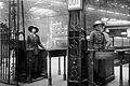 Women Railway Workers during the First World War Q109850.jpg 800 × 532; 75 KB
-
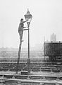 Women Railway Workers during the First World War Q109866.jpg 589 × 800; 51 KB
-
 Woodlands Road station - geograph.org.uk - 1625907.jpg 640 × 529; 61 KB
-
 Woodlands Road station - geograph.org.uk - 679061.jpg 640 × 543; 61 KB
-
 Woodlands Road station - geograph.org.uk - 679062.jpg 640 × 564; 61 KB
-
 Woodlands Road station - geograph.org.uk - 679063.jpg 640 × 537; 57 KB
-
 Woodlands Road station - geograph.org.uk - 679065.jpg 640 × 570; 63 KB
-
 Worsley (6526586413).jpg 4,320 × 3,240; 5.51 MB
-
 Worsley (6526586919).jpg 4,320 × 3,240; 2.32 MB
-
 Worsley (6526588813).jpg 3,240 × 4,320; 4.79 MB
-
 Yorkshire Street, Rochdale - geograph.org.uk - 721000.jpg 640 × 537; 80 KB

_-_53Fi547_(cropped)_(cropped).jpg)
_-_53Fi547_(cropped).jpg)
_-_53Fi547.jpg)


.jpg)
.jpg)

.jpg)


_railway_station_1954623_014957cf.jpg)


_-_geograph.org.uk_-_579634.jpg)


,_Rochdale,_Lancashire_-_geograph.org.uk_-_566155.jpg)


_-_geograph.org.uk_-_689144.jpg)
_-_geograph.org.uk_-_689225.jpg)


.jpg)
.jpg)


_-_geograph.org.uk_-_678167.jpg)


.jpg)
.jpg)
.jpg)


.jpg)
.jpg)
_station_-_geograph.org.uk_-_706987.jpg)


.jpg)
.jpg)
.jpg)

.jpg)