Category:20th-century maps of the Balkans
Appearance
Subcategories
This category has the following 19 subcategories, out of 19 total.
Media in category "20th-century maps of the Balkans"
The following 8 files are in this category, out of 8 total.
-
Carte des Balkans - btv1b53209992w.jpg 9,931 × 12,221; 22.66 MB
-
1940 German military map - Übersichtskarte Bulgarien-Griechenland.jpg 24,892 × 32,442; 132.82 MB
-
1940 German military map - Übersichtskarte Rumänien-Bulgarien.jpg 24,996 × 31,562; 153.66 MB
-
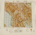
1942 German military map - Internationale Weltkarte - Sofia.jpg 7,784 × 7,496; 7.72 MB
-
1943 Chapin Map of the Balkans and Eastern Europe for TIME Magazine.jpg 5,898 × 7,200; 16.58 MB
-
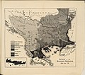
William Zebina Ripley – The races of Europe 1910 ethnographic map.jpg 1,454 × 1,286; 445 KB


