
Category:14th-century maps of the Balkans
![]() This category includes maps created in the 14th century depicting the Balkans.
This category includes maps created in the 14th century depicting the Balkans.
Subcategories
This category has the following 4 subcategories, out of 4 total.
#
B
G
R
Media in category "14th-century maps of the Balkans"
The following 2 files are in this category, out of 2 total.
-
 Leibnizer Fig 3 Petrus Vesconti (1318).jpg 1,035 × 1,205; 130 KB
-
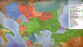 Balkansin1389.png 1,599 × 901; 2.23 MB
.jpg)
