Category:1900s maps of the Balkans
Jump to navigation
Jump to search
English: This category is intended to collect maps from the 1900s that show multiple Balkan countries in one map frame.
Subcategories
This category has the following 7 subcategories, out of 7 total.
A
- 1900s maps of Albania (3 F)
B
- 1900s maps of Bulgaria (3 F)
C
- 1900s maps of Croatia (4 F)
G
R
- 1900s maps of Romania (14 F)
S
- 1900s maps of Serbia (10 F)
Media in category "1900s maps of the Balkans"
The following 15 files are in this category, out of 15 total.
-
 Austria-Hungary 1900.jpg 1,677 × 1,276; 346 KB
-

-
 Review of reviews and world's work (1890) (14577908347).jpg 2,250 × 1,812; 531 KB
-
 Modern history; Europe (1904) (14579139950).jpg 3,008 × 2,012; 1.8 MB
-
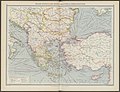
 Balkans at 1905.jpg 1,362 × 2,000; 1.06 MB
-
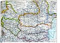
 Kosovo Vilayet 1905.jpg 600 × 444; 166 KB
-
 The Harmsworth atlas and Gazetter 1908 (135849288).jpg 9,566 × 12,561; 129.62 MB
-
 The Harmsworth atlas and Gazetter 1908 (135849627).jpg 12,470 × 9,574; 121.15 MB
-
 The Harmsworth atlas and Gazetter 1908 (135849681).jpg 12,466 × 9,571; 129.71 MB
-
 1909 map - Königreich Bulgarien und Türkisch Thrakien.jpg 22,041 × 16,720; 93.56 MB
-
 D463- N° 506. Slaves extérieurs. - Liv4-Ch04.png 1,447 × 1,887; 283 KB
-
 RumBulgSerb.1903.jpg 3,504 × 2,550; 2.59 MB
-
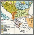
 VolkBalk-1908 (28).jpg 1,275 × 833; 718 KB
-
 VolkBalk-1908.jpg 1,352 × 1,380; 931 KB
-
 Балканы в 1878.jpg 1,740 × 1,370; 797 KB


_(14577908347).jpg)
_(14579139950).jpg)


.jpg)
.jpg)
.jpg)


.jpg)

