Category:20th-century maps of Prince Edward Island
Jump to navigation
Jump to search
Provinces and territories of Canada: Alberta · British Columbia · Manitoba · New Brunswick · Newfoundland and Labrador · Nova Scotia · Ontario · Prince Edward Island · Quebec · Saskatchewan · Northwest Territories · Nunavut · Yukon
Media in category "20th-century maps of Prince Edward Island"
The following 14 files are in this category, out of 14 total.
-
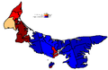
 1947PEI.png 454 × 228; 6 KB
-
 Pei1996.PNG 1,353 × 875; 54 KB
-
 PEI89.gif 453 × 228; 6 KB
-
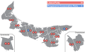
 Prince Edward Island general election 1982 - Results by District.svg 1,200 × 740; 129 KB
-
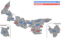
 Prince Edward Island general election 1986 - Results by District.svg 1,200 × 740; 132 KB
-
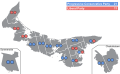
 Prince Edward Island general election 1989 - Results by District.svg 1,200 × 740; 133 KB
-
 Prince Edward Island general election 1993 - Results by District.svg 1,200 × 740; 132 KB
-
 Prince Edward Island general election, 1962 results by district.svg 1,200 × 740; 156 KB
-
 Prince Edward Island general election, 1970 results by district.svg 512 × 637; 254 KB
-
 Prince Edward Island general election, 1974 results by district.svg 512 × 637; 246 KB
-
 Prince Edward Island general election, 1978 results by district.svg 512 × 637; 258 KB
-
 Prince Edward Island general election, 1979 results by district.svg 1,200 × 740; 152 KB
-
 Prince Edward Island general election, 1996 - Results By Riding.svg 1,048 × 723; 172 KB
-
 Prince Edward Island general election,1966 results by district.svg 1,200 × 740; 156 KB


