Category:20th-century maps of Newfoundland and Labrador
Jump to navigation
Jump to search
Provinces and territories of Canada: Alberta · British Columbia · Manitoba · New Brunswick · Newfoundland and Labrador · Nova Scotia · Ontario · Prince Edward Island · Quebec · Saskatchewan · Northwest Territories · Nunavut · Yukon
Subcategories
This category has only the following subcategory.
Media in category "20th-century maps of Newfoundland and Labrador"
The following 8 files are in this category, out of 8 total.
-
Lake Melville-Hamilton Inlet-Groswater Bay.png 1,752 × 904; 1.53 MB
-
1925 Air Routes of Newfoundland and Nova Scotia.jpg 591 × 857; 242 KB
-
A". The Labrador Peninsula - btv1b53200590c.jpg 10,015 × 8,868; 10.93 MB
-
Labrador from the Most Recent Surveys (1910).jpg 2,400 × 2,478; 818 KB
-
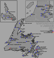
Newfoundland Second Referendum 1948.png 325 × 334; 11 KB
-
Nl elections 2007.png 870 × 929; 161 KB
-
Tnl elections 2007.png 870 × 929; 160 KB
-
Nl2007.PNG 1,076 × 1,482; 71 KB


