Category:20th-century maps of New Brunswick
Jump to navigation
Jump to search
Provinces and territories of Canada: Alberta · British Columbia · Manitoba · New Brunswick · Newfoundland and Labrador · Nova Scotia · Ontario · Prince Edward Island · Quebec · Saskatchewan · Northwest Territories · Nunavut · Yukon
Media in category "20th-century maps of New Brunswick"
The following 10 files are in this category, out of 10 total.
-
 Confederation of Regions candidacy map (New Brunswick, 1991).gif 613 × 513; 12 KB
-
 Nb1995.PNG 1,111 × 1,026; 64 KB
-
 Nb1999.PNG 1,111 × 1,026; 63 KB
-
 New Brunswick general election 1978 - Results by Riding.svg 2,000 × 1,215; 315 KB
-
 New Brunswick general election 1987 - Results by Riding.svg 2,000 × 1,215; 294 KB
-
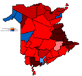
 New Brunswick general election map 1967.gif 613 × 513; 11 KB
-
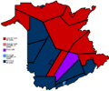
 New Brunswick general election map 1970.gif 613 × 513; 11 KB
-
 New Brunswick general election, 1974 results by riding.svg 3,092 × 1,871; 244 KB
-
 New Brunswick general election, 1982 results by riding.svg 3,092 × 1,871; 255 KB
-
 New Brunswick general election, 1991 results by riding.svg 512 × 310; 243 KB
.gif)


