Category:19th-century maps of Prince Edward Island
Jump to navigation
Jump to search
Provinces and territories of Canada: Alberta · British Columbia · Manitoba · New Brunswick · Newfoundland and Labrador · Nova Scotia · Ontario · Prince Edward Island · Quebec · Saskatchewan · Northwest Territories · Nunavut · Yukon
Media in category "19th-century maps of Prince Edward Island"
The following 18 files are in this category, out of 18 total.
-
 Image taken from page 6 of 'An Account of Prince Edward Island, etc' (11000561985).jpg 4,358 × 2,348; 2.37 MB
-
 Admiralty Chart No 1738 Hillsborough Bay, Published 1846.jpg 11,922 × 8,040; 17.53 MB
-
 Admiralty Chart No 1973 Murray Harbour, Published 1849.jpg 7,959 × 5,957; 8.25 MB
-
 1850 Mitchell Map of Eastern Canada including Quebec - Geographicus - CanadaQuebec-c-50.jpg 2,500 × 2,021; 1.63 MB
-
 Admiralty Chart No 1983 Richmond Bay (Malpeque Bay), Published 1850.jpg 8,432 × 12,337; 11.86 MB
-
 Admiralty Chart No 2029 Cardigan Bay, Published 1850.jpg 12,012 × 8,096; 18.37 MB
-

-

-

-

-

-

-

-
-
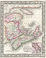
 1874 Mitchell Map of the Maritime Provinces of Canada.jpg 2,327 × 2,957; 2.1 MB
-
 PrinceEdwardIsland.jpg 1,120 × 695; 619 KB
-

-
 Map of the Maritimes.jpg 3,482 × 2,923; 2.33 MB
.jpg)


,_Published_1850.jpg)

_-_Geographicus_-_CanadaEast-b-51.jpg)


.jpg)
