Category:19th-century maps of Newfoundland and Labrador
Jump to navigation
Jump to search
Provinces and territories of Canada: Alberta · British Columbia · Manitoba · New Brunswick · Newfoundland and Labrador · Nova Scotia · Ontario · Prince Edward Island · Quebec · Saskatchewan · Northwest Territories · Nunavut · Yukon
Subcategories
This category has only the following subcategory.
Media in category "19th-century maps of Newfoundland and Labrador"
The following 17 files are in this category, out of 17 total.
-
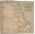
Map of the Peninsula of Labrador.png 2,557 × 2,471; 8.11 MB
-
199 of 'Pitman's Commercial Geography of the World' (11294299923).jpg 1,312 × 1,463; 540 KB
-
Albert Peter Low's sketch Map of Labrador and Northern Quebec.png 1,071 × 745; 947 KB
-
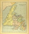
Map of Newfoundland.jpg 2,934 × 3,447; 2.26 MB
-
Review of reviews and world's work (1890) (14804703123).jpg 1,540 × 2,556; 554 KB


