Category:20th-century maps of Australia
Jump to navigation
Jump to search
Countries of Oceania: Australia · Fiji · Kiribati · New Zealand · Papua New Guinea · Samoa · Solomon Islands · Tonga · Tuvalu · Vanuatu
Other areas: Hawaii – Partly: Indonesia
Other areas: Hawaii – Partly: Indonesia
Subcategories
This category has the following 16 subcategories, out of 16 total.
#
- 1930s maps of Australia (11 F)
- 1950s maps of Australia (3 F)
- 1960s maps of Australia (2 F)
- 1970s maps of Australia (6 F)
N
Q
- 20th-century maps of Queensland (189 F)
S
Media in category "20th-century maps of Australia"
The following 10 files are in this category, out of 10 total.
-

-

-

-
 1925 Air Routes of Australia.jpg 1,659 × 1,201; 559 KB
-
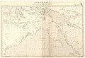 Admiralty Chart No 2759a Australia northern portion, Published 1934.jpg 16,426 × 11,208; 64.05 MB
-
 Eucumbene Map 1960.png 887 × 749; 1.7 MB
-
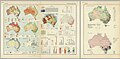 1967 data of Australia.jpg 5,831 × 2,880; 3.91 MB
-
 Australia, 1967.jpg 4,038 × 2,880; 2.29 MB
-
 Southeast Australia, 1967.jpg 2,180 × 2,892; 1.21 MB
-
 Southwest Australia and some Australian cities, 1967.jpg 1,976 × 2,880; 2.17 MB


