Category:20th-century maps of Western Australia
Jump to navigation
Jump to search
Media in category "20th-century maps of Western Australia"
The following 5 files are in this category, out of 5 total.
-
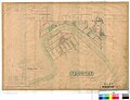 Map of West Toodyay, 1910, Cons 3868 item 395.jpg 5,231 × 3,999; 3 MB
-
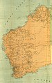 Map of Western Australia, 1916.jpg 3,422 × 5,434; 3.44 MB
-
 Perth Water c.1909.png 816 × 610; 553 KB
-
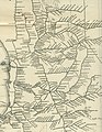 WA part railway network map 1935.jpg 2,865 × 3,693; 2.39 MB
-
 WAGR 1935 network Bowelling.JPG 2,368 × 1,290; 2.14 MB


