Category:2007 maps of Canada
Jump to navigation
Jump to search
Countries of North America: Canada · Saint Vincent and the Grenadines · United States of America‡
‡: partly located in North America
‡: partly located in North America
| ← 2000 2001 2002 2003 2004 2005 2006 2007 2008 2009 → |
English: Maps of Canada from 2007 or related to Canada in 2007
Français : Les cartes du Canada de 2007 ou se rapportant au Canada en 2007
Subcategories
This category has only the following subcategory.
Media in category "2007 maps of Canada"
The following 13 files are in this category, out of 13 total.
-
 2007 Prince Edward Island general election - Popular vote by polling division.svg 4,042 × 2,913; 4.26 MB
-
 COB data Canada.PNG 1,357 × 628; 62 KB
-
 CTrain Route Map.svg 550 × 720; 80 KB
-
 Edmonton street map.png 678 × 625; 222 KB
-
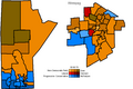 Manitoba2007.PNG 694 × 462; 23 KB
-
 Manitoba elections 2007.png 1,072 × 524; 113 KB
-
 Newfoundland & Labrador Election 2007 - Results by Riding.svg 2,991 × 2,390; 1.49 MB
-
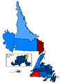
 Nl elections 2007.png 870 × 929; 161 KB
-
 Tnl elections 2007.png 870 × 929; 160 KB
-
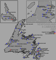
 Nl2007.PNG 1,076 × 1,482; 71 KB
-
 Nwt elections 2007.png 1,050 × 742; 93 KB
-
 Quebec - Arrondissements.svg 1,133 × 1,091; 26 KB
-
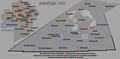
 Sask07.PNG 949 × 980; 42 KB


