Category:1999 maps of Canada
Jump to navigation
Jump to search
Countries of North America: Canada · Haiti · United States of America‡
‡: partly located in North America
‡: partly located in North America
| 1990 1994 1996 1997 1998 1999 → |
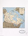
English: Maps of Canada from 1999 or related to Canada in 1999
Français : Les cartes du Canada de 1999 ou se rapportant au Canada en 1999
Media in category "1999 maps of Canada"
The following 8 files are in this category, out of 8 total.
-
 Canada - DPLA - 157b8492b18185ece1a2347334e8c24a.jpg 2,554 × 3,270; 5.83 MB
-
 Canada - DPLA - 79fd612551836475b3a9af7d1c3a4b50.jpg 2,552 × 3,268; 5.66 MB
-
 Canada. LOC 00556577.jpg 2,514 × 2,627; 862 KB
-
 Canada. LOC 00556577.tif 2,514 × 2,627; 18.9 MB
-
 Canada. LOC 99463846.jpg 3,341 × 4,355; 1.91 MB
-
 Canada. LOC 99463846.tif 3,341 × 4,355; 41.63 MB
-
 Nb1999.PNG 1,111 × 1,026; 63 KB
-
 NsElectoralMap1999.png 789 × 904; 61 KB


