Category:2000 maps of Canada
Jump to navigation
Jump to search
Provinces and territories of Canada:
Media in category "2000 maps of Canada"
The following 4 files are in this category, out of 4 total.
-
 2000 Arctic Region (30849229476).jpg 2,131 × 2,652; 3.43 MB
-
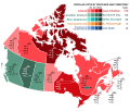 Canada 2000 Federal Election.svg 1,084 × 920; 476 KB
-
 Canada Population Density, 2000 (6172434336).jpg 2,401 × 3,161; 881 KB
-
 Prince Edward Island general election, 2000 - Results By Riding.svg 1,048 × 723; 157 KB
.jpg)

.jpg)
