Category:2006 maps of Canada
Jump to navigation
Jump to search
Countries of North America: Canada · Mexico · United States of America‡
‡: partly located in North America
‡: partly located in North America
| ← 2000 2001 2002 2003 2004 2005 2006 2007 2008 2009 → |
English: Maps of Canada from 2006 or related to Canada in 2006
Français : Les cartes du Canada de 2006 ou se rapportant au Canada en 2006
Media in category "2006 maps of Canada"
The following 24 files are in this category, out of 24 total.
-
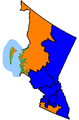 BC Interior (39th Parl).png 293 × 446; 10 KB
-
 British Columbia 2006 population density.PNG 561 × 526; 101 KB
-
 Calgary-CTrain stations.png 960 × 1,192; 553 KB
-
 CalgaryAB-map-CTrain.png 589 × 763; 50 KB
-
 Canada 2006 Federal Election.svg 1,084 × 920; 446 KB
-
 Canada map minority language use.jpg 2,312 × 2,719; 423 KB
-
 Canada marine transportation infrastructure 2006 harbours map.png 6,879 × 6,165; 15.15 MB
-
 Canada2006.PNG 715 × 580; 52 KB
-
 Canada2006ridings.PNG 1,180 × 1,326; 107 KB
-
 Ceclfcezones.PNG 539 × 395; 12 KB
-
 CEF map.jpg 1,984 × 1,408; 910 KB
-
 Dawson-shooting-map.svg 514 × 356; 33 KB
-
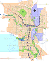
 Edmonton-map.png 352 × 691; 12 KB
-
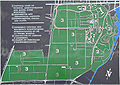
 Fredericton-fortnashwaak.PNG 914 × 1,527; 96 KB
-
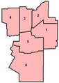 Guelphwardmap.PNG 324 × 454; 8 KB
-
 Kingston 2006 senior population in Central Kingston - source 2006 Census.png 3,300 × 2,550; 1.18 MB
-
 Map indicating Banks Island, New Territories, Canada.png 428 × 370; 17 KB
-
 Map indicating Banks Island, Northwest Territories, Canada.png 428 × 370; 63 KB
-
 Montréal - Secteurs Statitiques 2006 - Langue Maternelle.svg 1,563 × 999; 359 KB
-
 Novascotiahrm-detail-map.gif 260 × 461; 32 KB
-
 Ottawa South 2006 popular vote map.png 676 × 1,071; 54 KB
-
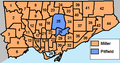 Toronto mayor - 2006.PNG 481 × 251; 14 KB
-
 West island.png 643 × 533; 88 KB
-
 Yukon2006.PNG 591 × 1,314; 29 KB
.png)


