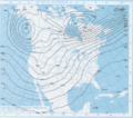
Category:1998 maps of Canada
Jump to navigation
Jump to search
Subcategories
This category has the following 5 subcategories, out of 5 total.
M
- 1998 maps of Manitoba (1 F)
N
- 1998 maps of Nova Scotia (1 F)
O
- 1998 maps of Ontario (1 F)
Q
- 1998 maps of Quebec (1 F)
Media in category "1998 maps of Canada"
The following 9 files are in this category, out of 9 total.
-
1998 Ice Storm GOES8-ir-1998-01-09-0015TU.png 800 × 600; 179 KB
-
1998 Ice Storm map.png 1,500 × 772; 519 KB
-
1998 North American ice storm Jetstream 1998-01-08 12UTC.png 923 × 552; 351 KB
-
Boucle GOES8-1998-01 07-09.gif 400 × 300; 1.01 MB
-
Ice storm Wv loop.gif 602 × 400; 1.79 MB
-
NWS Surface map 1998-01-06.gif 1,247 × 818; 691 KB
-
NWS Upper air map 500mb 1998-01-05.gif 752 × 662; 315 KB
-
Situation pluie verglacante.png 706 × 648; 57 KB
-
Verglas massif 1998 trajectoire humidité.png 545 × 381; 21 KB


