Category:1988 maps of Canada
Jump to navigation
Jump to search
Countries of North America: Canada · Mexico · United States of America‡
‡: partly located in North America
‡: partly located in North America
| 1980 1985 1988 → |
English: Maps of Canada from 1988 or related to Canada in 1988
Français : Les cartes du Canada de 1988 ou se rapportant au Canada en 1988
Media in category "1988 maps of Canada"
The following 3 files are in this category, out of 3 total.
-
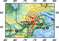 1988 Saguenay earthquake location.png 214 × 149; 24 KB
-
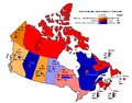 Canada 1988 carte vote populaire.png 774 × 608; 50 KB
-
 Canada 1988 Federal Election.svg 1,084 × 920; 485 KB


