Category:1980 maps of West Virginia
Jump to navigation
Jump to search
States of the United States: Alabama · Arkansas · California · Connecticut · Delaware · Florida · Georgia · Kentucky · Maryland · Massachusetts · Mississippi · New Jersey · New York · North Carolina · Ohio · Pennsylvania · South Carolina · Tennessee · Texas · Utah · Vermont · Virginia · West Virginia
| ← 1980 1984 1988 |
Media in category "1980 maps of West Virginia"
The following 2 files are in this category, out of 2 total.
-
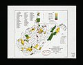 Watershed project progress map, West Virginia LOC 81690098.jpg 3,977 × 3,114; 1.5 MB
-
 Watershed project progress map, West Virginia LOC 81690098.tif 3,977 × 3,114; 35.43 MB
