Category:1980 maps of Arkansas
Jump to navigation
Jump to search
States of the United States: Alabama · Arkansas · California · Connecticut · Delaware · Florida · Georgia · Kentucky · Maine · Maryland · Massachusetts · Mississippi · New Jersey · New York · North Carolina · Ohio · Pennsylvania · South Carolina · Tennessee · Texas · Utah · Vermont · Virginia · West Virginia
| 1980 1981 1982 |
Media in category "1980 maps of Arkansas"
The following 16 files are in this category, out of 16 total.
-
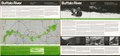
 Buffalo River, national river, Arkansas LOC 80691752.jpg 10,036 × 4,710; 8.05 MB
-
 Buffalo River, national river, Arkansas LOC 80691752.tif 10,036 × 4,710; 135.24 MB
-

-
-
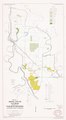
 General soil map, Calhoun County, Arkansas LOC 83693127.jpg 5,526 × 7,146; 3.55 MB
-
 General soil map, Calhoun County, Arkansas LOC 83693127.tif 5,526 × 7,146; 112.98 MB
-

-

-
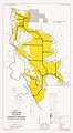
 General soil map, Franklin County, Arkansas LOC 81692332.jpg 7,232 × 5,562; 3.42 MB
-
 General soil map, Franklin County, Arkansas LOC 81692332.tif 7,232 × 5,562; 115.08 MB
-

-

-

-

-
-


