
Category:1930s maps of India
Subcategories
This category has the following 3 subcategories, out of 3 total.
- 1930 maps of India (2 F)
- 1931 maps of India (9 F)
- 1934 maps of India (1 F)
Media in category "1930s maps of India"
The following 9 files are in this category, out of 9 total.
-
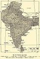
 Map of India, 1930.jpg 2,250 × 2,591; 791 KB
-
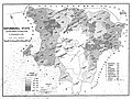 1931, Mayurbhanj state's population density map.jpg 3,639 × 2,730; 5.03 MB
-
 1931, Mayurbhanj state's population immigration map.jpg 3,229 × 2,421; 3.46 MB
-
 1931, Mayurbhanj state's population literacy map.jpg 3,229 × 2,421; 4.15 MB
-
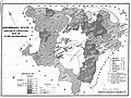 1931, Mayurbhanj state's population variation map.jpg 3,286 × 2,464; 4.56 MB
-
 1936 Survey of India map of Highlands of Tibet and Surrounding Regions.jpg 16,605 × 11,925; 17.46 MB
-
 McMahon Line on 1936 Survey of India map of Tibet.jpg 2,969 × 1,509; 2.12 MB
-
 Politická mapa Indie.jpg 1,072 × 1,564; 527 KB
-
 Roads India 1939.png 7,050 × 9,518; 166.35 MB


