Category:1900s maps of Canada
Jump to navigation
Jump to search
Subcategories
This category has the following 12 subcategories, out of 12 total.
O
Q
Media in category "1900s maps of Canada"
The following 8 files are in this category, out of 8 total.
-
 HO -2570, Moresby Passage to Gabriola Pass - NARA - 84785960.jpg 24,892 × 18,624; 60.7 MB
-
 A history of Canada for high schools and academies (1905) (14767426702).jpg 2,208 × 1,384; 352 KB
-

-
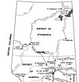 Alberta During the Territorial Period.jpg 442 × 457; 23 KB
-
 Canada provinces 1901-1905.png 1,000 × 864; 61 KB
-
 Manitoba and Northwest Territories (1900).jpg 3,510 × 2,550; 9.76 MB
-
 Map of Canada's Arctic Archipelago, circa 1903.jpg 2,000 × 2,654; 4.63 MB
-


_(14767426702).jpg)
_(14744152146).jpg)


.jpg)

_(14764104175).jpg)