Category:1970s maps of Canada
Jump to navigation
Jump to search
Subcategories
This category has the following 3 subcategories, out of 3 total.
- 1974 maps of Canada (3 F)
- 1975 maps of Canada (2 F)
- 1976 maps of Canada (1 F)
Media in category "1970s maps of Canada"
The following 3 files are in this category, out of 3 total.
-
 Alberta general election 1971 - Results by Riding.svg 1,211 × 1,362; 245 KB
-
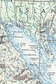 Frobisher Bay, Baffin Island, aeronautical chart section.jpg 807 × 1,205; 622 KB
-
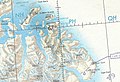 Padloping Island and Cape Dyer aeronautical chart section.jpg 1,329 × 911; 868 KB


