Category:1900s maps of Colombia
Jump to navigation
Jump to search
Subcategories
This category has the following 2 subcategories, out of 2 total.
Media in category "1900s maps of Colombia"
The following 11 files are in this category, out of 11 total.
-
 Admiralty Chart No 3318 Punta de Santa Elena to Golfo Dulce, Published 1903.jpg 11,093 × 16,285; 55.99 MB
-
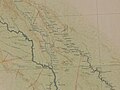
 Review of reviews and world's work (1890) (14598170619).jpg 1,586 × 2,204; 360 KB
-
-

-
 D455- N° 391. Nouvelle Grenade et Equateur. - liv3-ch13.png 1,441 × 1,831; 385 KB
-
 India rubber world (1905) (14764475992).jpg 1,206 × 2,088; 231 KB
-
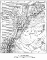
 Mapa de Colombia (1905).jpg 1,588 × 1,234; 1.71 MB
-
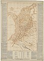
 Mapa de Colombia (1908).jpg 2,206 × 1,662; 3.36 MB
-
 Nueva Carta geografica de Colombia - por F. J. Vergara y Velasco... - btv1b84441905.jpg 7,008 × 10,346; 9.04 MB
-
 Nueva Carta geografica de Colombia - por F. J. Vergara y Velasco... - btv1b8444191k.jpg 8,112 × 11,145; 13.36 MB
-


_(14598170619).jpg)


_(14764475992).jpg)
.jpg)
.jpg)


_(14760565891).jpg)