Category:1890s maps of Canada
Jump to navigation
Jump to search
Countries of the Americas: Argentina · The Bahamas · Belize · Bolivia · Brazil · Canada · Chile · Colombia · Costa Rica · Cuba · Ecuador · Guatemala · Guyana · Mexico · Nicaragua · Panama · Paraguay · Peru · United States of America · Uruguay · Venezuela
Other areas: Bermuda · French Guiana · Greenland · Puerto Rico
Other areas: Bermuda · French Guiana · Greenland · Puerto Rico
Subcategories
This category has the following 12 subcategories, out of 12 total.
Media in category "1890s maps of Canada"
The following 14 files are in this category, out of 14 total.
-
 1891 map of the Yukon, western NWT, northern BC, northern Alberta.jpg 1,500 × 1,031; 295 KB
-

-
 PIKE(1896) Map of Alaska showing the Author's Route.jpg 3,871 × 2,449; 4.39 MB
-
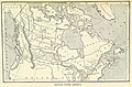
 (1899) MAP OF DOM. OF CANADA - comp. by Irvine.jpg 2,553 × 2,045; 3.26 MB
-
 27 of 'Arnold's Geographical Handbooks' (11252897035).jpg 1,904 × 1,256; 721 KB
-
 43 of 'Arnold's Geographical Handbooks' (11250508996).jpg 1,904 × 1,248; 741 KB
-
-
 Image taken from page 165 of 'Advanced Geography' (15967942514).jpg 2,443 × 1,488; 897 KB
-

-
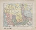 Canada west including Manitoba, British Columbia etc. (IA bp 32730).pdf 2,060 × 1,725, 2 pages; 2.22 MB
-
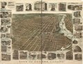
 City of Ottawa, Canada with views of principal business buildings. LOC 75696739.jpg 12,624 × 9,760; 27.92 MB
-
 City of Ottawa, Canada with views of principal business buildings. LOC 75696739.tif 12,624 × 9,760; 352.51 MB
-
 The land of the muskeg (microform) (1895) (20592057836).jpg 2,438 × 3,498; 1.17 MB
-
 The land of the muskeg (microform) (1895) (20618263575).jpg 1,284 × 2,870; 745 KB

%27_(11231997466).jpg)
_Map_of_Alaska_showing_the_Author%27s_Route.jpg)
_MAP_OF_DOM._OF_CANADA_-_comp._by_Irvine.jpg)
.jpg)
.jpg)
.jpg)
.jpg)
.jpg)

_(1895)_(20592057836).jpg)
_(1895)_(20618263575).jpg)