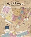
Category:1897 maps of Canada
Jump to navigation
Jump to search
Subcategories
This category has the following 3 subcategories, out of 3 total.
Media in category "1897 maps of Canada"
The following 6 files are in this category, out of 6 total.
-
A new map of Upper & Lower Canada (NYPL b15450802-465022).tiff 5,683 × 5,112; 83.12 MB
-
The century atlas. Manitoba, British Columba and the Northwest Territories (12797058734).jpg 2,500 × 1,754; 2.29 MB


